SSB - Thomas Stone National Park Historic Site Traditional Geocache
SSB - Thomas Stone National Park Historic Site
-
Difficulty:
-

-
Terrain:
-
Size:  (regular)
Related Web Page
Please note Use of geocaching.com services is subject to the terms and conditions
in our disclaimer.
During the first challenge along the Star-Spangled Banner GeoTrail, over 400 first edition SSB geocoins were awarded. We would like to thank everyone who participated in the Star-Spangled Banner GeoTour. We are currently out of geocoins but stay tuned for other opportunities along the Star-Spangled Banner GeoTour!


Come on a journey to remember and commemorate the dramatic chain of events, people and places that led to the birth of our National Anthem.
The story of the Star-Spangled Banner was shaped by the events of the Chesapeake Campaign during the War of 1812. From February 1813 until February 1815, the Chesapeake Bay was the center of a fierce struggle between the British and Americans. Places and landscapes still exist today that provide a touchstone to the past. The trail traces events and related sites that figured prominently in the Chesapeake Campaign of the War of 1812 that have national significance, physical integrity, and the potential for contemporary recreation and interpretation.
The Star-Spangled Banner (SSB) Geotrail launched February 27, 2010 with over 30 caches within Maryland, Virginia and the District of Columbia. A trackable geocoin will be awarded to the first 400 geocachers, while supplies last, for locating at least 20 SSB caches. To be eligible for the coin, geocachers must download a passport from either the SSB Geotrail or Maryland Geocaching Society website. Geocachers must find and log at least 20 SSB finds, record the code word from each cache on their passport and post a picture of yourself at each cache location. After discovering the 20 required caches, geocachers may have their passports validated in person or via mail at the Friends of Chesapeake Gateways office located at 410 Severn Ave, Suite 314, Annapolis, MD 21403. Please refer to the passport for complete validation instructions.
Participating in the SSB geotrail is fun and we hope that many people join in. However, it is not a requirement for logging your find on this cache once you find the container.
Welcome to the Thomas Stone National Historic Site
This facility is free of charge and is open Wednesday - Sunday, 10:00 a.m. - 4:00 p.m. Closed: Thanksgiving, December 25, and January 1. Hours are subject to change so please contact the facility before visiting: 301-392-1776.
Please observe that geocaching is only permitted during daylight hours. Cachers should park at the Visitor Center and walk to the cache. Dogs are allowed but must be kept on a leash. We ask that all visitors follow the park rules.
You are looking for a regular Lock & Lock container stocked with relevant swag. Please take the time to stop in the Visitor Center; see the film and take a tour of the historic house. We appreciate it !
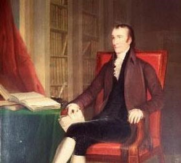
The Thomas Stone National Historic Site is located about 25 miles south of Washington D.C. in Charles County, Maryland in the historic town of Port Tobacco. The site was established to protect the home and property of Thomas Stone, one of the 56 signers of the United States Declaration of Independence. Today, it is managed by the National Park Service. Ranger-led tours of Haberdeventure, Thomas Stone's home, are available until 4pm each day. Visitors are also welcome to experience the park at their own pace to stroll across the park grounds amidst the farm buildings or travel old farm trace roads and imagine the past.
Thomas Stone was elected to Congress in 1775 and served on the committee that framed the Articles of Confederation. He voted for Independence in 1776, and signed the Declaration. He was elected to Congress again in 1783 and served as chairman, but retired at the end of his term. He was elected to attend the Constitutional Convention in 1787, but declined the office because of his wife's failing health. As her condition declined, he withdrew more from public life. When she eventually succumbed to illness in 1787, Stone became depressed and died less than four months later in Alexandria, Virginia reportedly of a "broken heart".
What happened here during the War of 1812?
While the British were preparing to march overland from the Patuxent River to Washington, British Captain Gordon led a squadron of frigates, bomb vessels, and schooners up the Potomac River in a diversionary tactic. Americans were watching both rivers, trying to figure out where the British were going next. One Potomac River observation post, Chapel Point, is on a knoll just south of Thomas Stone National Historic Site on Port Tobacco Creek. Arriving near Alexandria, Virginia, British Captain Gordon accepted the town’s surrender, took their plunder, and left after five days to sail back down the Potomac. The Americans vowed to harass them as they could, with fire ships and torpedoes, and a gun battery at Indian Head, to the west from Thomas Stone’s house. But the British fended off any opposition, and Captain Gordon and his British fighting men returned to the Chesapeake and several weeks later participated in the bombardment of Fort McHenry.

Thanks to Ponylovermom and pony_lover for helping with this hide and to the Maryland Geocaching Society for assisting with this project!
Additional Hints
(Decrypt)
Haqre yrsg pbeare