An extensive beach fronts the dune system, which is located between rocky headlands at the northern and southern ends of the beach.
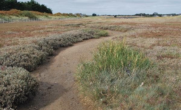
The peninsula is made up of a series of sand dune ridges. While sand and gravel ridges form the spine of the Burrow. Towards the northern end plants such as Prickly Saltwort and Sea Sandwort provide an anchor for the sand.
Rogerstown Estuary, of which the Burrow peninsula in Portrane is a part, is a proposed Natural Heritage Area. It is also a designated Special Protection Area (SPA).
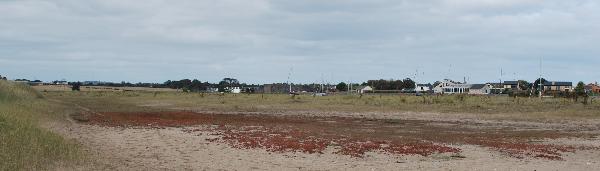
Both the Ballyboghil and Ballough rivers flow into the sea at the Estuary. At low tide the estuary drains and exposes the mud and sand flats and areas of salt marsh.
Cord grass and Green algae grow in the muddy areas at the northern tip of the Burrow Beach. Tassel weed also grows here and is grazed by the Brent geese and Widgeon. Lugworm and mussels in the outer estuary add to the food sources that attract birds, particularly during winter months.
The estuary is an important link in the chain of estuaries on the Irish East Coast and it supports an internationally important population of Brent geese. Other species of national importance include the Greylag Goose, Shelduck, Shoveler, Ringed and Grey Plover and Knot and Black-Tailed Godwit. The estuary is a regular staging post for scarce migrants especially in autumn when Green Sandpiper, Ruff, Little Stint, Curlew Sandpiper and Spotted Redshank are in evidence.

A lot of costal erosion has taken place over recent years and the dunes to the rear of the sandy Burrow Beach have been adversely affected by visitor traffic, a wooden walkway is now in place to help prevent erosion caused by foot traffic to the sand dunes.
To log this earth cache please answer the following questions
Question 1.
When did the modern word "dune" come into the English language and what language and year did it appear from.
Question 2.
Name the different shapes and types of Sand Dunes.
Question 3.
How many boulders are at the above coordinates and what type of Quartz can be seen in them.
Question 4.
What is a Glacial ridge?
Finally At the listed coordinates estimate the wide of the Sand and Gravel ridges at this location.

The Windsockers