“THE RIM OF THE CAROL-SINGING SEA” EarthCache
“THE RIM OF THE CAROL-SINGING SEA”
-
Difficulty:
-

-
Terrain:
-
Size:  (other)
Please note Use of geocaching.com services is subject to the terms and conditions
in our disclaimer.
Swansea Bay (Welsh: Bae Abertawe) is an bay on the Bristol Channel on the South Wales coast. Places on the bay include Mumbles, Swansea and Port Talbot. The River Neath, River Tawe, River Afan and Blackpill stream flow into the bay.
Do not visit these coordinates unless you have a boat! THIS IS PART OF A SERIES OF ACCESSIBLE EARTHCACHES
The coordinates for the viewing point are N 51.37.374 W 003.57.932. on Pant y Celyn Road. You will be in a lay-by/ turnout above the 'Hillside Wildlife Corridor'.
There are many traditional caches in close proximity. My favourite is also linked to Dylan Thomas, the poet, who was born 150 metres from where you now stand. (Hunchback in the Park (GC1BHKQ) )
The name of the this earthcache is a quote taken from "A Child’s Christmas in Wales". Visit this link - Click here to read this wonderful work. .
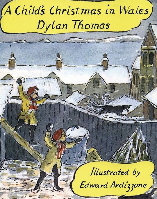 A snowy Christmas in Cwmdonkin, in Dylan Thomas's Swansea.
Look to the southeast and follow the shape of the land from the furthest headland towards Port Talbot, which is the first noticeable town on the coast, with its steelworks. The sudden increase in height of the land behind the immediate coastline is the result of resistant Coal Measure sandstones coming to the surface on the southern limb of the South Wales Coalfield syncline. The flatter land to the south of this hilly region is made up mostly of Triassic and Jurassic rocks overlying the eroded basement of folded Carboniferous rocks. You are, in effect, looking at an ancient coastline, because as the younger strata get thinner northward, they also develop into sediment types more characteristic of shallow water.
Older Triassic rocks beneath lie directly upon basement and are the deposits of large, fan-shaped screes formed by desert-erosion of high mountains, which are now only the rounded hills you see before you. Only one small patch and a few in-filled fissures now remain to tell of a similar Triassic cover over Gower.
Swansea Bay (and all of the upper reaches of the Bristol Channel) experiences one of the largest tidal ranges in the world with a maximum range of about 10 metres To your left, as you face the sea, stands Kilvey Hill: a brownish-black, rounded hill like those over Port Talbot, and made of the same rocks. It has a television mast on its summit.
Swansea's northern and western suburbs are built on Mayhill and Townhill; also stand on northerly-dipping Carboniferous rocks, whose geology closely controls the topography of the town. If, for example, you were to drive northwards from Swansea to joint the M4 at Llangyfelach, you would notice several distinct ridges that the road must traverse. These are the thick formations of sandstone - look out for quarries and cuttings on the way - and the valleys that lie between them are formed along the intervening shales and coals.
These valleys and escarpments run east-west, and they are cut across, on the west side of Kilvey Hill, by the other major feature of the Swansea landscape, the Swansea Valley. Anyone coming to Swansea on the train will, after having left Neath, have descended into the Swansea Valley from the high land which separates the two depressions and traversed the broad, level valley floor towards the Landore Viaduct. This wide, glaciated valley, a cradle of the Industrial Revolution and once the largest area of industrial- dereliction in Europe, is filled and flattened by the sediment deposited by the retreating glacier. This tongue of ice carved the valley along the line of one of Wales' major fault-lines the Swansea Valley Disturbance. Much of the valley, and also much of Swansea Bay itself, is filled with this glacial debris.
The exact course of the Swansea Valley Disturbance is not known for certain in the immediate vicinity of the city, but it probably meets the sea along the northern edge of the Gower peninsula, having veered westwards somewhere to the north. Nevertheless, many other faults come to the coast in the bay itself. Not all are major features like the Swansea Valley Disturbance, though the Neath Disturbance (which controls the Neath Valley in similar fashion) is of comparable scale. At any rate, these numerous faults, all converging here, have resulted in the formation of this extremely wide and dramatic harbour. (Note that the term 'disturbance' is meant to convey a zone of complex faulting rather than a single fracture-line. Most of the major faults of Britain are similarly complex, but only in South Wales, it seems, are they called 'disturbances'.)
The sandstones Townhill where you stand are called the Pennant Measures, and lie above the Lower and Middle Coal Measures that are richer in shales and have fewer, thinner sandstone beds. This is why they give rise to a more subdued topography to the south of the Pennant Hills, across the northern 'neck' of the peninsula and directly surrounding the head of Swansea Bay itself. Now let your eye follow the coastline around the western arm of the bay, and notice how level the skyline becomes towards Mumbles. It lies at a fairly constant 70 metres (200 feet) above sea level, as does much of Gower.
This level topography is called a peneplain, an ancient marine erosion level, formed when the sea was 200 feet higher (relative to the land) than it is today. Sea levels have fluctuated widely in the last 2 million years, as a result of the dramatic variations in climate that the Ice Age involved. The Ice Age really consisted of a series of advances and retreats of the polar ice caps, which were interrupted by interglacial periods lasting many thousands of years during which time the climate was much milder - in many cases even warmer than it is today. The last ice left this area about 18,000 years ago: but there is no reason to believe that it will not return, nor that present conditions represent anything more than another brief respite in a predominantly glacial age.
The retreat of the ice resulted in the deposition of many different kinds of glacial sediment in the region. The actual bedrock of Swansea Bay, for example, is some 600 feet below the present seabed. In the area of the town, however, the most common deposit is boulder clay (also called glacial till), which is a mixture of clay and massive boulders dumped by the melting glaciers. Singleton Park on your right as you face the sea, lying behind the University campus and which deserves a visit, displays well the hummocky topography typical of this kind of glacial deposit. The lighthouse at Mumbles stands on the outer of two islands made of Carboniferous Limestone - as is much of the coast leading up to them.
So it should be clear, bearing in mind the ordering of the rock units that the rocks are indeed becoming progressively older to the south. However, the structure of Mumbles is far from a simple case of northerly-dipping strata in the southern limb of the coalfield syncline. In times gone by, it was the site of much early industry - particularly coal-mining and brick-making -and it is cut along the approximate line of demarcation between Lower and Middle Coal Measures Many valleys around Swansea owe their origin to the drainage of glaciers, as shown by the fact that many have no stream in them at all - above Hendrefoilan Student Village, for example. To your right
LOGGING REQUIREMENT
To claim this earth cache. Please MESSAGE me the answers ~ From the guidelines: You do not need to wait for permission to log. Requiring someone to wait is not supported by the EarthCache guidelines. You should send your logging task answers , then log the EarthCache. I will then message or email you ASAP.
Don’t include the answers in your log even in an encrypted form.
1. Notice the two tallest buildings below you. The towers are prominent, the Meridian (29 Floors) and the Old Civic Centre clock tower. They are approximately a kilometre apart. Use this as a guide to estimate the width of the bay from Port Talbot docks to Mumbles Head (East to West)
2. Mumbles Head is older limestone. You are standing on a younger sandstone. Suggest a reason why the Bay is the shape it is. (Good hint in the text)
3. Behind the recommended viewing point, there is a group of terraced houses. What are the numbers of the group of THREE?
4. YOU NEED to upload a picture with you and / or something of yours with MUMBLES HEAD with the the background. (No picture = no log)
DONT USE STREETVIEW GET OUT THERE AND ENJOY!!!

Additional Hints
(Decrypt)
ZHPU zber fcrpgnphyne ivrjf vs pna lbh ivfvg gur fvgr ng gjvyvtug