Der Pferdskopf - ein Vulkan in der Rhön
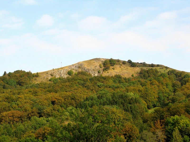
Der Pferdskopf ist ein etwa 875 m hoher erloschener Vulkan in der hessischen Rhön. Das Gebiet im äußersten Südosten dieses Mittelgebirges ist teilweise vulkanischen Ursprungs. Die Landschaft ist geprägt durch vulkanische Ganggesteine, die sich senkrecht durch eine Schichtstufenlandschaft aus Buntsandstein ziehen. Der Buntsandstein wurde zur Zeit der Untertrias vor ca. 250 bis 245 Millionen Jahren abgelagert. Der Vulkanismus in der Rhön brach vor etwa 25 Millionen Jahren im Zeitalter des Oligozän aus und hielt lange an. Zu Beginn wurden überwiegend effusive und intrusive Vulkanite gefördert (d.h. Gestein, das aus ausfließender Lava entstanden ist und Gestein, das sich durch das Eindringen von Magma in ein bereits existierendes Gestein gebildet hat); man stellt einen Übergang von anfänglich geförderten Basalten hin zu kieselsäurereichen Phonoliten fest. Aus den abgelagerten Produkten schließt man, dass der Vulkanismus außerordentlich explosiv gewesen sein muss. Man vermutet Einflüsse der Alpenhebung auf die zeitgleiche Steigerung der vulkanischen Aktivität und Hebungsprozesse in der Rhön vor ca. 11 Millionen Jahren. An vulkanischem Gestein sind außer Basalt und Phonolith stellenweise auch Trachyte, Andesite, Tephrite, Basanite, Hornblendebasalte, Olivinbasalte und Tuffe vertreten Die heutige Rhönlandschaft entstand nach dem Erlöschen des Vulkanismus im Neogen durch weitreichende Abtragungen, die auch sämtliche primären Oberflächenformen des Vulkanismus beseitigten.
Der Pferdskopf - ein Vulkan quillt über
Beim Aufstieg von der Ostseite wechselt auf halber Höhe das Gestein unvermittelt von schwarzem Basalt zu einem hellgrauen Gestein, dem Trachyt, der den oberen Bereich des Pferdskopfes einnimmt. Der Trachyt ist ein feldspatreiches Gestein, das beim Aufschmelzen des Daches einer basaltischen Magmakammer entstand. In frischem Zustand ist er mittelgrau, durch Verwitterung bleicht er aus und wird heller. Der Trachyt floß nicht als Lava aus, sondern ein zäher Schmelzpfropfen schob sich nach oben. Dieser Vulkantyp wird als Staukuppe bezeichnet.
Der Abbruch am Pferdskopf - Blick in einen Lavastrom
Hier kann man einen Blick in den Unterbau des Pferdskopf werfen. Der schwarze Basalt, der hier aufgeschlossen ist, ist sehr locker und einzelne große Blöcke sind zu sehen. Es handelt sich um den Randbereich eines Blocklavastroms, der entsteht, wenn bereits abgekühlte Schmelze an die Oberfläche kommt und sich wie die Kette einer Planierraupe zu Tal wälzt.
Klippe vor dem Pferdskopf - eine trachytische Quellkuppe
Die Felsklippe westlich des Pferdskopf besteht auch aus Trachyt, allerdings ist er hier massiv und nicht in Platten, wie am Pferdskopfgipfel, ausgebildet. Diese massige Ausbildung entsteht typischerweise beim langsamen Abkühlen einer Schmelze. Die Schmelze ist auf dem Weg nach oben steckengeblieben und unter einer Überdeckung, wie in einer Warmhaltekanne, langsam erstarrt. Mit dem Mikroskop erkennt man Kristalle im Gestein, die aus der Tiefe mitgebracht worden sind. Anhand der Ausrichtung dieser Kristalle kann man auf die Fließrichtung des Magmas schließen.
Der Pferdskopf ist am einfachsten über die Wasserkuppe (dem höchsten Berg der hessischen Rhön) zu erreichen, wo es im Bereich des Segelflugplatzes ausgeschilderte Parkplätze gibt. Die Wegstrecke beträgt einfach ca. 2 km. Auf dem Weg befindet sich auch der Earthcache GC1CQFX Lerchenküppel von wildchicken.net. Alternativ kann man auch vom Tal aus auf den Perdskopf gelangen (Wanderparkplatz Gukaisee oder Abtsroda)
Logbedingung:
Beantworte folgende Fragen:
- Tafel 11: Wie heißt das Gestein auf dem Bild 2 und 4?
- Tafel 14: Wie nennt man einen Vulkan, der nicht nach oben durchgebrochen ist?
Schicke die Antworten per Mail an meinen Account, schreibe in den Betreff deinen/eure Cachernamen.Ihr könnt sofort loggen, wenn etwas nicht stimmt melde ich mich. Ein Foto von euch oder eurem GPS wäre schön.
The 'Pferdskopf' - a volcano in the 'Rhön'
The 'Pferdskopf' is about 875 m high extinct volcano in the Hessian 'Rhön'. The area in the extreme southeast of this low mountain range is partially of volcanic origin. The landscape is shaped by volcanic course rocks, which are perpendicularly puncturing a layer stage landscape of new red sandstone. The new red sandstone was deposited at the Early Triassic before approx. 250 to 245 million years. Volcanism in the 'Rhön' started approximately 25 million years ago in the age Oligocene and continued for a long time. At the beginning predominantly effusive and intrusive Volcanic rocks were build (i.e. rock, created from effluent lava and rock, which was formed by the penetration of magma into a already existing rock); you can determine a transition of initially build basalts to silicic acid rich Phonolite. From the existing sedimentation of the volcanic rocks you can conclude that the volcanism must have been extraordinarily explosive. One assumes influences of the alpine elevation on the contemporaneous increase of the volcanic activity and elevation processes in the 'Rhön' approx. 11 million years ago. At volcanic rock are except basalt and Phonolite also in parts Trachyte, Andesite, Tephrite, Basanite, horn screen basalts, Olivin basalt and tuffs represented The today's landscape of the 'Rhön' was formed after extinct volcanism in the Neogene from extensive decomposition, which eliminated also all primary surface forms of volcanism.
Top of the 'Pferdskopf'
With the ascent of the eastern side the rock changes from suddenly from black basalt to a light-grey rock, the Trachyte which takes the upper range of the 'Pferdskopf'. The Trachyte is a feldspar-rich rock, which developed in a melt at the roof of a basal magma chamber. In fresh condition it is mid-grey, during decomposition it bleaches out and becomes brighter. The Trachyte flow not out as lava, but a stiff melt plug was pushed upward. This volcanic type is called lava dome.
The scarp at the 'Pferdskopf'
Here you can have a look into the inner of the 'Pferdskopf'. The black basalt, which is exposed here, is very crumbly and individual large blocks can be found. This concerns the boundary region of a block lava stream, which develops, if already cooled down magma comes to the surface and rolls like the chain of a bulldozer to valley.
Cliff before the 'Pferdskopf'
The rock cliff west of the 'Pferdskopf' consists also of Trachyte, however it is here substantial and not in plates, as formed at the top of the 'Pferdskopf'. This massive form is typically built within a slow cooling melt. The melt was stuck upward on the way and under an earth-cover, like in a warm retaining can, slowly solidified. With the microscope you can recognize crystals in the rock, which were brought along from the depth. From the direction of these crystals you can determine the direction of the magma flow.
The 'Pferdskopf' can be reached simply from the 'Wasserkuppe' (the highest mountain of the Hessian Rhön), where are well-signposted parking zones within the range of the glider airfield. The distance from there is approx. 2 km one way. On the way is also the Earthcache GC1CQFX Lerchenküppel of wildchicken.net.
Log condition:
Answer the following questions:
- Info board 11: Which rock is shown on the pictures 2 and 4?
- Info board 14: How is a volcano called, which did not break through upward?
Send the answers by mail to me. You can log the cache directly, if there are questions i will contact you. A photo of you or your GPS would be nice.