EARTHCACHE DUBÍ HORA

Tato earthcache má za cíl Vás zavést
na zajímavé a klidné místo v CHKO Ceské Stredohorí, které vzniklo
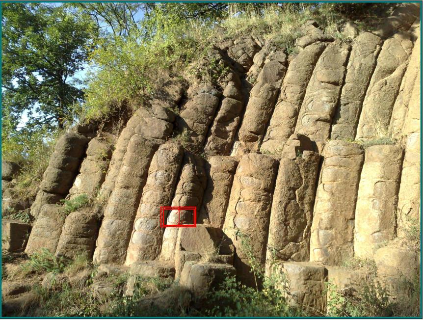
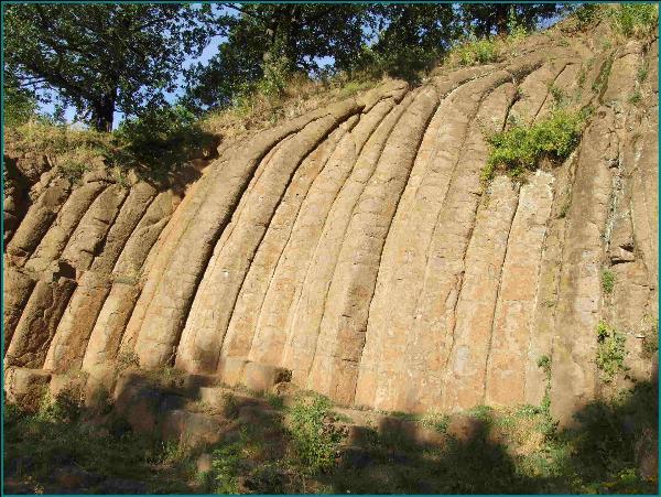
vulkanickou cinností v období tretihor. Nachází se ve starém lomu
jihovýchodne od obce Konojedy a je známé také jako Konojedské
bochníky. Lom byl založen v lávovém proudu analcimického tefritu
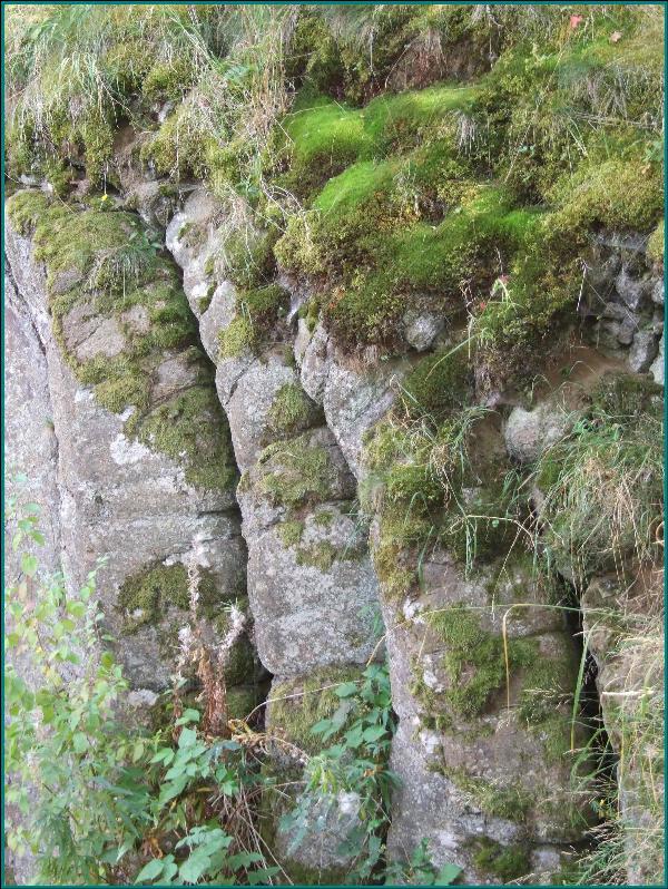
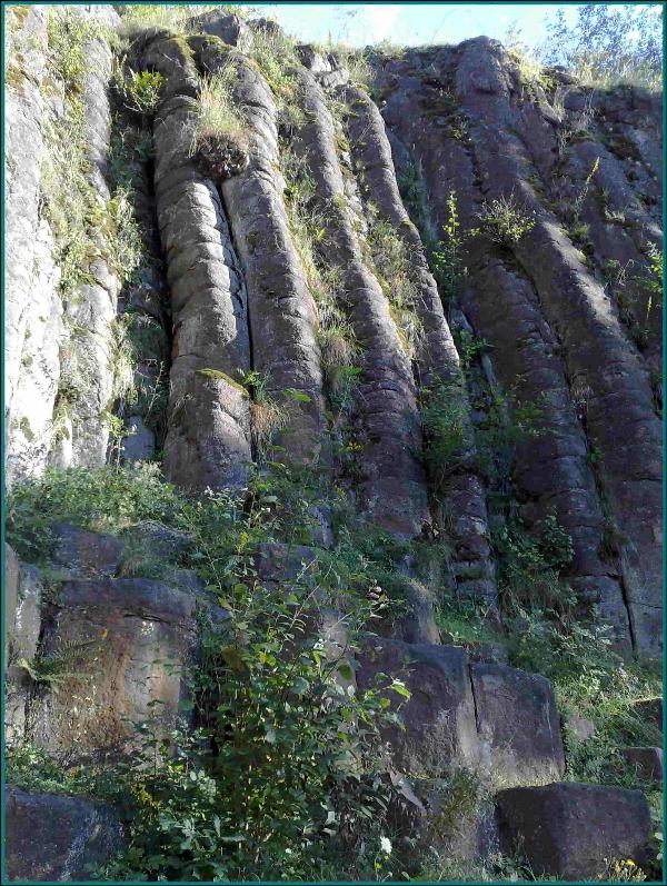
Dubí hory. Tefrit je tmavošedá magmatická hornina. V lomu lze
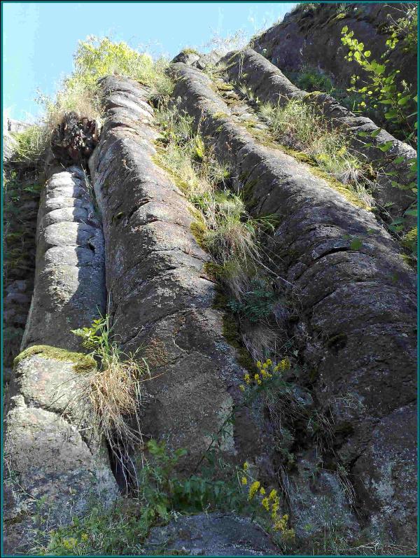
pozorovat prícne rozpukané ohýbané sloupce, které se jakoby
sestávají z mnoha na sebe postavených bochníku. Subhorizontální
odlucnost v kombinaci se sloupci je pro celý tento výlev
charakteristická. Ohýbání sloupcu na chránené lokalite je zpusobeno
morfologií terénu, na který se lávový proud vylil. Ony
charakteristické bochníky jsou pouze výsledkem zvetrávání
zvýraznené primární textury horniny. Tefritové sloupce jsou asi 7
metru vysoké a 80 centimetru silné.
Vaším úkolem je zodpovedet
následující:
1.Místo je národní prírodní
památka, ve kterém roce byla vyhlášena ?
2.Jak velká je plocha národní
prírodní památky ?
3.Na severní strane lomu najdete
místo, oznacené na poslední fotografii cerveným rámeckem, zmerte
výšku oznaceného „bochníku“.
4.Zašlete nadmorskou výšku na
souradnicích.
K logu priložte fotografii vás
nebo vaší GPS s bochníky.
Zaslat na adresu :
earthcache@centrum.cz


This earthacache is going to lead
you to a very interesting and quite place in natural reserve Ceské
Stredohorí, the countryside created with volcanic activity in the
tertiary period. The site is located in the old quarry situated
southeast of Konojedy and is also known as Konojedy loafs . The
quarry was founded in the lava flow of analcimite tefrite of Dubí
Mountain. Tefrite is dark grey magmatic rock. In the wall the
formel quarry, paralel columns of secondarily cracked tephrite rock
can be found which look like stacked loafs. Sub-horizontal dividing
in combination with columns is characteristic for the whole flow.
Bending of columns is caused with terrain morfology where the
stream of lava poured out. The typical loafs are just the result of
weathering. The columns of tefrite are about 7 metres high and 80
centimetres thick.
Your task is to answer the
following questions :
1.This site is national nature
sanctuary, send the year when it has been declared.
2.How big is the area of the
national nature sanctuary (ha) ?
3.There is a „loaf“ on the
northern wall (in the red box on the last picture), What is the
height of this loaf ?
4.Send the altitude on the
coordinates.
Add a picture of you or your GPS
device with loafs to your log.
Send to : earthcache@centrum.cz