Die Fränkische Linie - The Franconian Line
[ENG]
Along the Franconian Line ("Fränkische Linie") the crust of the earth is broken up across several hundred kilometers.
At the geological points ("Geopunkte") in Goldkronach this fracture zone, which seperates basement and overburden, is descriptive explained.
Go to the following geological points and answer the respective question.
1. Overburden - Geological Panorama
N 50° 00.767
E 11° 41.929
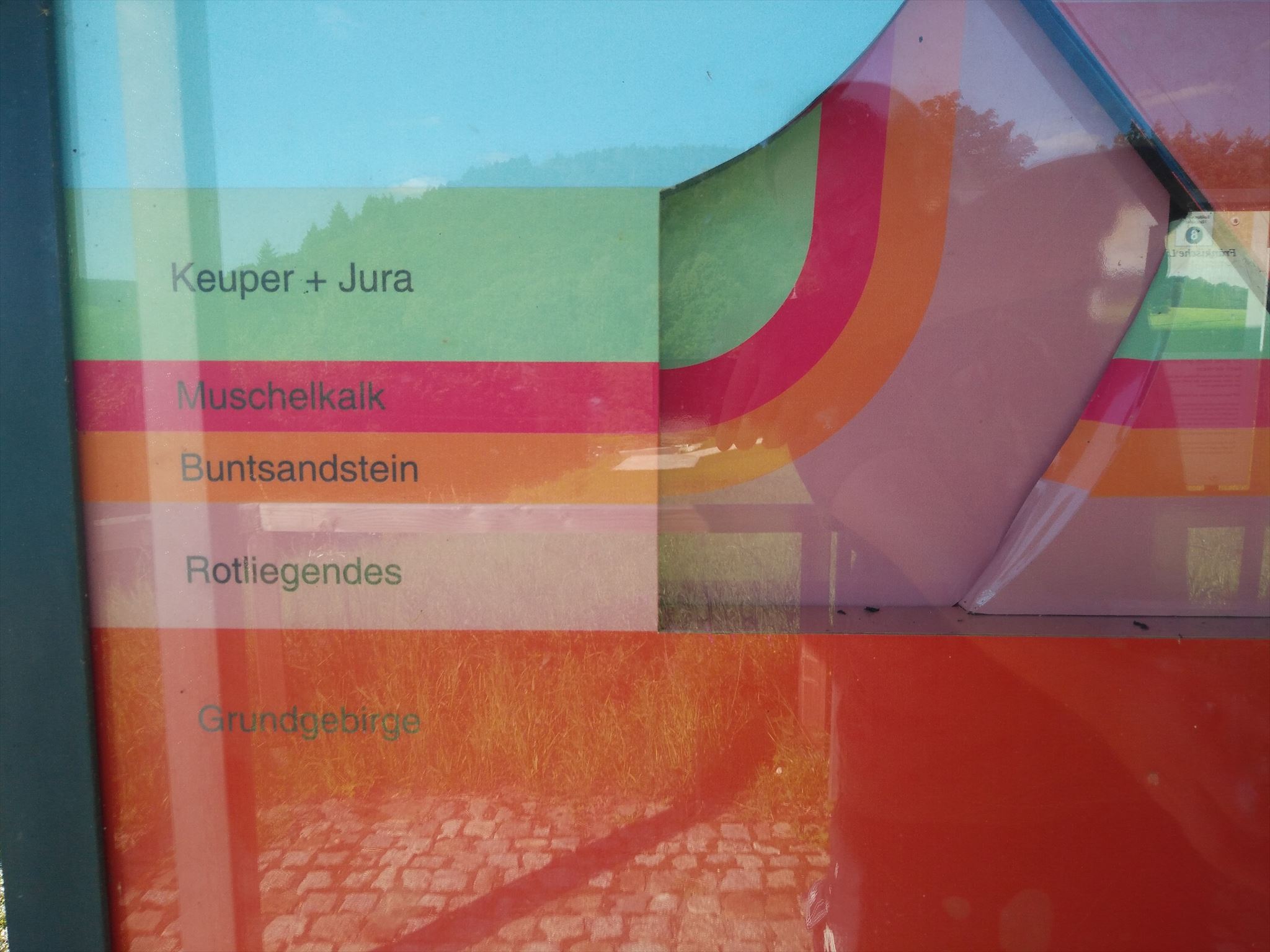
From here you can see almost all geologic formations of Europe:
- in the East the Fichtelgebirge as a part of the Bohemian Mass ("Böhmische Masse");
- in the North the plateau of the Frankenwald with the folded layer of the Palaeozonic
- in the West and Southwest the overburden with the different layers of Permian, Trias and Jurassic.
The question:
Of which rock consists the heights of the Oschenberg and Bindlacher Berg?
2. Basement - Ottenleite Quarry
N 50° 00.729
E 11° 41.544
Here you can see the cuesta from the Palaeozonic which, amongst others build the basement of Central Europe
The question:
Which rock is embedded in the lower layer?
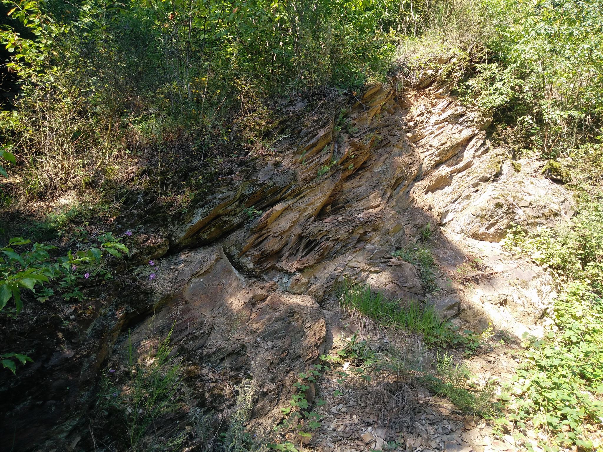
3. The Fault
N 50° 00.892
E 11° 41.146
Here (ca. 20 m above the pavillion) you can see the Franconian Line ("Fränkische Linie") where the Bohemian Mass moves over the Souther German Massif. At the model you can simulate the formation of the Franconian Line.
The Question
How many million years ago the Franconian Line had the same form as shown in the picture below?
To log the cache send me the answers to the 3 questions.
(take the German words)
You may log the cache immediately. I will contact you if your answers are wrong.
Have fun!
[GER]
Entlang der Fränkischen Linie ist die Erdkruste über mehrere hundert Kilometer aufgebrochen.
An den verschiedenen Geopunkten in Goldkronach wird diese Bruchzone, die Grund- und Deckgebirge trennt, anschaulich erklärt.
Begebt euch zu den folgenden Geopunkten und beantwortet die jeweilige Frage.
1. Deckgebirge - Geologischer Rundblick
N 50° 00.767
E 11° 41.929
Von hier könnt ihr auf fast alle geologischen Formationen blicken, die in Europa vorkommen:
- Im Osten das Fichtelgebirge als Teil der Böhmischen Masse;
- Im Norden die Hochfläche des Frankenwaldes mit den gefalteten Schichten des Erdaltertums;
- Im Westen und Südwesten das Deckgebirge mit den verschiedenen Schichten des Perm, Trias und Jura.
Die Frage hierzu lautet:
Aus welchem Gestein bestehen die Höhen des Oschenberg und Bindlacher Berg?
2. Grundgebirge - Steinbruch Ottenleite
N 50° 00.729
E 11° 41.544
Hier sieht man Schichtstapel aus dem Erdaltertum, die u. a. den Unterbau Mitteleuropas bilden.
Die Frage hierzu lautet:
Welche Gesteinsart ist in die untere Gesteinsschicht eingelagert?
3. Der Bruch
N 50° 00.892
E 11° 41.146
Hier (ca. 20 m oberhalb des Pavillions) verläuft die Fränkische Linie, an der sich die Böhmische Masse auf die Süddeutsche Scholle schiebt. Am Modell kann man aktiv die Entstehung der Fränkischen Linie nachvollziehen.
Die Frage hierzu lautet:
Vor wieviel Millionen Jahren hatte die Fränkische Linie die auf dem unten Foto gezeigte Form?
Um den Cache zu loggen beantwortet die 3 Fragen und sendet mir die Antworten per Mail.
Du kannst den Cache sofort loggen. Sollten die Antworten falsch sein, melde ich mich.
Quellangaben: GEOPARK Bayern-Böhmen