 Cartography is a
science in the base of Geology. Without good positioning no
maps would have been drawn, without maps, Geology would just
be a useless collection of dusty rocks, minerals and
fossils.
Cartography is a
science in the base of Geology. Without good positioning no
maps would have been drawn, without maps, Geology would just
be a useless collection of dusty rocks, minerals and
fossils.
This Earth cache is a memento to all
cartographers, particularly the Portuguese ones of old times. Yes,
I have a special bias towards the Portuguese navigators and
cartographers of XV and XVI centuries that opened the world seas
and charted the coastlines and, in varying degrees the hinterland,
of Europe, America, Africa, Asia and Oceania (Antarctica was much
too cold…). They have done all this with magnetic compasses and
astrolabes, without satellites, GPS, laser based devices or cell
phones. No hints or spoilers in web pages, they just had
intelligence and courage. Those were true geocachers; Earth
discovery was their treasure. 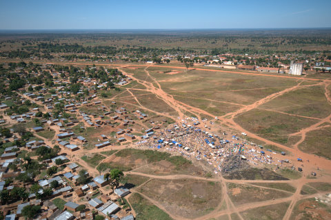
This cache in the exact center of Angola is also
a recognition of the warmth and “joie de vivre” of the Angolans, a
people with whom we Portuguese share History and with whom we mixed
the blood, values and culture.
Cartography’s central function, spatially
structuring geological knowledge, is very visible in Economical
Geology. Two Angolan examples I have faced:
1.
Alluvial diamond
mineralization occurs in clusters: diamond concentrate in
morphological traps (e.g. bedrock depressions, old river channels,
potholes, etc.). Given this erratic mineralization nature, a
precise conversion from the older Angolan coordinate systems
Camacupa-based into modern systems is is crucial for mine planning
and resource evaluation based on old (but extremely valuable)
exploration data, only crudely geo-referenced. In the not very
distant past, 200 to 300 m positioning errors (due to bad
conversions) were common, leading to erroneous decisions and
consequently to an unjustified credibility loss of past exploration
data.
2.
Kimberlites are rare
rocks; diamond mineralized kimberlites are even rarer bodies;
economic primary diamond deposits are counted by a few dozens.
Kimberlite bodies have small outcrops, with areas above 30 ha being
quite uncommon. An economic kimberlite being crossed by the line
separating two concessions seems an impossible event. Well, it
happened in Angola (and elsewhere). In Angola, with potentially
imprecise coordinate systems conversions (from Camacupa based to
WGS 84), this may lead millions of dollar losses to one of the
sides (and gains to the other) of the concession
borders.
This particular c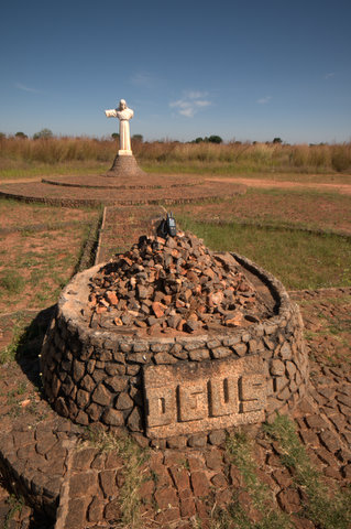 ase led me to
investigate and evaluate the available conversion algorithms
(ArcGIS has ten and I have found others). Later on I visited
the Camacupa’s datum origin. This cache is a secondary result
of this work.
ase led me to
investigate and evaluate the available conversion algorithms
(ArcGIS has ten and I have found others). Later on I visited
the Camacupa’s datum origin. This cache is a secondary result
of this work.
Located in the geographical center of Angola,
Camacupa is an important locality. The region is crossed by the
railway (Caminho de Ferro de Benguela), on its way from the
Lobito harbor in the Angolan coast to Luau in the Eastern border of
Angola and further to Central Africa (Zambia and RDC). The complete
rehabilitation of the 1301 km long railroad to Moxico County is
estimated to be concluded in 2012. Camacupa has also an economic
potential based on agriculture and mining. This entire region will
bloom, as soon the trains start moving again.
Camacupa also has the distinction of being the
Angolan geographical center and the origin of the Camacupa datum,
used in most Angolan maps. The (somewhat technical) description
Camacupa datum has been based on a paper by Clifford J. Mugnier
published in Photogrammetric Engineering & Remote Sensing
(March 2001).
The Camacupa Datum of 1948 is based on the
origin at Campo de Aviação (airfield) where f0 =
12° 01' 19.070" South, ?0 = 17° 27' 19.800" East of
Greenwich, and ho = 1508.3 m.
Thanks to John W. Hager, “This is the principal
vertex marked by a concrete monument, constructed on a high part of
the Camacupa Air Field, immediately to the north of the runways.”
(This is) “defined as the “Datum Point” of the main triangulation
network of Angola. A concrete monument with the dimensions 70 ´ 60
´ 100 cm (length E-W ´ width N-S ´ height), topped by a white
marble slab on which is cut in black: M.G.A. –P.F.- 1948; in the
center of which is placed the top mark of the base, which is
defined as the extreme West of the Geodetic Base of Camacupa. The
mark found here is protected by a masonry casing with a metallic
cover, easily removed to permit observations over the base when
necessary.” Remarkably, some Datums establ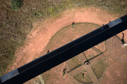 ished by the
Portuguese in Angola (and Mozambique) were referenced to the
Clarke 1866 ellipsoid (the same as used in the U.S. for the
North American Datum of 1927) where a = 6,378,206.4 m and b=
6,356,583.8 m.
ished by the
Portuguese in Angola (and Mozambique) were referenced to the
Clarke 1866 ellipsoid (the same as used in the U.S. for the
North American Datum of 1927) where a = 6,378,206.4 m and b=
6,356,583.8 m.
Other datums existing in Angola include the
Lobito Datum of 1937 based on the origin point at the astronomical
pillar Restinga do Lobito, Extremo NE da Base do Lobito, where
f0 = 12° 19' 00.86" South, ?0 = 13° 34'
45.67" East of Greenwich, Clarke 1866 ellipsoid. Dr. José Carvalho
of Maputo, Mozambique states that the Camacupa Datum of 1948
coordinates of the same point are f0 = 12° 19' 01.357"
South, ?0 = 13° 34' 58.375" East of
Greenwich.
The transformation from the Lobito 1937 Datum to
the WGS 84 Datum is DX = –256.73 m, DY = 0.00 m, and DZ = –103.67 m
(±10 m).
The Luanda Datum is based on the origin point at
Luanda Observatory where F0 = 08° 48' 46.8" South, ?0 =
13° 13' 21.8" East of Greenwich, Clarke 1866 ellipsoid. The
Moçamedes Datum of 1956 origin point is at the Moçamedes
Meteorological Station where f0 = 15° 11' 16.34" South,
?0 = 12° 07' 34.53" East of Greenwich, Clarke 1866
ellipsoid.
To log this cache you have to:
-
E-mail me a picture of you (with your GPS) next
to the statue nearby.
-
This cache is about coordinate conversion (and
diamond deposits). E-mail me the Camacupa origin point coordinates
in both the WGS84 and WGS72 Map Datums.
-
The Camacupa Datum origin is located inside the
Lucapa Corridor (don't confuse it with the Lucapa Graben), a belt
of kimberlites and carbonatites extending from SW Angola into
Mbujy-Mayi (RDC). The statue next to the datum origin is made of a
rock: that rock's most abundant mineral is also a characteristic
mineral of a certain type of
kimberlites. What is the mineral in
question?