Geology
The most prominent geological feature of this valley is the Wellington Fault.
The Wellington Fault
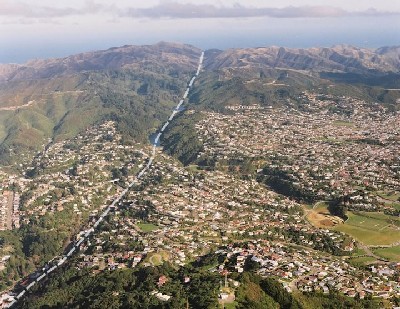
The Wellington Fault is one of the longest of New Zealand’s on-shore active faults. From its southernmost known location in Cook Strait, it can be followed for some 420 km more or less continuously, northwards past the south Wellington shoreline, through Wellington and the Hutt Valley, through the Tararua Range to the Manawatu River. Beyond the Manawatu River the fault essentially changes only by name and continues northwards to the coastline of the Bay of Plenty and beyond.
The 75 km length of the fault between Cook Strait and Kaitoke is known as the Wellington-Hutt Valley segment. The southernmost section of this segment that runs through the Karori Sanctuary valley is aligned approximately NNE-SSW. As you approach the published coordinates, the fault forms a steep west-facing scarp along Waiapu Road. Behind the block of flats at Number 29 is a slightly modified fault scarp. The fault is thought to pass underneath the flats, as their foundation design was such that piles were not planned to be founded in bedrock. The fault then runs along the road above the true right bank of the Kaiwharawhara Stream. At the published coordinates, the fault is directly below your feet. From this point the fault runs south-westwards to pass through the Lower Karori dam between the centre and the right (east) abutment, and then through the Upper Reservoir and beyond.
Faults and gold
Major geological faults often play a role in controlling the deposition of gold and other metal deposits. Heated water rises through the faults to surface. In some cases, this water contains dissolved particles of gold and other minerals. When the water hits a certain temperature and pressure, these minerals precipitate out, forming a vein. At lower levels, elements such as copper, lead and zinc are deposited. Higher up in the system, gold is deposited.
The rocks in this valley, as in most of the Wellington area, are old sedimentary rocks that once filled the New Zealand Geosyncline. A geosyncline is a trough-like depression in the sea floor bordering a landmass or group of islands into which is deposited the products of the erosion of the landmass, or of volcanic activity. The great thickness of sediments (mud, sand, gravel, etc.) accumulating in the geosyncline gradually weigh down the crust, deepening the geosyncline and allowing the deposition of even more material. More or less evenly dispersed through the sediments in this area were minute amounts of metallic elements (gold, mercury, antimony and tungsten) that had been eroded from the rocks of the old landmass bordering the geosyncline.
The features of the greywacke and argillite rocks of the Wellington area tell us they were originally buried to a depth of some 16-24 km. The pressures and temperatures at that depth have compacted and hardened the rocks, and in the process have produced a very complex and closely-spaced pattern of joints. As the sediments in the geosyncline were pushed deeper and deeper into the crust, the water originally present in them was driven upwards towards the higher cooler levels. This migrating water was able to react with the sediments and remove various minerals such as quartz and many of the metallic elements in the rocks. This process concentrated the metals, and in the higher cooler parts metallic deposits were left behind by the percolating water in cavities, fissures, etc.
Gold occurs originally in quartz veins in the rock. When the rock is exposed on the surface, its individual minerals decompose to form various types of clay. The clay is washed away, but the gold and quartz, being very resistant, remain behind. This natural “winnowing” process, acting over long periods of time, has concentrated the gold in alluvial deposits – the materials deposited by rivers and streams.
Brief gold mining history
In the 19th century, there was a short-lived gold rush in this valley before the area was set aside as the catchment for Wellington's water supply. In June 1869, alluvial gold was discovered in the Kaiwharawhara Stream near the present-day Karori tunnel. Because of the proximity to the city (within half an hour’s walk), residents quickly flocked to the area. But by the end of July, claims in the upper stream were abandoned and new claims were opened downstream where the Old Karori Road crossed the stream.
Within two years though, alluvial mining had disappeared and was replaced by quartz mining. Miners tried to intercept quartz outcropping on the surface by driving adits (horizontal tunnels) to the rock 5-10 metres below the surface, in the hope of encountering zones enriched in gold at the base of the weathering profile. Water wheels and crushing machinery were installed by the Baker's Hill Mining Company and at the Morning Star lease. Three other neighbouring claims were also formed in the area.
Unfortunately, most quartz in the region turned out to be non-mineralised, re-crystallised cherts. Poor returns from all leases soon spelled the end of gold mining in Karori. In 1873, completion of the waterworks dam resulted in the closure of the Baker's Hill and Morning Star mines, as their land and ground works were submerged when the reservoir was filled. Two claims in the upper valley, Union and Try Again, although not directly affected by the water level, could not operate within the restricted access area of the reservoir catchment. When the Golden Crown also faded shortly after, quartz mining in Karori came to an end. Some small-scale alluvial mining, intermittent prospecting, and working of quartz reefs persisted to 1897.
EarthCache activities
The published coordinates are at the car park. You enter ZEALANDIA through the predator-proof fence. Then, head towards the Morning Star and Union Mine Tracks, which will take you to discover remnants of the respective mines. A lot of interesting information on the Karori gold rush is displayed along these walking tracks. You will need information from these displays to answer some of the EarthCache questions below. (Note: the waypoint coordinates below are approximate, but should be sufficient to guide you to the right general areas.)
From the start of the Morning Star Track on Lake Road (S41°17.67 E174°45.02), a 2-minute walk uphill takes you to the Morning Star goldmine (S41°17.70 E174°45.06). The gate inside the goldmine is open on weekends and public holidays, so you can go right inside the length of the adit to the bottom of the vertical shaft. Outside these times, you can venture about a third of the way in. The path to the goldmine is however not suitable for pushchairs or wheelchairs.
At the entrance to the Morning Star tunnel, mark a waypoint on your GPSr noting the altitude (elevation) at this point (WP-MS). Take a photo of yourself (and the GPS) here.
Go further up the track to the top of the Morning Star vertical shaft (S41°17.69 E174°45.07). From this point, using your GPSr estimate the length of the goldmine tunnel (distance to WP-MS) and the height of the vertical shaft (altitude difference from WP-MS).
The Union goldmine is located on the next track up the valley beyond the Weka Fence. The adit (S41°17.75 E174°44.99) is however not open to the public.
The Golden Crown mine is located downstream from ZEALANDIA and is near another cache (Cave on Pooh Corner - GC12APJ) in the area.
The EarthCache location is open 10:00 – 17:00 daily (except Christmas Day), with last entry at 16:00. (In February & March, there are special summer opening hours every Friday, Saturday and Sunday until 20:00, with last admissions at 19:00.) Admission is free for Trust members and children under 5 years. Otherwise general admission fees apply. See www.sanctuary.org.nz for details and Conditions of Entry.
Logging requirements
To claim your find, you need to answer the following questions, using your measurements, observations, and information obtained along the walking tracks:
- Around 1869-1870 alluvial mining in the valley gave way to hard rock mining. What was the main kind of gold-bearing rock being dug out?
- From your measurements, how deep is the Morning Star tunnel from the entrance to the bottom of the shaft?
- How high is the Morning Star shaft?
- How far (straight line) is the Union Mine tunnel entrance from the Morning Star tunnel entrance?
- There are four main types of geology associated with where New Zealand gold is found. From your observation and information at the site, which type is associated with the Karori gold mines?
A. Quartz veins in schist and in river gravels which have weathered from schist
B. Greywacke and argillite rocks in faulted areas called shear zones
C. Quartz veins within volcanic rocks
D. Geothermal deposits
Please email us your answers and wait for our confirmation before logging your find. With your log, post a photo of yourself (and the GPS) in front of the Morning Star Goldmine entrance.
In order not to spoil the fun of other geocachers, please do not post any other spoiler photos.