Pisecny presyp Pisty
CZ
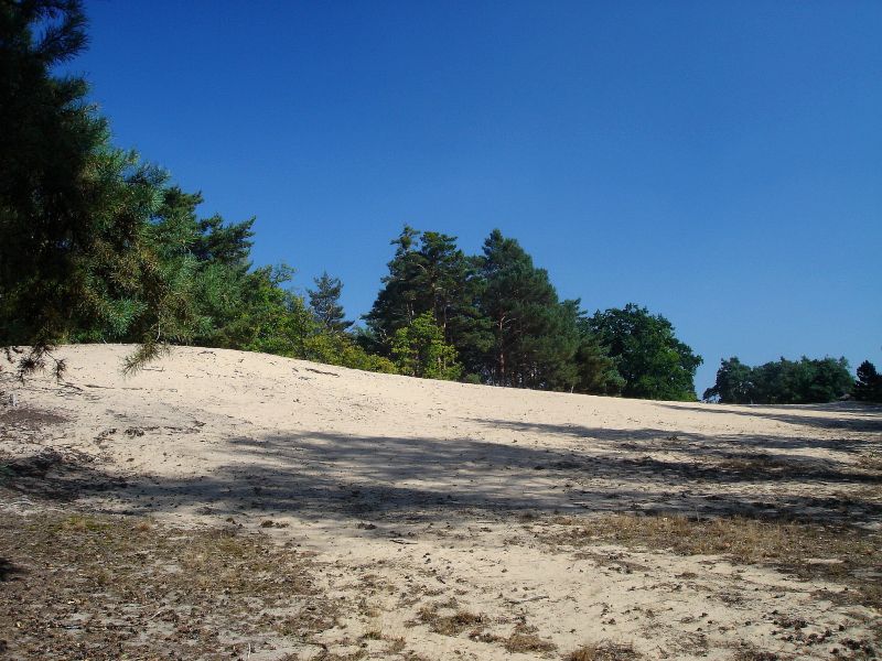
Hned za vesnici Pisty muzeme najit krasny
pozustatek polabske duny. Nachazi se na rozloze cca 3.7 ha a byla
jako Pisecny presyp u Pist vyhlasena v roce 1951 narodni
pamatkou.
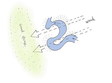
Duna byla zformovana behem Pleistocenu (starsi oddeleni ctvrtohor
cca 1.8 milionu let az 10 000 let pr.n.l.) jemnym navatym piskem.
Klima v plestocenu bylo poznamenano obakujicimi se doby ledovymi,
behem kterych v nezamrzlych castech sveta doslo k logickemu ubytku
vody v rekach, kdyz voda byla zamrzla v ledovcich. Snizeni hladiny
rek samozrejme prispivalo k erozim, stejne jako opetovne vzedmuti
hladiny pri teplejsim obdobi. Material reky odnasely a na
klidnejsich mistech vyplavovaly a tak vznikaly terasy. Na nich
eroze na drobnejsi castecky nadale pokracovala a ty nejjemnesi byly
odnaseny vetrem, diky kteremu byla vytvorena velka duna.
Do dnesni doby samozrejme vetsina duny zarostla vegetaci, ale porad
velika cast (na rozdil napriklad od dun u Svaravy - Tynec nad
Labem, ktere jsou zarostle cele) zustala odkryta.
V pisecne "pousti" se samozrejme libi piskomilnym spolecenstvim
rostlin a hmyzu. Jake to jsou muzete nastudovat na nedaleke
informacni tabuli.
Jako podminku zalogovani prilozte vasi fotku (nebo gpsky) s
dunou nebo s informacni ceduli, na ktere si muzete precist par
poucnych veci.
EN
Next to a village Pisty is located one of the
last sand dunes around river Labe.
Dune occupies area of 3.7 ha and as Natural monument was publicated
in 1951.
The dune was formed in Pleistocene by blowing sand. The material
like stones and gravel sand was carried here during the centuries
by river Labe made the terrace. Then material eroded and finally
winds done their work - ultra-fine grained sand was blowed away and
formed the dune.

The Pleistocene is the epoch from 1.8 million to
10 000 years BP. The name pleistocene is derived from the Greek
pleistos = "most" and kainos = "new".
Pleistocene climate was marked by repeated glacial cycles where
continental glaciers pushed to the 40th parallel in some places. It
is estimated that, at maximum glacial extent, 30% of the Earth's
surface was covered by ice.
The effects of glaciation were global. Antarctica was ice-bound
throughout the Pleistocene as well as the preceding Pliocene. The
Andes were covered in the south by the Patagonian ice cap. There
were glaciers in New Zealand and Tasmania. The current decaying
glaciers of Mount Kenya, Mount Kilimanjaro, and the Ruwenzori Range
in east and central Africa were larger. Glaciers existed in the
mountains of Ethiopia and to the west in the Atlas mountains.
(wiki)
The warner and colder times had ged. In the colder times there were
less water in the rivers, because water was frozen in the glaciers.
Repetitious decreasing (in cold times) and raising (in warmer time)
of the river level caused erosions. Material was carried by rivers
and formed terraces. Progressive erosions caused, that small
seeding could be blowed away and formed the dunes.
In our times Pisty dune is only remaining of the great dunes around
river Labe. In last 10 000 years most of the dunes were grown by
vegetation.
thx Milancer for photo
Today location is important for sandloving communities of herbs and
insects.
Which typical sandloving herbs, beetles and animals here we can
find is written on a table nearby coordinates.
LOGGING EARTHCACHE
Your task is:
1) write me at least 3 of them
2) write me length and width of the dune (use your steps  )
)
3) upload your or gps photo with the dune
web site:
http://botany.cz/cs/pisty/