Møns Klint er Danmarks største hvide Klint. Og virkeligt et besøg værd. Lettest adgang er ved at køre til GeoCenter Møns Klint, hvor der er en stor parkeringsplads (P-Afgift på 35 kr. der går til vedligeholdelse).
Advarsel:Fare for Skred - Færdsel på eget ansvar!!! Normalt sker skred i forårsmånederne eller efter kraftige regnskyl, men kan forekomme året rundt .
Møns Klint is the highest white cliff and one of Denmark’s most scenic places. Easiest access by car is to park at the parking lot at Geocenter Møns Klint (P-fee 35 kr. to maintain area).
Warning!!! Landslides!!!Walking in the Cliff is on own risk!!! Landslides normally occur only in spring but can happen year round, especially after heavy Rain
Se nederst på siden for regler for at logge denne Earth cache
At the bottom of the page you can see rules for logging this Earth Cache
Møns Klint består af kridtformationer fra det hav der dækkede Danmark for millioner af år siden. Kridtet blev dannet af kalkskaller fra mikroskopiske dyr, der aflejrede sig på bunden og blev presset sammen. Og blev under istiden foldet sammen i op til 50 meter tykt kalk lag. Hvis du er heldig kan du i kridtet og på stranden finde forsteninger af større dyr som eksempelvis blæksprutter, søpindsvin og muslinger. Oftest i kridt, men kan også findes i flintestenene
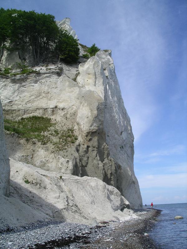
Møns Klint er 7 km lang og op til 130 m høj. Den strækker sig fra Møns Fyr i syd til Liselund Slotspark i nord. Møns Klint byder på et særligt og kuperet terræn, som er delt i mange afsnit, der hver for sig bidrager til det imponerende, fantastiske landskabsbillede som Møns Klint er. En klint der er i konstant forandring som følge af havets grådige nedbrydning. Hvert år forsvinder cirka 20-40 centimeter af klinten. Fra toppen af klinten har du en fantastisk udsigt over Østersøen, der ved klinten er farvet i helt fantastiske blå og grønne nuancer, som står i markant kontrast til det hvide kridt og de lyse bøgetræer. Man kan normalt følge Møns Klint til fods langs kysten, selv om skred af og til skaber naturlige forhindringer. Ved klintens fod er der rig mulighed for at finde rav eller andre forsteninger.
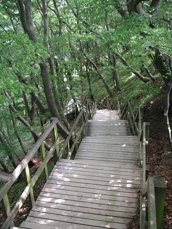
Afsæt god tid til besøget, måske med madkurv og nyd naturen med bl.a. de sjældne orkidéer, eller hvis man er meget heldig kan man få et glimt af verdens hurtigste dyr – Vandrefalken, som i Danmark kun yngler på Møns Klint. Ved Geocenter Møns Klint kan man få gratis oplysninger om Klinten og dens historie, inklusive kort og forslag til vandre ture. Der er 4 trapper fra klintens top og ned til vandet. Alle har lige under 500 trin, og husk man skal også gå op igen, husk drikkevarer. Foruden turen ned til vandet må I ikke snyde jer selv for en vandretur på toppen af klinten. Man kan også parkere ved Møns Fyr (gratis) og gå der ca. 3-4 Km langs vandet til de højeste skrænter, men vil så gå glip af udsigten fra toppen af Klinten
Møns Klint is created in when ocean was covering Denmark. The ocean was lukewarm and of the algae living in the water had shell of limestone. Throughout millions of years the shells was creating thick layers of chalk on the bottom of the ocean during the time the “chalky” animals and the dinosaurs died out. During the Ice Age up to 50 meters the chalk were peeled off pushed and folded together. If you search a bit on the shoreline, you can find several Fossils, most often belemnites, urchins and mussels. Most often you find the fossils in the white chalk, but you can also find them into the stone (flint)
Møns Klint is 7 km long and up to 130 meter high. It start in the south at Møns Fyr and walk at the cost line to the north at Liselund Park. It is normally possible to walk at the beach shoreline, but can be impossible if landslides pushed down the land into the ocean or when high tides when the wind blows against the shore. Land sliding will every year “eat” 20-40 cm of Møns Klint.
Assign a full day for the visit. Possibly take a picnic basket and enjoy the nature and the protected wild orchids- and if you are very lucky you can discover the Peregrine Falcon, the fastest animal on earth in Denmark on breeding at Møns Klint. Free maps and information can be obtained at Geocenter Møns Klint.Take one of the 4 stairs down to the ocean (almost 500 steps) remember drinking water – you will need to climb up again, but also take a nice walk on the forest path on top of the cliff. Alternative you can park at Møns Fyr (free) and walk the shoreline 3-4 kilometers.
For at logge denne Cache skal du: (danner grundlag for sværhedsgraden)
- Sende en e-mail til os på vores Geocaching profil, hvor du besvarer følgende to spørgsmål:
a. For mange millioner år siden var det at havet dækkede Danmark og dyr og alger dannede det enorme kridtlag der i dag kan ses på Møns Klint. For hvor mange millioner år siden var det?
b. Efter et skred ved ”Store taler” i 2007 fandt man en sjælden forstening, en tand fra en for længst uddød dyreart. Hvad er navnet på den dyre-familie hvorfra tanden stammer - (svaret er ikke dinosaur)
Du må meget gerne "uploade" et billede af din oplevelse med klinten set i baggrunden set fra stranden, gerne nedenfor trappen Kordinatet:N54 57.946 E012 33.150
Du behøver ikke afvente vort svar for at logge cachen på geocaching.com. Hvis svaret er forkert, kontakter vi dig. – logs uden e-mail med korrekt svar vil blive slettet
To log this cache you must do the following: (justify cache level)
- E-mail us at our Geocaching profile e-mail, with answer to the following 2 questions:
a. Many millions of years ago, the ocean covered Denmark and small animals and microscopic algae were creating the enormous layers of white chalk you can see at Møns Klint today.
Answer me: how many millions of years ago this happened
b. After a landslide at”Store Taler” in 2007 a rare fossil was found, a tooth of specie that no longer exist. What do you call those animals? (The answer is not dinosaur)
If you wish, we would be happy to see a photo from your visit at Møns Klint seen from the beach with the white cliff in the background.
Could as an example be just at the beach end of the stairs at Coordinates: N54 57.946 E012 33.150
Your don’t need to wait for our answer to log the cache at geocaching.com. If you don’t have the correct answer we will contact you. – logs without e-mail with correct answers will be deleted.
Additional information
Parkering (Parking) N54 57.931 E012 32.807 (Afgift/Fee = 35kr)
Geocenter Møns Klint - Trappe til Stranden /Stairs to the beach N54 57.987 E012 32.907
Photo spot Earth cache = N54 57.946 E012 33.150
Gråryg trappe (retur?) oppe /alternative stairs uppper = N54 57.541 E012 32.982 (482 trin)
Gråryg trappe (retur?) nede /alternative stairs beach = N54 57.517 E012 33.131 (482 steps)
GeoCenter Møns Klint home page: http://www.moensklint.dk/
Skov og natur vandreture 53
English folder here: http://www.skovognatur.dk/NR/rdonlyres/07C13F4A-A4FC-4ACB-8491-10C50CE035AD/0/53_Moen_UK_A4.pdf