Byrd Point is the site of a Fire Lookout for the US Forest
Service. It is listed as a camp and was manned in the 1930s. The
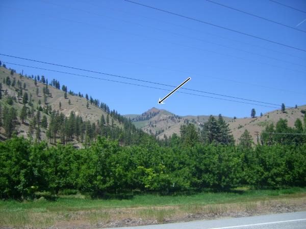
elevation is 3737 feet and the location has an exceptional 360 view
of the area, which takes in the Entiat and Chelan Mountains, Chelan
Butte, and miles of the Columbia River. If you look across the
Columbia river, you can see Desert Canyon Golf Resort on the other
side.
To get there drive North on US 97A past Entiat and drive up
Oklahoma Gulch to the top. Drive the ridgeline west then south,
past a cache called Long Lost Lookout site (another former lookout
on Goman Peak), and after 1/2 mile or so, take a left fork. The
road after that is no longer car-friendly. The next mile and a half
requires a high clearance rig. If you don't have one, then you can
walk the old lookout access road for 1-1/2 miles to the cache. If
you have a high clearance vehicle, you can drive to within 1/4 mile
of the cache.
Since this was a FS camp, very little remains, but if you look
closely you can see where they stacked stones as chairs for
viewing.
Enjoy!
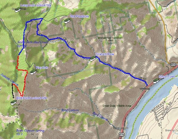
Map legend: Blue Line is Oklahoma Gulch Road, Red Line is
lookout access road (high clearance or hike), black line is 1/4
mile hike to the top from parking coordinates. Other nearby caches
also shown.