 Os Descobrimentos
|
Lagos e Sagres são duas localidades
intimamente relacionadas, desde o início do Século XV, ao início da
expansão marítima portuguesa que veio dar novo vigor às terras e
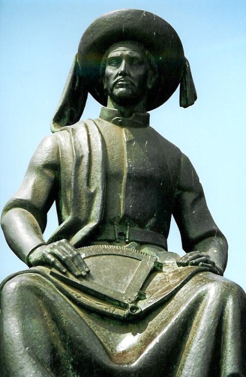
gentes algarvias e ficam para sempre ligadas ao Infante D. Henrique
e aos Descobrimentos.
A
conquista de Ceuta é considerada como o início da época da expansão
portuguesa, tipicamente referida como os Descobrimentos. Foi uma
praça conquistada com relativa facilidade, por uma expedição
organizada por D. João I, em 1415. A aventura ultramarina ganharia
grande impulso através da acção do Infante D. Henrique reconhecido
internacionalmente como o seu grande impulsionador. |
 |
 |
Terminada a
Reconquista, o espírito da Cristianização dos povos muçulmanos
subsistia. Portugal dirigia-se agora para o Norte de África outrora
cristão, mas de onde tinham vindo os mouros que invadiram a
Península Ibérica e aí se estabeleceram. Portugal inicia assim um
projecto nacional — o Norte de África que se iria estender às
costas de continente africano e iria até ao extremo da Ásia,
prolongando-se por vários reinados e séculos, desde o reinado de D.
Dinis (1279), passando pelas expedições às Ilhas Canárias do tempo
de D. Afonso IV, pelo projecto do caminho até à Índia de D. João
II, até ao cume de D. João III (1557), altura em que se estabelecia
o Império Português.
Motivações
As motivações para as descobertas foram principalmente, embora não
unicamente, de carácter económico: procurar acesso directo a fontes
de fornecimento de trigo, de ouro ou de escravos e, mais tarde, das
especiarias orientais. Para além da necessidade de alcançar as
fontes de bens escassos ou caros na Europa, havia a intenção
política de atacar ou debilitar pela retaguarda o grande poderio
islâmico, adversário da Cristandade (neste desiderato se
confundindo a estratégia militar e diplomática e o espírito de
evangelização herdado das Cruzadas).
|
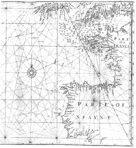
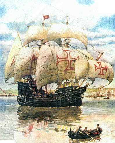
O
equipamento
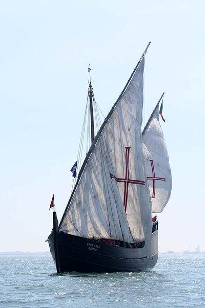
O
navio que marcou a primeira fase dos Descobrimentos portugueses, a
fase atlântica e africana foi a caravela. Era de navegação fácil e
melhor capacidade de bordejar, dado ter um aparelho latino. No
entanto a sua capacidade limitada de carga e a necessidade de uma
grande tripulação eram os seus principais inconvenientes, que, no
entanto, nunca obstaram ao seu sucesso. Este deve-se em boa parte à
evolução técnica registada no século XV e graças às múltiplas
viagens de exploração da costa atlântica africana, substituindo
definitivamente as barcas e os barinéis naquelas actividades de
navegação.
Para a navegação astronómica os lusos,
como outros europeus, recorreram a instrumentos de navegação
árabes, como o astrolábio e o quadrante (um quarto de astrolábio
munido de um fio de prumo), que aligeiraram e simplificaram.
Inventaram ainda outros, como a balestilha, ou "bengala de Jacob"
(para obter no mar a altura do sol e de outros astros), que não
utiliza a graduação de um arco de circunferência mas um segmento
deslizante ao longo de uma haste, com o olho do observador em linha
recta com o astro observado. Eram preciosos instrumentos de
navegação em alto-mar, tendo conhecido uma notável difusão.
Adaptado da Wikipedia
|
 |
|
A cache:
Para descobrir esta cache, terão de investigar um pouco mais acerca
dos Descobrimentos ou simplesmente recordar as aulas de história na
escola, para encontrar as seguintes datas:
A - Descoberta da Madeira (Porto
Santo)
B - Descoberta dos Açores
C - Data em que dobraram o Cabo das Tormentas
(Boa Esperança)
D - Chegada à Índia
E - Descoberta do Brasil
Deverão somar todas as datas para encontrar um número (WXYZ) de
4 algarismos cujo último é 0 (zero).
(A+B+C+D+E) = WXYZ
Retirem o Z (0 - zero) e utilizem o WXY para somar a estas
coordenadas e encontrar as coordenadas finais.
N 37º 05.(237 +WXY)
W 8º 39.(226 +WXY)
Do local final da cache, espero que consigam imaginar as
caravelas portuguesas a partirem para dar Novos mundos ao
Mundo.
NOTA: A cache não deve ser feita por crianças porque o acesso é
algo complicado. Em caso de tempestade no mar e forte ondulação não
façam esta cache pois pode ser perigosa.
|
 |
 The Age of
Discovery
The Age of
Discovery
Lagos and Sagres are two cities related, since the earlier XV
century, to the beginning of the Portuguese marine exploration
which gave a new energy to the Algarve region and its inhabitants.
These cities will remain connected to Henry the Navigator's and the
Age of Discovery.
The Age
of Discovery or Age of Exploration was a period from the early 15th
century and continuing into the early 17th century, during which
Europeans explored the world by ocean searching for trading
partners and particular trade goods. The most desired trading goods
were gold, silver and spices. Western Europeans used new sailing
ship technologies to seek a viable trade route to Asia for valuable
spices which would be uncontested by Mediterranean powers. In terms
of shipping advances, the most important developments were the
creation of the carrack and caravel designs in Portugal. These
vessels evolved from medieval European designs from the North Sea
and both the Christian and Islamic Mediterranean. They were the
first ships that could leave the relatively placid and calm
Mediterranean, Baltic or North Sea and sail safely on the open
Atlantic. |
|
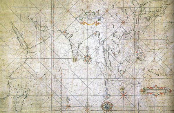
The
first great wave of expeditions was launched by Portugal under
Prince Henry the Navigator. European sailing practices before
Prince Henry had been primarily coastal. Voyages out of sight of
land relied on proven routes detailed in a portolan chart. Portolan
charts showed details of geographic land features, allowing
navigators to identify their departure point, follow a compass
heading, and on landfall identify their position and drift from the
newly presented land features. Due to the risks involved in this
process, European sailors avoided sailing beyond sight of land for
extended periods. A number of nautical myths explained these risks
in terms of oceanic monsters or an edge of the world. Prince
Henry's navigation challenged this belief. The Madeira and the
Azores Islands were discovered in the Atlantic ocean and The
Portuguese settled these islands as colonies.
|
 |
 |
Henry the Navigator's primary project was
exploration of the West Coast of Africa and development of useful
portolan charts. There were commercial, regal and religious
motivations for Henry's endeavor. For centuries the only trade
routes linking West Africa with the Mediterranean world were over
the Western Sahara Desert. These routes bringing slaves and gold
were controlled by the Muslim states of North Africa, long rivals
to Portugal and Spain. The Portuguese monarchy hoped that the
Islamic nations could be bypassed by trading directly with West
Africa by sea. It was also hoped that south of the Sahara the
states would be Christian and potential allies against the Muslims
in the Maghreb. The Portuguese explorers surmounted the obstacle of
Cape Bojador. In the bull Romanus Pontifex the trade monopoly for
newly discovered countries beyond Cape Bojador was granted to the
Portuguese. Within two decades of Portuguese exploration, the
barrier of the Sahara had been overcome and trade in slaves and
gold began in what is today Senegal. A trading fort was built at
Elmina. Cape Verde became the first sugar producing colony. In 1482
an expedition under Diogo Cão made contact with the Kingdom of
Kongo. The crucial breakthrough was when Bartolomeu Dias rounded
(and later named) the Cape of Good Hope and proved that access to
the Indian Ocean was possible from the Atlantic. Later Vasco da
Gama made good on this promise by reaching India.
Adapted from Wkipedia |
|
The cache:
To find this cache, you’ll have to do a little search about
the Age of Portuguese’s’ Discovery to find the year
these events occurred:
A - Discovery of Madeira (Porto
Santo)
B - Discovery of the Azores
C – The year Bartolomeu Dias rounded the
Cape of Good Hope
D – The year Vasco da Gama reached
India
E - Discovery of Brasil
You will have to do some math and sum all the dates to find a
four digits number (WXYZ). Where Z is 0 (zero).
(A+B+C+D+E) = WXYZ
Forget the Z (0 - zero) and use WXY to sum to these coordinates
and find the final coordinates.
N 37º 05.(237 +WXY)
W 8º 39.(226 +WXY)
I hope you’ll be able to imagine from the final cache
location the portuguese caravels sailing away to the unknown, to
discover new worlds.
NOTE: The cache is not recommended for children since the access
could be dangerous. In case of bad weather and storms, DON’T
do this cache because it could be dangerous.
|