Lemieux's Legendary Leda Landslide EarthCache
Lemieux's Legendary Leda Landslide
-
Difficulty:
-

-
Terrain:
-
Size:  (not chosen)
Please note Use of geocaching.com services is subject to the terms and conditions
in our disclaimer.
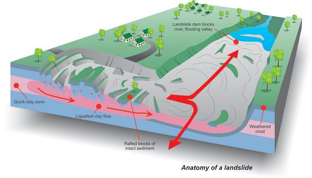
10,000 years ago much of the Ottawa Valley and Eastern Ontario were
covered by the Champlain Sea, formed by glaciers of the most recent
ice age. The sea lasted about 3,000 years until a gradual process
of isostatic rebound occurred, bringing the area back up above sea
level. Glacial sediment, clay and silt, were deposited throughout
much of this area, making what is known as Leda Clay. This clay can
absorb a large amount of water and can thereby liquefy. If
disturbed, and the protective outer layer of soil is removed, the
liquefied Leda clay will become unstable and move, causing a chain
reaction that results in landslides.
About the town of Lemieux: Being situated right on the banks of the
South Nation River was an excellent location for an Eastern-Ontario
mill town: Lemieux. It was established in 1850 and grew into a
farming community with the prevalence of dairy and crop farming in
the area. In 1971 a small landslide occurred along the South Nation
River just upstream from Lemieux. In 1989 the South Nation River
Conservation Authority and Ministry of Natural Resources for
Ontario purchased all the homes in Lemieux. From 1989 until 1991
all homes and buildings were either moved or demolished. “With the
closing of the church, the Parish of Lemieux ceased to exist on
August 4, 1991.”

This is very fortuitous because less than two years later, after
heavy rains, the saturated Leda clay started a landslide. At 3:30pm
on 20 June 1993 the Leda clay under 17 hectares at the former town
site washed into the South Nation River. “Debris traveled 1.7 km
upstream and 1.6 km downstream, completely blocking the river for
several days. The costs related to this event were estimated at $12
500 000.”
To log this earthcache you must go to the posted coordinates. There
is a plaque and an information panel at that location, make note of
the information about Lemieux’s Legendary Leda Landslide. Look
around the field and spot the large white cross nearby.
1. Take a picture of yourself and your GPSr in front of the cross.
2. Send me an e-mail with the following information:
a. The coordinates of the cross.
b. What were the volumetric dimensions of the crater?
c. What was the date and location of Canada’s deadliest Leda clay
landslide?
Please be respectful at the cemetery, no pets allowed.
Additional Hints
(No hints available.)