Pantokrator EarthCache
-
Difficulty:
-

-
Terrain:
-
Size:  (not chosen)
Please note Use of geocaching.com services is subject to the terms and conditions
in our disclaimer.
Introduction
During our 10-days holiday on Corfu in August 2008 we successfully
found all twelve caches on this island. In addition our wayfaring
led us in fabulous places where no cache is placed. On three of
them we decided to create Earthcaches:
Pantokrator,
Pantokrator II and
Bella Vista to Paleokastritsa. We also highly recommend to
visit by boat
Lake Butrint and Vivari Channel which is not so far.
Enjoy this spectacular countryside!
Geomorphology
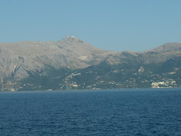
Mount Pantokrator is a mountain located in north-eastern Corfu. At
906m (2,972ft) it is the highest mountain on the island. Corfu is
one of the islands that are contained to the Ionian zone.
The Ionian zone exhibits three distinct stratigraphic sequences,
representing a pre-rift, a syn-rift, and a post-rift stage of
evolution of the Ionian realm, from a neritic platform environment
to a pelagic basin. Corfu is located near the Kefalonia geological
fault formation and as such earthquakes sometimes are felt. The
whole island, composed as it is of various limestones formations,
presents great diversity of surface, and the views from the more
elevated spots are magnificent.
Pantokrator
Additional information
At the summit the whole of Corfu can be seen, as well as Albania
which lies a short distance from the island. On particularly clear
days it is also possible to see Italy despite it being around 130km
(80 miles) away. To reach the peak there is a narrow road with a
number of hairpin bends, at the top there is a café for tourists, a
telecommunications station, whose largest tower stands directly
over a well, and a monastery. The first monastery on the site was
Angevin, built in 1347 but then destroyed sometime around 1537. The
current church on the site dates from around 1689, and the current
facade was built during the 19th century. It is dedicated to the
transfiguration of Christ.
How to get the earthcache coordinates
Earthcache “Pantokrator” is reachable using car and road from
Petalia. Drive carefully!
Approving the finding
To approve the finding of this Earthcache you need to:
1) Using profile e-mail me in which rift stage Pantokrator
limestones were formed.
2) At the earthcache coordinates you can see lots of stones. Using
profile e-mail me from which matter these stones are composed.
Please select one of the following possibilities: granite, gneiss,
lime, grit or anthracite.
3) Using profile e-mail me how many footsteps is in the rear stairs
in the outside part of the monastery. You will have to go round the
monastery and see it from the north. The number of footsteps is
even.
4) Upload in the log photo from the Pantokrator coordinates with
you, the telecommunication station and the monastery (see spoiler).
Please do not put the rear monastery stairs in any photo that you
uploaded.
Please feel free to log your finding and to send your answers for
approving questions at the same time. If your answer will be
incorrect we will contact you for its correction.
Additional Hints
(Decrypt)
1) hfr vagrearg
2) ybbx ebhaq ng gur pnpur pbbeqvangrf naq hfr lbhe oenva
3) ybbx ebhaq sbe gur fgnvef arne gur zbanfgrel
4) frr fcbvyre