Abano; N38 44.611 W9 28.351
From the guidelines, as from January 2013"People do not need to wait for permission to log your EarthCache. Requiring someone to wait is not supported by the EarthCache guidelines. People should send their logging task answers to you, then log your EarthCache. When you review their logging task answers, if there is a problem, you should contact them to resolve it. If there is no problem, then their log simply stands."

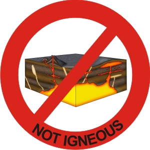
Colour is one of the tools that can be used to classify rocks and many igneous rocks are initially classified on this characteristic. In igneous rocks colour is based on the relative amounts of iron and magnesium contained within the minerals of the rock. The color is considered light if there is little iron or magnesium (mafic minerals). The color is intermediate if there is an increased concentration of iron and magnesium. The color is considered dark if the rock appears as a dark gray to black.
In sedimentary rocks the amount of carbon contained in the rock can make it look totally different and from a distance induce in misclassification.
Kimmeridgian (1, 2) Limestones (3) in the Guincho - Abano area are typically black due to their rich carbon content but yet these are not to be confused with igneous rocks.
(1) Kimmeridge is a small village in the Purbeck district of Dorset, England, situated on the English Channel coast with a population of 110 (2001). The village stands on Jurassic shale cliffs, and gives its name to the division of the Jurassic period in which the beds were deposited, because of the quality of the cliffs and the fossils they yield. It is part of the Jurassic Coast World Heritage Site because of the quality and variety of geological landforms along the coast. The Bay is also the Type locality for the Jurassic age Kimmeridge Clay formation, which is the source of approximately 95% of petroleum in the North Sea.
(2) The Kimmeridgian is a stage of the Late Jurassic Epoch. It spans the time between 155.7 ± 4 Ma and 150.8 ± 4 Ma (million years ago).
(3) Limestone is a sedimentary rock that is made from the mineral calcite which came from the beds of evaporated seas and lakes and from sea animal shells. It is composed mostly of the mineral calcite. Sometimes it is almost pure calcite, but most limestones are filled with lots of other minerals and sand and they are called dirty or marly limestones. The calcite is derived mostly from the remains of organisms such as clams, brachiopods, bryozoa, crinoids and corals. These animals live on the bottom of the sea and when they die their shells accumulate into piles of shelly debris. This debris can then form beds of limestone. Some limestones may have been derived from non-biogenic calcite formation. Although some limestones can be nearly pure calcite, there is often a large amount or sand or silt that is included in the shelly debris.
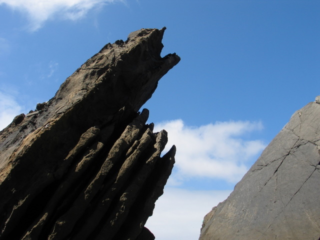
In the Guincho-Abano area west of Lisbon outcrop particular limestone beds of Kimmeridgian age. The Kimmeridgian of Cascais is respresented by marly limestones, marls and limestones with corals and oncoliths. The limestones have well defined bedding and are characteristically black in colour.
Palaeogeographically the Upper Jurrassic lithologies indicate a progressive shallowing of the basin due to intense carbonate sedimentation. During this time interval the basin switches from a typically pelagic marine environment to a more confined lagoonal setting.
Claiming the cache means going to ground zero to view the Kimmeridgian limestones. At the location tell me in which direction the strata are dipping and what is the average range in bed (strata) size. Email me the answers referring the cache to validate the find.
Please note that the terrain can be dangerous. I have given you a set of coordinates such that you will be directly on top of these limestones. If you're not confident please stay 10 m back and answer the question from there. Note: No children and don't go in stormy weather or at night.
Sources:
Ramalho, MM; Rey, J; Zbyszewski, G; Matos Laves, CA; Mointinho de Almeida, F; Costa, C and Kullberg; MC. 191. Carta geológica de Portugal na escala 1/50000. Notícia Explicativa da folha 34-C (Cascais). Serviços Geológicos de Portugal, 87p.
Moitinho de Almeida, F, 1959. Carta geológica de Portugal na escala 1/50000, Folha 34-C (Cascais).
NO tell-tale photos in the logs.
Have fun!

A cache:
Para conseguirem logar esta cache têm de se deslocar às coordenadas indicadas para observer os calcários do Kimeridgiano. Nesse ponto digam-me qual a espessura média dos estratos aos vossos pés.Enviem-me uma mensagem com as devidas respostas para validar o found.
Cuidado que aqui o terreno é perigoso, nada de crianças e se acharem que não conseguem, prefiro que fiquem afastados 10 m e respondam o melhor que puderem dessa localização. Não vão em tempo de chuva, temporal e definitivamente não vão à noite!
Nada de fotos reveladoras nos logs!
Divirtam-se!
 The most exciting way to learn about the Earth and its processes is to get into the outdoors and experience it first-hand. Visiting an Earthcache is a great outdoor activity the whole family can enjoy. An Earthcache is a special place that people can visit to learn about a unique geoscience feature or aspect of our Earth. Earthcaches include a set of educational notes and the details about where to find the location (latitude and longitude). Visitors to Earthcaches can see how our planet has been shaped by geological processes, how we manage the resources and how scientists gather evidence to learn about the Earth. To find out more click HERE.