The area of the Mont-Perdu is registered since 1997
on the world inheritance of UNESCO.
On the french side, the circuses of Gavarnie,
Estaubé and Troumouse offer particular aspects of this site of high
mountain.
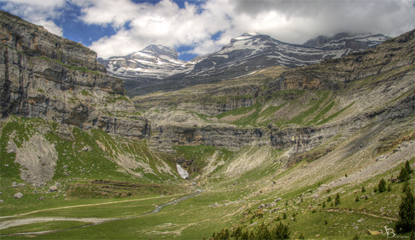
On the spanish side, in the province of Aragon, the canyons of
Ordesa, Niscle and Pinete are among the deepest of Europe.

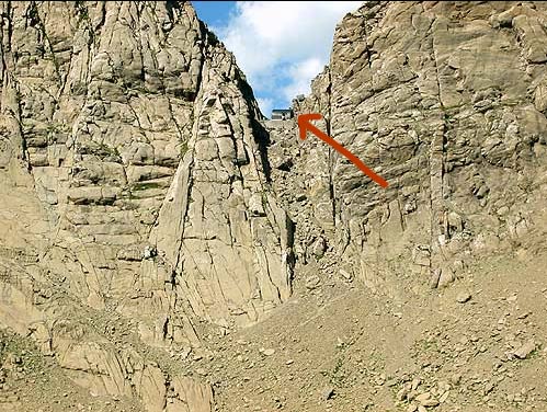
This earthcache offers the possibility of an
excursion to the breach of Tuquerouye in order to admire since a
single view-point the Frozen Lake, the northern face of the
Mont-Perdu, its suspended glacier and its unstable seracs.
During your walk, you'll be able to discover these
wild landscapes resulting from the double action of the erosion and
the plate tectonics. You'll also be able to measure the impact of
the reheating of the planet by seeing the retreat of the glacier of
the Mont-Perdu.
The terrain park owes its originality to the
predominance of limestone : the massif of the Three Sisters is the
largest limestone massif of Europe. These sedimentary rocks
accumulated below the sea in the primary era (mainly limestone, but
also marl and sandstone) were at the beginning of the Tertiary era
raised, folded and deported.
In the quaternary era, glacial erosion carved
limestone rocks. They gave the landscape this aspect very assertive
of circuses and glacial valleys into U form, as it can be seen in
the valleys of Ordesa or Pinède. The karstic transformation came in
addition to glacial erosion, creating multiple caves, avens,
gorges, combs, sinkholes, and so on. Thus, in the canyon Niscle and
garganta of Escuain, the upper part is an icy circus while the
lower part is between deep gorges.
This cache being an earthcache, to be able to log a
"found it", you'll be required 2 things :
- take a picture of yourself on the breach, at the given
coordinates, beside the refuge, with the glacier of the Mont-Perdu
in the background and your GPS in hand.
- send me by email before your log the answer to the following
question: "What is the name of the 'Three Sisters' ?"
Good luck !