The Highwood Pass area in Kananaskis Country is our all-time
favourite area for hiking. We’ve now placed a total of 5 geocaches
to encourage others to come out and explore the Arethusa Cirque
“trail”.
While you won’t attain any of the 360 degree views typical of a
ridge walk or summit, this 5 km loop requires only about 300 meters
gain to enjoy 2 waterfalls; a beautiful meadow that's carpeted with
wildflowers well into late July / early August; and a great variety
of ancient ocean bed fossils. The trail passes the entrance to 3
different cirques (only the middle cirque - Arethusa - is named)
and provides access to the base of Little Arethusa and Mount
Arethusa should you wish to hike to a summit (or possibly over into
Ptarmigan Cirque). You might be interested to know we regularly
spot (or hear) moose while hiking this area.
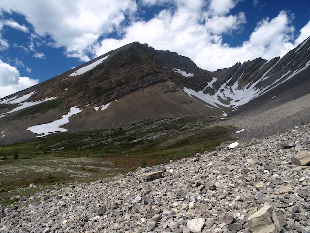
Little Arethusa and unnamed cirque
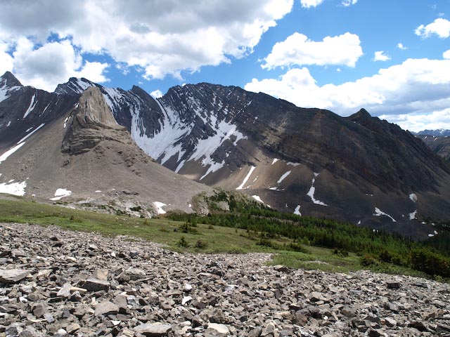
Dramatic upthrusting peak (unnamed)
This is a fairly easy hike for kids and they'll enjoy the
multiple creek crossings, waterfalls, pond, walking along the edge
of the creek / talus field and spotting fossils.
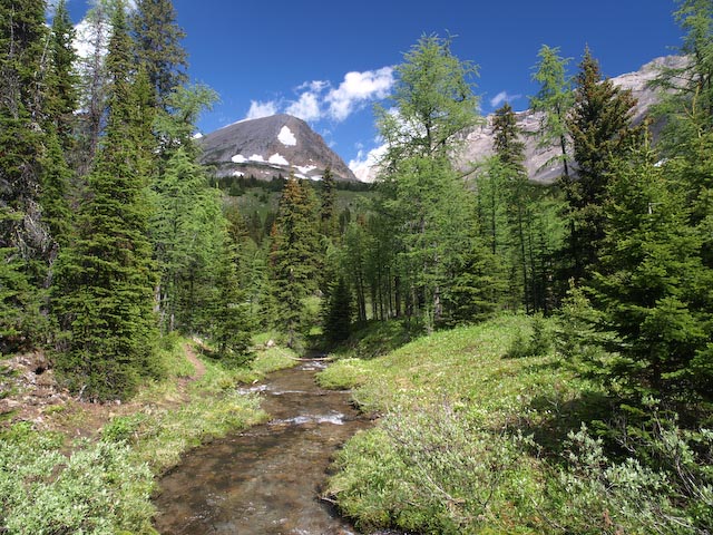
Creek that runs through meadow after you emerge from forest
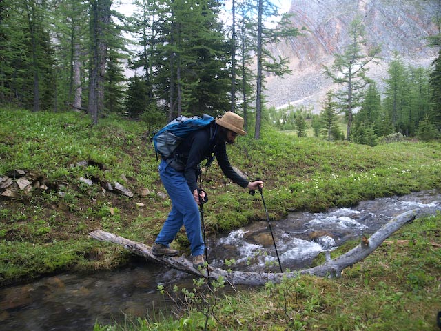
Most difficult creek crossing
The trail is not maintained, but basic route details can be
found in Kathy & Craig Copeland’s “Where Locals Hike in the
Canadian Rockies” and Gillian Daffern’s “Kananaskis Country Trail
Guide Vol 2.” We’ve also submitted this trail to the Calgary Area
Trail Maps project. If you decide to explore this area before the
next release of maps, contact us via e-mail and we’ll send you a
.gpx or .gbd file to aid in your route-finding. We have also
provided several additional waypoints to assist with
navigation.
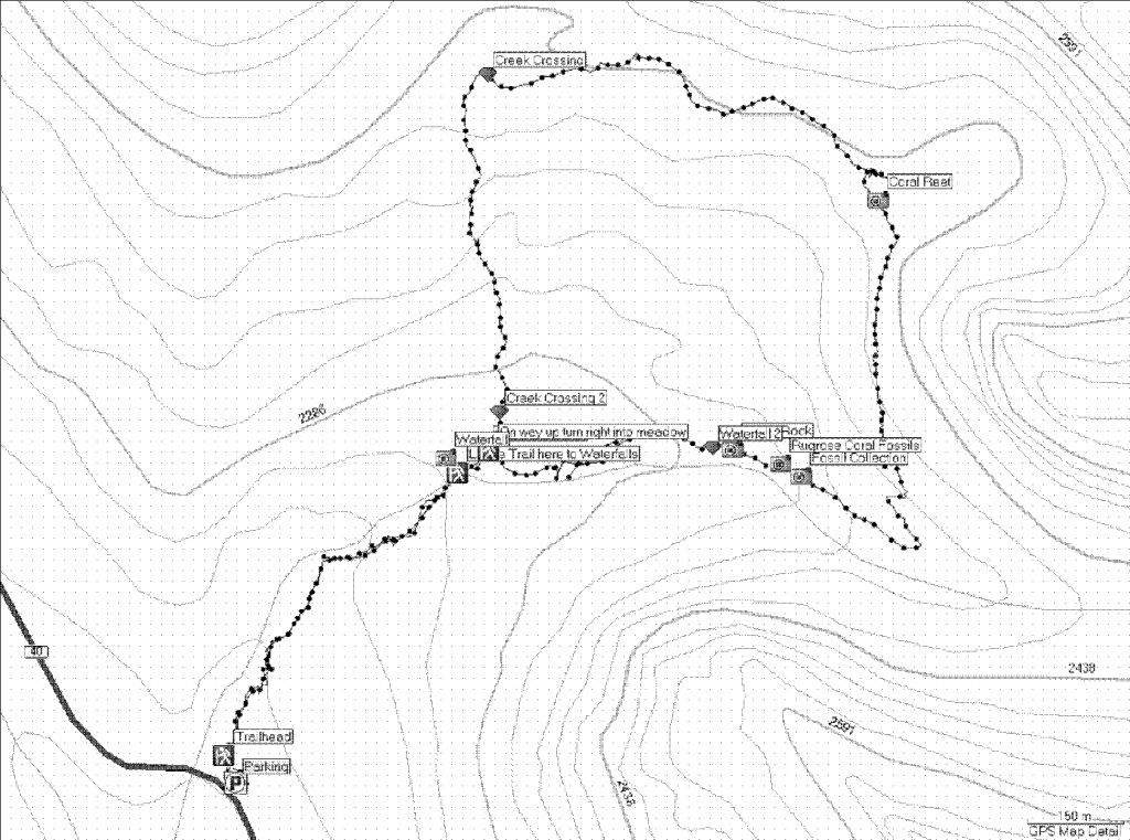
Our track
Access is via Highway 40, a few km southeast of the Highwood
Pass day use area. Parking is not marked and there are no outhouse
facilities. Highway 40 to the trailhead is closed from December 1
through June 15 each year. The posted coordinates are for the
parking area. Coming from the north, drive a few hundred meters
past the parking coordinates and you will see a turn off across the
ditch into the parking area / meadow. Rocky Mountain Sheep frequent
this meadow. From the parking area walk along the edge of the
forest and look for the unmarked trail heading into the trees,
about 30 meters south of the creek, to start your “Arethusa
Adventure”.
This multi-cache series is comprised of three, stand-alone micro
caches plus this final regular cache. Each micro contains one
stanza of the poem “Arethusa’s Adventure” - an original and unique
version of a lesser known Greek myth featuring Arethusa as the main
character. If your quest sparks an interest in the original subject
matter, you might enjoy reading Percy Bysshe Shelley’s poem
“Arethusa”.
The coordinates for the final cache can be found in 3rd Stanza -
Arethusa Adventure. If you aren’t quite up to completing the loop
and are willing to settle for just 3 smileys, the coordinates are
also on the inside of the lid of
GCXATF Fav. Hike #1 – Arethusa Cirque. But if you take this
shortcut, you’ll miss out on the middle two stanzas of the
poem!
The final cache does not contain any ancient Greek coins
featuring the image of lovely Arethusa (too bad!). However, when
hidden the final container (a camo-painted, regular-sized
Lock’n’Lock) did contain more a recently minted ‘coin, along with
an assortment of geocaching and hiking related swag, log book,
etc.
Between the trees and the surrounding mountains, GPS reception
at the final location is quite poor. The best we could get, after
averaging 100 readings, was +/- 7 meters accuracy, which accounts
for the 2.5 difficulty rating. The cache is hidden about 3 or 4
meters off the trail.