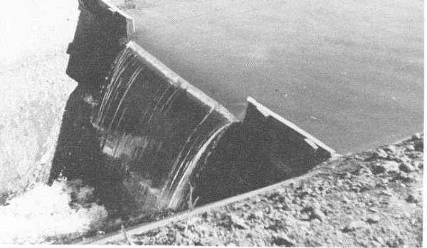
Weir Dams
A weir dam is a small overflow-type dam commonly used to raise the level of a river or stream. Weir dams have historically been used to create mill ponds but have also been used to create fishing ponds. Water flows over the top of a weir. Since the weir is the portion where water is overflowing, a long weir allows a lot more water with a small increase in overflow depth. This is done in order to minimize fluctuation in the depth of the river upstream with changes in the flow rate of the river. Weirs also give hydrologists and engineers a simple method of measuring the rate of flow over the weir. There are different types of weirs. It may be a simple metal plate with a V notch cut into it or it may be a concrete and steel structure across the bed of a river.
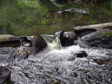
Sharp Crested Weir
A sharp-crested weir allows the water to fall cleanly away from the weir. Sharp crested weirs are typically thin metal plates
Broad Crested Weir
Broad crested weirs are large structures that are generally constructed from reinforced concrete and which usually span the full width of the river. 
Crump Weir
A Crump weir is a fixed weir dam with water flowing over it and usually it has a trapezoidal shape while being made out of concrete.If the down-stream level below the weir crest is about the same as the up-stream it can be known as an underwater weir

Proportional Weir or "V" notch weir
A specially shaped weir in which the flow through the weir is directly proportional to the head.
Combination Weir
For accurate flow measurement over a wider range of flow rates, a combination weir combines 2 or more types of weirs. Below a V-Notch weir with a crump weir

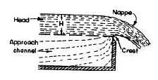
There are several terms associated with weir dams.
Nappe the flow or discharge after the crest.
Head the level above the crest
Crest the width of the top of the weir
Approach the level of the river below crest also know as the datum.
LOCAL HYDRO-GEOLOGY
The area has three confined or semi-confined aquifers consisting of sand, gravel, sand and gravel, or alternating layers of sand and gravel and clay occur in the 150 feet of glacial till overlying a carbonate bedrock aquifer. The aquifers generally are separated by confining layers of glacial till sediments. The shallow and middle aquifers vary considerably in thickness and horizontal extent, although they maybe connected horizontally beneath the western and northern area around the dam. In some areas, the aquifers may be vertically connected. The deep aquifer and bedrock aquifer are vertically separated from the shallow and middle aquifers and appear to extend beneath all of the area. Recharge occurs locally from infiltration of precipitation. Ground water in the shallow aquifer discharges primarily to Pleasant Run.
To get credit for this cache you must answer the following questions.
1 What type of weir dam is this?
2 What is the approximate width (thickness) in inches of the crest? Not side of river to opposite side of river
3. What is the approximate drop in feet from the crest to the river below?
4. Post a picture of yourself and your GPSr with the pond created by the dam in the background.
Park on the side of the road at:
N 39 47.622
W 86 02.704