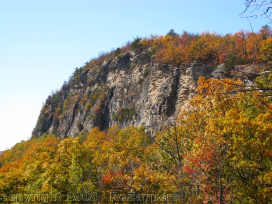
The Near Trapps cliff is the second most popular rock climbing cliff at the Gunks ranging in height from 40 to 200 feet and providing around 200 routes. There is a beautiful view of the cliffs from the scenic overlook after the hairpin turn on Rt. 44/55 going west from New Paltz.
Park in the West Trapps Parking Lot off of Rt. 44/55 after the Trapps Bridge overpass going westbound. You will have to pay a day use fee at the entrance to the parking lot (see below for more information about the Mohonk Preserve). From the car to the cache could take anywhere from 45-60 minutes. On busy weekends, especially in the autumn, finding parking can be difficult. Best bet is to arrive before 9am or late in the afternoon.
The cache is on an unmarked trail from Rt. 44/55 that follows along the base of the cliffs. This is a climbers' trail that starts where the railing from the scenic overlook ends and the rocks rise up above the road.
Because a small 150 foot section of trail that travels over private property was posted in 2009, going over the top of the cliff and backtracking is required to get to the cache without trespassing on private property (although often ignored). Makes you appreciate when private landowners are willing to allow hikers and climbers to cross their property.
From the West Trapps parking lot, an easy trail takes you from the end of the parking lot to the Trapps Bridge to cross over the highway. Continue on the carriage road over the bridge. (By the way, if you like to look for benchmarks, there is one in the rock around N41 44.141 W74 11.720.)
If you choose to hike the trail under the cliffs anyway, go downhill back to Rt. 44/55, walking towards the scenic overlook and turn right onto the climbers' trail. However, if you choose to avoid trespassing, after the steel bridge, very soon you will turn left on the blue blazed trail that travels across the top of the cliffs. That trail starts at approximately N41 44.229 W74 11.725. The detour to avoid trespassing, requires you to travel over the top of the cliffs and come down a steep primitive trail at the south end of the cliff band and backtrack on the climbers' trail at the base of the cliffs. To get to the cache, take the blue trail over the top of the cliffs until you see a descent trail off to the left (it used to be blazed with orange survey tape and small flags). This trail is NOT marked on trail maps. This trail starts at approximately N41 43.770 W74 12.171. The trail is rudimentary, steep and tricky, but does not require any climbing. It may be tricky for children unless they are experienced hikers on rough trails. Walking sticks may help with your balance. Please do not leave the trail, as it causes erosion. At the base of the cliffs, head back northbound on the climbers' trail under the cliffs, and be careful not to step on anyone's climbing gear, especially ropes.
The cache is a round lock-n-lock container hidden on the side of the trail. Easy to spot but because of the signal bounce the cliff may cause, it was rated a 2 for difficulty. Be careful that you don't drop anything, the hillside below the trail is very steep and anything dropped could roll and keep going down, down, down, beyond your reach. There aren't many popular rock climbs in this section of the cliff, so hopefully you won't have any muggle climbers hanging around, but still, watch out for frequent climbers passing on the trail. Please re-hide the cache carefully so it's not obvious to anyone walking on the trail.
The Mohonk Preserve is a private land conservation organization established to protect the Shawangunk Ridge, it is not public land funded by the government. Therefore, there is a day use fee to use the preserve which funds its maintenance and programs. For the current day pass fees, check the Mohonk Preserve website. The Mohonk Preserve does allow geocaching on its land, as long as it is along established trails and carriage roads. Note that dogs must be leashed at all times.

Note: all markings are approximate.
Blue arrow: start of the blue blazed trail over the top of the cliffs.
Orange arrow: unmarked descent trail (not on maps).
Red X: general location of the cache on the trail under the cliffs.