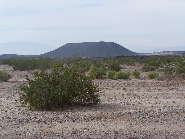
Amboy Crater, formed of ash and cinders, is 250 feet high and
1,500 feet in diameter. It is situated in one of the youngest
volcanic fields in the United States. It is located in the
Barstow-Bristol trough, a conspicuous west-northwest trending
physiographic feature which approximately straddles the boundary
between the Mojave and Sonoran tectonic blocks.
This field was created by at least 4 distinct periods of
eruptions, resulting in a coaxially nested group of volcanic cinder
cones. The most recent eruption of Amboy Crater was approximately
10,000 years ago.
The lava flows consist of basalt rich in minerals of magnesium,
iron, and calcium. Upon close examination, you may be able to see
minute green-colored olivine crystals. The red color indicates the
presence of ferric iron and is a result of steam on heated
rocks.
Trail to the Crater: The Park Rangers tell us to allow
yourself a minimum of 3 hours hiking time (my family was able to do
it in 2 hours). Located 1.1 miles from the day use area, the cone
is one-mile in circumference. Round trip is roughly 3 miles. Follow
the trail to the west of the cinder cone. This will take you to a
wide opening where an explosive eruption had breached the crater
wall. From here, the climb to the top is and 80-foot incline. Due
to extreme heat, it is suggested that hikes be planned between the
months of October thru April.
Scenic Overview: Located at
N 34.33.372
W 115.46.858
This covered platform is ADA compliant and provides for wonderful
viewing of the crater with a shaded area.
LEAVE NO TRACE: Enjoy your visit and help minimize
impacts by staying on designated routes to reduce erosion, packing
out litter, respecting others, and leaving natural and cultural
resources as you find them.
Amenities: There are several covered picnic benches in the
public parking lot. Facilities at the crater consist of a day use
area with four shaded picnic tables, two vault toilets, and a
shaded scenic overlook. The facilities are connected by a series of
concrete walkways and are all wheel-chair accessible. The closest
facilities for food and gas are either in Ludlow, CA 30 miles to
the west or Fenner, CA 42 miles to the east. There is no water
available on site, so please plan accordingly.
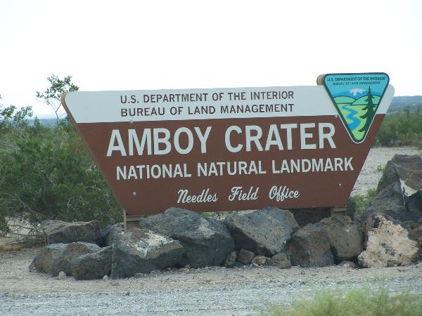
For more information: www.ca.blm.gov/needles
Amboy Crater is a good place to observe various volcanic
features. Look for the following when you are exploring the
area:
"PAHOEHOE FLOW" is a molten material that contained
steam, making it flow more smoothly, creating a surface like rope
with a glassy outer skin.
"JUMBLES" are subsurface explosions that disrupted
hardened lave flows, creating chunks of volcanic rock.
"BOWL-SHAPED DEPRESSIONS" were formed as a result of
inflation of an emplaced, but still plastic, curst by molten lava
around a general void in the flow. There are twelve depressions
throughout the lava field, ranging from 25 to 300 feet in diameter
and 4 to 40 feet in depth.
"PRESSURE RIDGES" are long, narrow ridges where large
slabs of lava buckled due to pressure from the molten lava flowing
under a hardened crust.
"SQUEEZE-UPS" are bulbous extrusions formed from lava
squeezing up through cracks.
"LAVA TUBES" are not known to be present in any of the
flows, a few lava channels are present, however.
Low-lying area on the flow are filled with windblown sediments
which range from a few inches to more than 3 feet think.
Sand-blasting is prevalent over the entire flow, and wind-faceted
pebbles of basalt are common.
In order to log this as a find, please send an email to
q22q17@gmail.com and a photo of one of the above mentioned volcanic
features and why you believe it is that feature. If you do not have
digital camera capability, please indicate to me by way of
description the volcanic feature that is prominently surrounding
the public parking area. You may post photos with your log, but
please do not post exhibition or descriptive panels with your
posts.