|
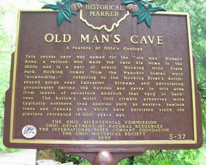
Old Man’s Cave Earth Cache
Coordinates are to the
Visitor Center and Parking Area
You must hike the
marked trails to see the rock formations.
|
|
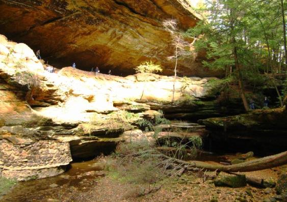
Old Man's Cave in
Hocking Hills State Park has a magnificent gorge that has been
carved through water erosion. Old Man's Creek has meandered through
the gorge sculpting spectacular rock formations and water falls
through the "Black Hand" sandstone of this region that was laid
down millions of years ago by a shallow sea. Walk the trail through
the gorge and you will see the power of water erosion.
Must-see areas of the gorge is the Upper Falls & “Devils
Bathtub”, Middle Falls, Lower Falls, and the “Sphinx
Head”. The masterpiece of the gorge is Old Man's Cave
itself, a large recessed cave 200 feet long, 50 feet high and 75
feet deep.
The entire gorge in
named after a hermit named Richard Rowe who lived here shortly
after the Civil War. He reportedly made his home in this cave and
remained there until his death. |
 |
|
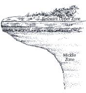 |
A History of How Black Hand Sandstone was
Formed
A warm shallow sea covered Ohio more than
350 million years ago and deposited this bedrock of Blackhand
sandstone. Shifts in the Earth's crust uplifted the area and the
sea drained away. The sea deposited sediment of varying
layers ranging in composition and hardness. The top and
bottom layers are much harder than the soft, loosely cemented
middle zone. The recess cave and rock formations at Old Man's Cave
are all carved by erosion in the softer middle zone. Millions of
years of shifting and uplift of the Earth's crust along
with stream erosion helped create the recessed caves,
waterfalls, and rock formations at Hocking Hills State
Park. |
Glaciers in Ohio
Two million years ago,
temperatures plummeted and great ice sheets from Canadian moved
south into Ohio. Glaciers advanced and retreated at least four
times, plowing through 56 of Ohio's 88 counties sparing nearly all
of Southeastern Ohio counties. The final retreat of the glacier was
13,000 years ago. Although the glacier itself did not advanced far
enough to scuplt features in the park , as the ice from the glacier
melted away, the tremendous surge of meltwater helped to
sculpt the formations by erosion.
|

Covered 2/3 of the State of
Ohio |
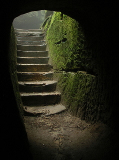
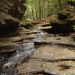
Hike The Trail
Along the
half-mile length gorge of Old Man's Creek, the trail reveals the
entire profile of the Black Hand sandstone formations. The natural
attractions begin at the Upper Falls that plunge 40 feet into the
"Devils Bath Tub". Follow the rapids to the Middle Falls, past the
"Sphinx Head" and on to the Lower Falls that cascade 40 feet. Along
the gorge trail, the streams elevation changes over 100 feet
in elevation. |
 |
Along the Path |

Sphinx
Head |
|
Old Man's
Creek
|
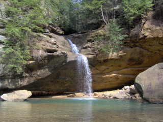
Lower
Falls |
|
YOUR TASK:
How did “Black Hand Sandstone” get its name?
To complete the
challenge you must:
- Visit the area and
take some snapshots of you and the water erosion that has formed
the area at Old Man’s Cave.
- Tour the visitor
center (seasonally) to find why the sandstone of this area is
referred to as “Black Hand”. Or, do an Internet search to find your
answer.
-
Email the answer along with a picture of your
visit. quidor@verizon.net
Your visit will be
posted on review of correct answer and receipt of
pictures. |

Upper Falls in
Winter
|
|
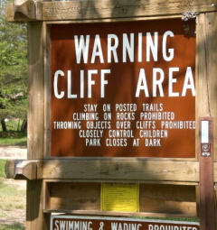 |
Be Cautious! Cliff Area
Stay on the marked
trails. There are many steep, dangerous cliffs. Take extra caution
with small children. There is no need to hike off the main trail to
complete this geocache/earthcache. The trails can be hazardous during rain
and snow.
Day-use areas of
Hocking Hills State Park open half an hour before sunrise and
close half an hour after sunset. Follow the Parks rules and
regulations.
The trails are
open year round! Some even more spectacular in
snowfall!
Special Thanks
to Chris Grupenhuf Asst. Park Manager of Ohio State Parks for his
help developing this Earthcache.
|
Sources:
www.dnr.state.oh.us/explore/magazine/fallwin2001/caves/tabid/464/Default.aspx
www.hikingohioparks.com/hocking-hills-state-park.html
www.dnr.state.oh.us/tabid/743/default.aspx