Mystic mountain – KIEV
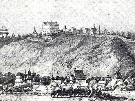
Castle (Zamkovaja) Mountain; also know as Horevitsa has huge
ancient history. In VIII - IX centuries there was a settlement
which can be connected with one of founders of Kiev - Horiv. During
Kiev takeover by khan Baty in 1240 mountain Zamkovaja was one of
strongholds of resistance to mongolo-tatar armies. Crimean Tartars
assault Castle twice in 1416 and 1482, but succeeded only in
1482.
The Kiev castle existed from the end of XI century up to the
middle of XVII century. Fortification was build around perimeter of
the top part of mountain, wooden frameworks carried out not only
defensive functions, but also used for storage of military
supplies, property and important documents, books. In 1570 castle
was used as state prison.
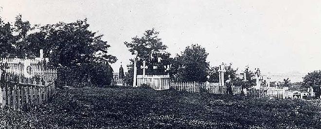
Starting from 1840 the mountain Zamkovaja was owned by Frolovsky
woman’s monastery. They used mountain hills as a cemetery. All
around mountain you can see remainings of old graves and crypts,
lot of weird holes and parts of old buildings. Most of them were
destroyed by vandals during last 50 years. Also there are few
sacrifice places used by Satanists for their rituals.
Cache directions:
(1) Take the stairs at approximate coordinates: N50 27.611 E30
30.870
It is very easy to approach them. If you are walking down
‘Andreevsky uzviz’ watch left side and you will see big metal
stairs going up to the green. You can use ‘Google maps’ picture as
a helper.
(2) Enjoy Podil ‘View’ at coordinates: N50 27.759 E30 30.695
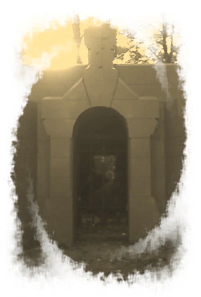
(3) You will need to find old spooky crypt like shown in the
picture below. It is located not so far away south from the
‘View’.
(4) Cache located 156 meters north-west from the crypt (Bearing
333, Altitude 154). You will need to go half way down the hill
until you hit big meadow with few fireplaces. Cache hidden under
huge brick very close to the fallen tree displayed on the picture.
Please, use ‘Google maps’ picture as a helper.
