De Bruid van Haarlem EarthCache
-
Difficulty:
-

-
Terrain:
-

Size:  (other)
Please note Use of geocaching.com services is subject to the terms and conditions
in our disclaimer.
Earth Geology monument
De Bruid van Haarlem
De Duinen van het Nationaal Park Zuid-Kennemerland en "De Bruid van Haarlem" in het bijzonder zijn door de provincie benoemd als Aardkundig Monument. Gedeputeerde Moens onthulde een tijd geleden een informatiepaneel op de Hazenberg.
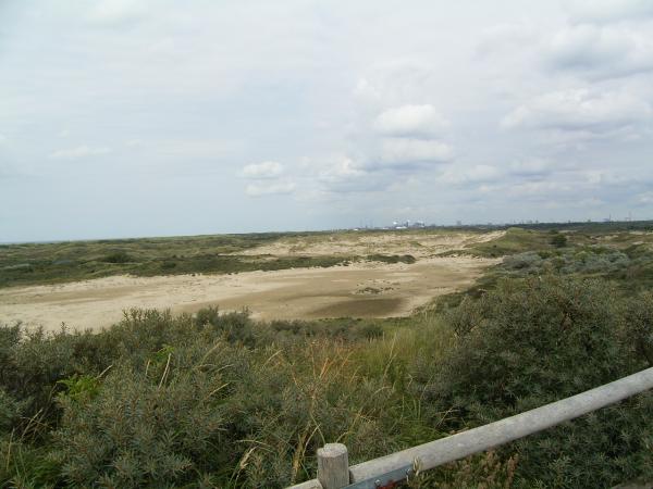
Vanaf dit uitkijkpunt heeft men een prachtig zicht op het kale, stuivende duin dat de naam "De Bruid van Haarlem" draagt. Dit duin,een zogenaamd paraboolduin, staat symbool voor de bijzondere aardkundige waarden in het Nationaal Park.
Uniek voor Nederland en voor Europa in dit gebied is de vorming van jonge duinen, strandvlakten en strandwallen met oude duinen. Onder invloed van wind, zand en water is door de eeuwen heen een zeer bijzonder duinlandschap ontstaan. Vanaf het strand vormden zich door de wind U-vormige duinen (paraboolduinen), die landinwaarts lopend steeds groter werden en af en toe aan elkaar groeiden.
Verschillende fasen vormden zich steeds weer nieuwe rijen duinen vanaf het strand. In het Nationaal Park moet je vijf duinenrijen overwinnen voordat je bij het strand aankomt! Het zand stoof steeds verder, waardoor de mooie paraboolvormen deels weer verwaaiden en het zand werd opgestoven tot hoge en steile duinen. De binnenduinrand van Zuid-Kennemerland is tot 45 meter hoog!
De Bruid is vernoemd naar het wilgenroosje. Dit plantje kwam vroeger veel voor op deze duinhelling. De zaadpluizen van de uitgebloeide plant doen denken aan een bruidssluier, vandaar de naam.
Het paraboolduin "De Bruid van Haarlem" is in 2003 ontdaan van alle begroeiing en afgeplagd tot op het kale zand. Hierdoor kan de wind weer greep krijgen op het zand en kan het duin zich weer gaan verplaatsen. Afhankelijk van wind en neerslag zal het duin waarschijnlijk een aantal meter per jaar gaan lopen. De Bruid van Haarlem wandelt zo langzaam in noordoostelijke richting.
In Duincentrum De Zandwaaier is een gratis informatie- brochure over het Aardkundig Monument beschikbaar. Er is ook voor 1 euro een wandelroute te koop, die naar het bijzondere monument voert en veel uitleg geeft. De route is circa 5 km, parkeren kunt u dan op N52 23.700 E004 35.589. Ook kun je vanaf ingang Parnasia naar het aardkundig monument toelopen, vanaf hier is het ongeveer 20 minuten lopen. Parkeer dan op coordinaat N52 24.439 E004 32.919.
Nederlands:
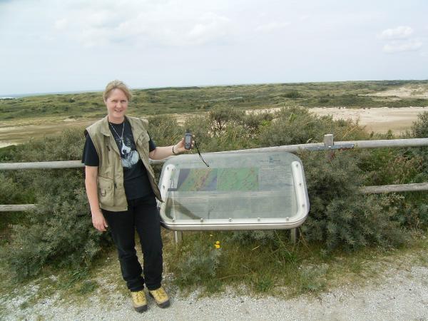
(1) Opdracht : Maak op het coördinaat dat bovenaan deze pagina staat een foto van jezelf met je GPS bij dit bord.
(2) Opdracht: Als voorwaarde om deze earthcache te mogen loggen moet je een email sturen aan de beheerder van deze cache met het antwoord op de volgende informatie: Wat is de afstand wat het duin per jaar afhankelijk van wind en neerslag zal gaan lopen? "Indien de email niet goedgekeurd is, wordt de log verwijderd".
The Bride of Harlem
The Dunes of this National Park South-Kennemerland and the Bride of Harlem specific are named, by the provence of North- Holland, a very special earth geology monument. A member of the board of the provence of North-Holland recently revealed a infopanel on the Hazenberg in this National park South-Kennemerland.
From this viewpoint you have a very beautiful view on this drift dune with the name “The Bride of Harlem”. This dune, a so called parabola dune, is a symbol for the special earth geology values in this National park. Unique for Holland and for Europe in this area is de making of young dunes, beaches and beach shores with very old dunes. Under the influence of wind, sand and water through the centuries a very special dune landscape developed. From the beach developed by the wind U-shaped dunes (parabola dunes), inland bigger and bigger and grow on to each other.
Different fases formed new rows of dunes from the beach, inland.
In this National Park you have to conquer five rows of dunes before you arrive at the beach. The sand blew much further, and the parabola dunes changed to high and steep dunes. The inner dune of South/Kennemerland is 45 meters high!.
The Bride of Harlem is named after a plant called : Chamerion angustifolium, or in Dutch "Wilgenroosje". This plant grow in the past on this dune. The seedpods from this plant look like a brides vale, thats why they called it the Bride.
The parabola dune “The Bride of Harlem” is cleaned-up as far as the sand in 2003. Now the wind can get a grip on the sand and this dune can “walk”it self to another distance. Depended of wind and rain it can vairy. This Bride of Harlem walks slowly in north-east direction.
You can get some info at the infocenter De Zandwaaier.Park at N52 23.700 E004 35.589. Also you can buy a route for 1 euro which gives you lots of info and the direction to the monument, it is a 5 km walk. But you don’t need it if you start at entrance Parnassia at N52 24.439 E004 32.919. From here to the viewpoint it is a 20 minute walk from the parkingplace.
English:
(1) Picture: Go to the coordinates on top of this page and take a photo of yourself with your GPS next to this information sign.
(2) Send an email to us with the following information: what is the distance that this drift dune can “walk” in a year?. If an e-mail is found to be incorrect the log will be deleted.
Additional Hints
(No hints available.)