
L’origine du nom vient de
« reïssa », qui signifie scie
en occitan, d’où le repérage de la structure en dents de scie
à partir de la vallée du Rhône.
Cette formation géologique
surplombe le plateau de Gras et son petit village, ainsi que le
plateau de Laoul et ses champs de lavandes.
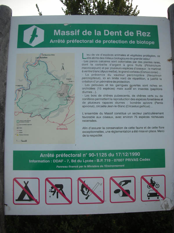
L’intérêt du site est
également floristique et faunistique, abritant de nombreuses
espèces rares ce qui a conduit à la création d’un arrêté de
biotope et à une réglementation particulière rappelée aux départs
du sentier.
The name of this place has its origins in the
Provencal French word « reïssa » meaning « saw » and thus, you will
spot the serrated structure from the Rhone Valley. This geological
formation overhangs the Plateau of Gras and its small village, as
well as the Plateau of Laoul and its lavender
fields.
This place is also interesting because of its
flora and wildlife: it shelters many rare species and this has led
to the creation of a biotope decree and specific rules which are
recalled at the beginning of the path.
Il y a deux possibilités pour les
petites randonnées, départ au WP1 (N 44°26.484’, E
004°30.668) sentier avec montée régulière et bien délimité, et
départ au WP2 (N 44°25.617, E 004°30.959) sentier plus facile au
début et plus dur à la fin, et il faut suivre le PR (balisage jaune
et blanc) en évitant de se perdre.
Pour le deuxième parcours,
intersection au WP3 à droite (N 44°25.493’, E 004°29.982)
puis intersection à gauche au WP4 (N 44°25.604, E
004°29.974).
Les sentiers mènent à une borne
au point le plus haut du massif, La cache se situe au bord
d’un ancien chemin de randonné qui passe sous la
borne.
There are two possibilities for the short walks
: departure from WP1 (N 44°26.484', E 004°30.668), a well delimited
path with a regular ascent, or departure from WP2 (N 44°25.617, E
004°30.959) an easier path at the beginning but harder at the end.
You'll have to follow the PR (yellow and white marking) and avoid
to get lost.
For the second route, intersection at WP3 on the
right (N 44° 25.493', E 004°29.982) and then intersection at WP4 on
the left (N 44°25.604, E 004°29.974).
The paths lead to a marker at the highest point
of the massif. The hiding place is located on the side of an old
walking path that goes under the marker.

ATTENTION : La ligne droite
n’est pas la meilleure solution à moins de savoir
voler…
CAUTION: The straight line isn't the best way to
get there unless you can fly!
Afin de respecter l’arrêté
de biotope, la cache est accessible sans que l’on ait besoin
de sortir du chemin.
Prévoir de l’eau, surtout
en été où il est conseillé de faire la cache à la fraîche, soit le
matin (versant ensoleillé), soit le soir (versant
ombragé).
Eviter par temps de neige, car
les petites routes ne seront pas dégagées, mais ce n’est pas
tous les ans qu’il neige…
In order to respect the biotope decree, you can
reach the hiding place without getting out of the
path.
Bring water with you, especially in summer when
you'd better search for the place when it's cool, either in the
morning (sunny side) or in the evening (shady side).
Avoid this walk when it's snowy because the
small roads wouldn't be cleared, but it won't snow every
year!
Pour le retour au parking,
refaire le chemin inverse, ou pour le WP2, possibilité de descendre
par l'ancien chemin, mais il n'est pas entretenu, n'est pas balisé
et il existe des clôtures électriques non signalées.
Sinon possibilité en partant du
WP1, de redescendre par le WP2 et de rallier le WP1 par une route
peu fréquentée mais ça rallonge le trajet de 3 km
environ...
To go back to the car park, walk back the same
way, or for the WP2, you can walk down the old path, but it's not
maintained nor marked and there are unannounced electric
fences.
You can also depart from WP1, get back down by
WP2 and rejoin WP1 by a road that isn't very busy but that will
lengthen the journey by about 3 km (1,86 miles).