Takaka Hill Tomo
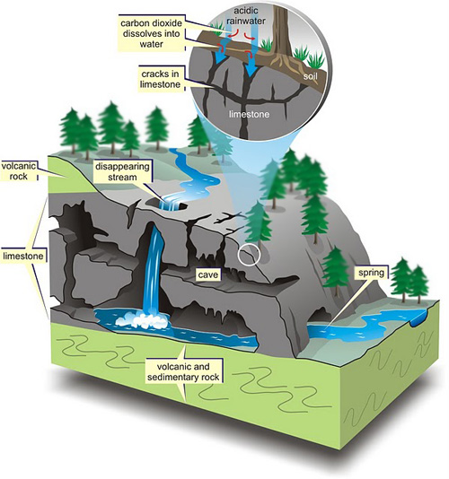
Tomo are commonly found in ‘karst’ landscapes
(limestone) such as that in the Waitomo District in the Waikato
Region and of course here on the Takaka Hill. ‘Wai’ =
water, ‘tomo’ = entrance: thus ‘place where water
enters the ground’ (water entrance)
Limestone has a high calcium carbonate content and is easily
dissolved in the acids. About ten percent of the earth's land
surface consists of soluble limestone, which can be easily
dissolved by the weak solution of carbonic acid found in surface
and underground water through "acid rain" (pollution) and through
mixing with organic matter.
The acidic water dissolves the limestone to form karst
topography - an collection of caves, underground channels, and a
rough and bumpy ground surface. Karst topography is named for the
Kras plateau region of eastern Italy and western Slovenia (Kras is
Karst in German for "barren land").
The underground water carves out channels and caves that are
susceptible to collapse from the surface. When enough limestone is
eroded from underground, a tomo (also called a sinkhole or doline)
may develop. Tomos are depressions that form when a portion of the
lithosphere below is eroded away.
Their sizes can range in size from a meter to over 100 meters
deep. A tomo can also collapse through the roof of an underground
cave and form what's known as a collapse sinkhole, which can become
a portal into a deep underground cave system.
Animals fall into these tomo, and it isn't unusual to find
skeletal bones at the bottom of the larger ones. This is of great
benefit to scientist. As the temperature and atmospheric conditions
are quite stable inside caves, well preserved bones of (the now
extinct) Moa
(Dinornis Sp.) have been found at the bottom of tomo in
this area.
To get to this location, make your way to the top of the Takaka
Hill to the Takaka Hill Walkway car park. From there, walk up the
4WD road until you get to the track entrance (see additional
coords). Between here and the published coordinates, you have a job
to do!
You can log your visit to this earth cache straight away, but
you must email the answers to the cache owner at the same time. We
will remove logs that we haven't received answers for within 24
hours.
To complete this earth cache, please answer the following
questions in an email to the cache owner (do not post these answers
with you on-line log):
- Tomo is a Maori word for sinkhole. What is a term a geologist
may use instead?
- Count the number of tomo between the track start and the
published coordinates.
- Estimate the size of the smallest and the largest tomo
entrances.
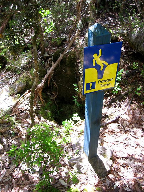
Finally, take a picture of your GPS next to one of the warning
signs you find along the way, and post this with your log.
Be careful: do not stray off the marked track! Not all tomo
are signposted. Some tomo appear to be "filled in". Do not go into
these as it may only be a thin layer of debris that may give way
under your weight.
Where does all this water go? Visit the sister earth cache to
this one, Riwaka Resurgence
(GC1JPHR), to see where the reticulated surface water emerges
from the vast cave system in this area!
You may also choose to visit the largest vertical shaft in New
Zealand (starting at the surface - a 50 metre round entrance,
descends 183 metres), the world-renowned Harwood Hole (GC1C4A). As caches go,
this one is one of the originals and is over 10 years old.