
Geology
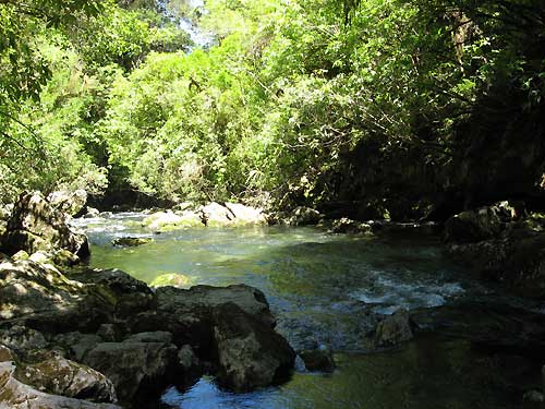
Riwaka Resurgence lies at the bottom of Takaka Hill (760m) below
Hawke’s Lookout. The hill itself is home to a vast network of
caves which have formed in between the layers of marble and granite
forming a typical karst landscape (Karst is a distinctive
topography in which the landscape is largely shaped by the
dissolving action of water on carbonate bedrock such as marble).
Melting snow and rain find their way into numerous sink holes
(dolines), and small streams “disappear” into the
ground. The catchment area for the Resurgence include the Ngarua
Caves and the Canaan Saddle (1200m). The water in this cave system
forms underground streams, rivers and waterfalls. The water comes
out at a reasonably steady 4 degrees Celcius (40 degrees
Farenheit), even during summer. Generations of Maori have visited
this sacred site for cleansing and healing, and you will be walking
in their footsteps as you visit.
Logging requirements
Send an email to geocachingnz.@.gmail.com with the
following information: how long it takes for water to travel
through the cave system.
History and spiritual significance
Te Puna o Riuwaka (Riwaka Resurgence) has been a place of
healing for Maori for many years. Early Polynesian explorer Hui Te
Rangiora , who seems to have voyaged all over the eastern, central
and south Pacific during the 7th century, is said to have used the
river’s sacred waters to heal himself on the way home from a
grueling voyage in which he discovered Antarctica. For Maori, every
river has its own mauri (life force). Rivers are the veins of
Papatuanuku (Earth Mother) and the water in them is her lifeblood.
Rivers nourish all living beings and link us with ancestors. Te
Puna o Riuwaka has special mana (status) because from them springs
waiora (the waters of life).
While you’re there
Surprisingly, for such a sacred site, you are allowed to swim in
the river, and suitably experienced and equipped cave divers can
enter the cave through the sump at the resurgence. Fishing is also
allowed (license needed), and there are several great spots to have
a picnic. (NO: camping, dogs, fires, bikes). After you have been
here, you might like to see where some of the water starts its
journey by visiting Ngarua Caves (entrance fee). This cave is quite
special in the sense that you are not only allowed to see Moa bones
(extinct large New Zealand flightless bird), this is reportedly the
only place in the world that lets you hold one. You should also
consider the drive to Canaan. One of the shortest and easiest walks
available from here is the approximately 2 hour return trip to
Harwoods Hole, a natural sink hole in the limestone over 200 metres
deep, and 15 metres in diameter. The well formed and easy to walk
track takes you through native bush (predominantly
Beech/Nothofagus) and past a couple of small ponds. Because of the
limestone structure of the Takaka Hill, it is not wise to deviate
from the formed tracks. The marble from the Takaka Hill are part of
many buildings in New Zealand, including Parliament Buildings in
Wellington.
Like to know how all that water got here? Then visit the sister
cache to this one, Takaka Hill
Tomo (GC2KMGW)