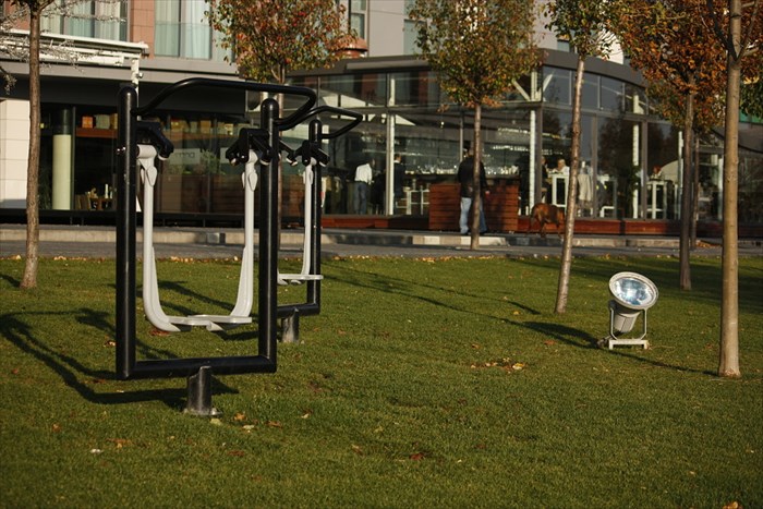
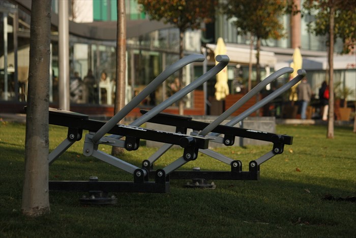
 Eurovea Fitness Trail
 actually consists of
10-15 pieces of simple gym equipment designed for outdoor use.
They are placed unnumbered at neat river Danube embankment in front of
Eurovea Galleria shopping, business and leasure time centre.
Fitness trail is very popular especially for recreational runners, as all the equipment is located around 10km long running track.
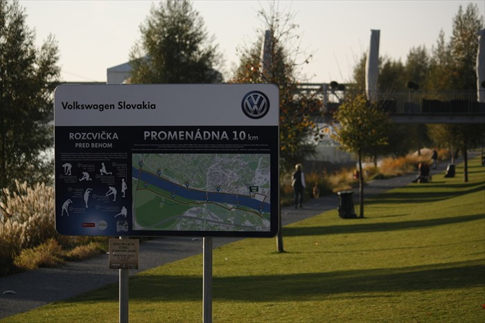 "Promenádna 10km"
 is
10 kilometres (6.21 miles) long running track along both sides of river Danube in Bratislava, capital of Slovakia.
Running lane starts and ends on river bank in front of Eurovea Galleria shopping mall, which is often called as "new city centre".
Course is easy, suitable for both recreational and profi athletes. Terrain is flat with only short ascents (approx. 15 metres) to bridges Apollo and Lafranconi.
Track is divided into 10 stages by 1 kilometre, all turns and changes of track direction are marked by arrow signs.
Runners have a chance to see historical centre of the city as well as nature around (Pecniansky forest, Sad Janka Krala - the oldest public park in central Europe).
This waymark will be also included to
Lucky 7 waymark lists. Have fun and take a good workout!
 Fitness park pri Eurovei
 momentalne pozostava z 10 az 15 outdoorovych naradi, ktore su rozmiestnene v prijemnom prostredi na brehu Dunaja pred Euroveou.
Je to tu vyhladavane najma bezcami, ktori sa tu radi rozcvicuju, kedze nabrezim vedie celkom vychytena znacena bezecka trasa:
"Promenádna 10km" je 10 kilometrový bezecký okruh po oboch stranách Dunaja v centre Bratislavy.
Okruh zacina a konci na nabrezi pri obchodnom centre Eurovea.
Je vhodny tak pre rekreacnych, ako aj profesionalnych bezcov.
Trat je rovinata s minimalnymi stupaniami (asi 15 metrov) na lavky mostov Apollo a Lafranconi.
Na trase su oznacene kilometrovniky a kazda zmena smeru trasy je oznacena sipkami.
Pocas behu mozete jednak vidiet historicke centrum mesta, ako aj prirodu v jeho blizkom okoli - ako Pecniansky les, ci Sad Janka Krala - najstarsi verejny park v strednej Europe.
Tento waymark je tiez sucastou nedalekeho
Lucky 7 projektu. Tak si to uzite!