Eulalona Trail - Klamath Falls, OR
Posted by: Groundspeak Premium Member NW_history_buff
N 42° 13.203 W 121° 47.800
10T E 599313 N 4674909
This trailhead is located just off Cypress Ave in Klamath Falls, OR.
Waymark Code: WMH6N6
Location: Oregon, United States
Date Posted: 05/31/2013
Published By:Groundspeak Charter Member huggy_d1
Views: 5

Wrap Text around Image
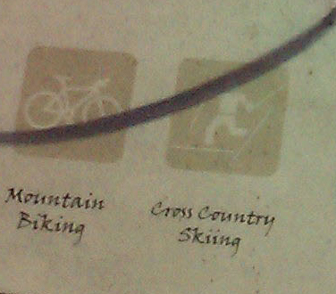
The Eulalona Trail is located on the southern part of Moore Hill and leads northward to Moore Park. The trail is a great trail for running and mountain biking. In fact, my geocaching buddies is one of the trail managers in charge of maintaining theses trails and keeping them groomed. The mountain biking trails through here are ever-growing and gaining more popularity with the locals in recent years. This trail splits into the Ridge View Trail about halfway to Moore Park with the Ridge View Trail continuing all the way to Lakeshore Drive, west of Moore Park. The Eulalona Trail also splits off into numerous mountain biking trails that meander all over Moore Hill and contain many stopping points for geocaching and sight seeing at the summit (many geocaches were placed by me). The trails along Moore Hill including Eulalona Trail are managed and maintained by friendsofmoorepark.org and klamathtrails.org, both being volunteer groups of citizens who desire to provide a venue for the general public to enjoy and appreciate. Unfortunately, not everyone appreciates the hard work and effort these groups have undertaken and it shows with the graffiti on one of the placards near this trailhead. Still, this trail is great for a quiet run or mountain bike ride. Enjoy!
Trail Name: Eulalona Trail

Short description of trail:
Eulalona Trail is approx. 1 mile long from the trailhead to Moore Park. This trail splits off into numerous other mountain biking trails that zigzag all over Moore Hill and continue all the way to Lakeshore Drive, past Moore Park. If you look on Google Maps, you'll see the new trails in white opaque and dotted lines. These weren't online last year so they are new and more trails should be showing online soon to reflect brand new trail runs.


Trail Average Difficulty:

Web Link to trail map (if available): [Web Link]

Visit Instructions:
One log per waymark per person per physical visit to the trailhead. You are welcome to log your own waymark locations.
Search for...
Geocaching.com Google Map
Google Maps
MapQuest
Bing Maps
Nearest Waymarks
Nearest Mountain Bike Trailheads
Nearest Geocaches
Create a scavenger hunt using this waymark as the center point
Recent Visits/Logs:
There are no logs for this waymark yet.