
Lake Chuzenji - Nikko, Japan
Posted by:  silverquill
N 36° 43.902 E 139° 29.478
54S E 365287 N 4066170
Lake Chuzenji was formed when volcano that formed Mt. Nantai erupted blocking the outflow of a river. It is one of the gems of the Nikko region in central Japan, with a long tradition.
Waymark Code: WMG5BQ
Location: Tochigi, Japan
Date Posted: 01/15/2013
Views: 4
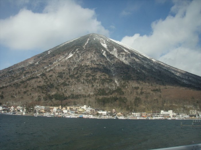
Mt. Nantai and Lake Chuzenji comprise a sacred site in the central mountains of Japan. There is a series of three temples going up the side of Mt. Nantai, a pilgrimage that will take one to the very top. The lake below is a treasure still revered. Traditional archery matches are still held here with the targets bobbing on boats in the lake. The 25-mile road around the like makes a scenic drive or one may hike the trail system.
The only outlet to the lake is the spectacular Kegon Waterfall. The famed temples of Nikko lie farther below.
References:
Travel Around Japan
Japan Guide
International Lake Environment Committe
Wikipedia-Lake Chuzenji
Lake Type: Crater lake

Coordinates location: Elevation sign near the boat docks
Max. Length: 7 km
Max. Width: 2km
Max. Depth: 163m
Surface area: 12,000,000 sq. m.
Website: [Web Link]
Parking / trail head: Not Listed
|
Visit Instructions:
To log a visit to a waymark, please post a photograph taken by you and a brief description of your visit.
Recent Visits/Logs:
| There are no logs for this waymark yet. |
|
|
|