
Trail Cairn - Mokpo, Korea
Posted by:  silverquill
N 34° 48.271 E 126° 26.399
52S E 265812 N 3854352
This simple cairn is at a trail intersection on a small mountain overlooking the port city of Mokpo, Korea.
Waymark Code: WMEDZE
Location: Jeolla nam do, South Korea
Date Posted: 05/14/2012
Views: 4
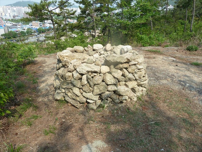
The easiest access to this cairn is from Mokpo Memorial Park (목포현충공원), just east and below. The trail from the park is just 100 meters. The trail then runs north and south along the top of the mountain with panoramic views of the city of Mokpo to the west.
The cairn is composed of loosely piled rocks, about 1m high and 2 m wide with a flat top. It may change over time as more rocks are added by hikers.
Cairn Location: Mokpo

Cairn Purpose: Trailhead Markers
Cairn Condition: 
Type if different from above list: Not listed
Types of rock: Not listed
|
Visit Instructions:
An original image picture of the cairn captured at the coordinates given by yourself.
At least one sentence to describe your impression of the Cairn, or your reason for visiting if it is more than just waymarking.
Recent Visits/Logs:
| There are no logs for this waymark yet. |
|
|
|