Osan Dam (오산저수지) - Jindo, Korea
Posted by: Groundspeak Premium Member silverquill
N 34° 29.856 E 126° 20.191
52S E 255445 N 3820551
This dam provides flood control and irrigation for this valley on the east side of the island of Jindo on Korea's south coast.
Waymark Code: WMEDJK
Location: Jeolla nam do, South Korea
Date Posted: 05/12/2012
Published By:Groundspeak Regular Member manchanegra
Views: 2


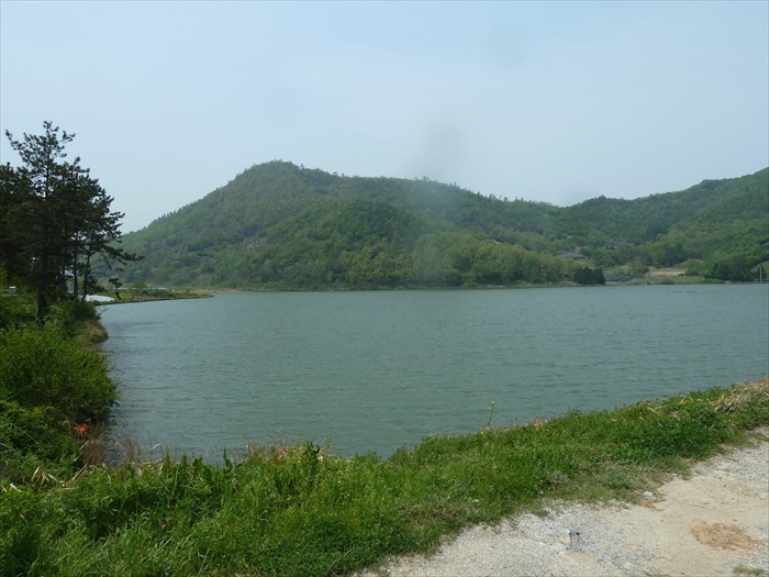
Dating back to 1956, this dam provides irrigation for 125ha (308 acres) of farmland below. The dam is 342m (1,122 ft) long and 14m (46ft) high creating a lake of 10ha (25 acres). There is a one lane dirt road across the top of the dam.
Waterway where the dam is located: Osan River

Main use of the Water Dam: Irrigation

Material used in the structure: embankment

Height of Dam: 14m (46 feet)

Date built: 01/01/1956

Motor Sports Allowed: no

Fishing Allowed: Not Listed

Visit Instructions:
Photo of the Dam and a description of your visit.
Search for...
Geocaching.com Google Map
Google Maps
MapQuest
Bing Maps
Nearest Waymarks
Nearest Water Dams
Nearest Geocaches
Create a scavenger hunt using this waymark as the center point
Recent Visits/Logs:
There are no logs for this waymark yet.