
LOCK 21, St Lawrence river
Posted by:  dutchmaster
N 44° 59.907 W 074° 53.940
18T E 507960 N 4982783
Long said to be the greatest shore dive in Ontario if not in Canada.
Waymark Code: WM83Y
Location: Ontario, Canada
Date Posted: 02/27/2006
Views: 349
Lock 21 was the western entrance to the Cornwall Canal which ran for 11 miles along the Canadian shore of the St Lawrence river and was built to bypass the Longue Sault Rapids. The initial canal was constructed around 1840 and could only handle ships with an eight foot draft and operated for approximately 50 years. The lock that remains today was upgraded around 1898 when the entire length of the canal was deepened to handle ships with a greater draft up to 14 ft. At that time the first hydro generating station was constructed to electrify the entire length of the canal. It's also claimed that Thomas Edison was at the opening of the new generating station and canal.
The entire site was inundated with the completion of the new seaway in 1958 and the tops of the walls are now in 35 feet of water with the floor of the lock at the 60 foot level. The weir contains small gates about 4x4 feet square, two of which are still open and accessible to divers who want to experience the force of the river by getting flushed through them. At one time, initiation required that a diver swim up current through these gates, not a small feat I can assure you from personal experience.
The lock gates were removed as they floated and would pose a hazard to the new generators downstream but the old wooden floor in the lock remains along with much of the hardware and machinery that controlled the weir. The handrails are still intact and offer great handholds in the stiff currents around the tops of the walls over which the river now flows. Immediately in front or behind the walls there is just enough current to keep the silt away and a slight back eddy will return a diver to the weir/entry point after a "fly through" of the lock itself.
There is still plenty to see and enough reason for many return visits. Since initially discovering the site in the late 70s, I've seen more and more divers coming to visit, to the point now where on a nice summer weekend there can be a hundred divers there from far and wide.
The coordinates will bring you to the south corner of McDonald island in the Long Sault Parkway, the location of a kiosk with information about the submerged sites and more dive information on the lock itself. During the summer months there is an entrance fee to the parkway.
Take nothing but pictures, leave nothing but bubbles and enjoy a really great shoredive.
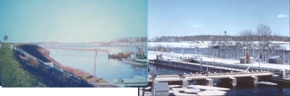
Combined photos showing the stairs (entry point) leading to the weir or sluice gates. Only the supports for the wooden stairs remain.
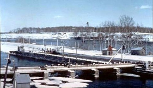
The building to the left and across the lock is the winch house, needed to pull barges into the lock itself. One of the smallest buildings was a shelter for a soldier on guard duty during certain conficts throughout the history of the canal. Directly above the west entrance of the lock and across the river is the diversion channel cut through Long Sault island, therefore this photo is from 1956-58.
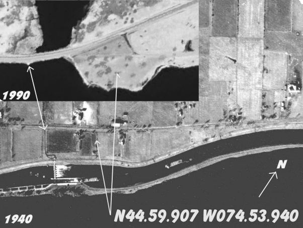
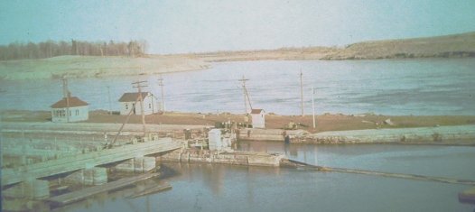
Before and after aerial photos of Lock 21 and the west end of McDonell Island. The little "nub" in the middle of the causeway is what remains of the road leading to the lockmaster's house next to the stairs. At low water levels one can wade the submerged road. I've seen the location of the lockmaster's house become a small island at extreme low water levels during the winter.
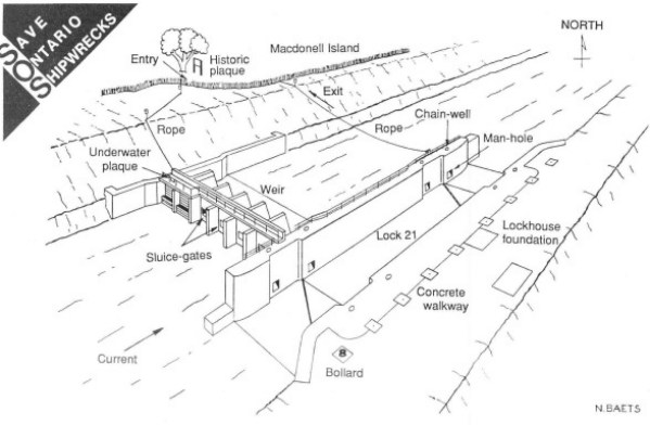
The entry and exit ropes are no longer maintained. Exiting along the bottom from the east end of the lock is much easier with the "zebra mussel" improved viz and there's only a slight current along the bottom at that point.
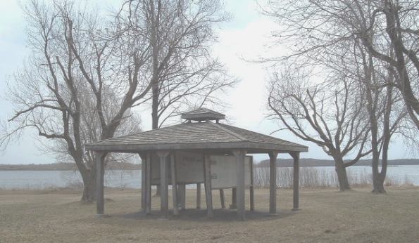
This is the information kiosk located metres from the entry point to the south. The information boards have since been upgraded and contain a wealth of historical information and great construction photos of others places along the canal and river.
