Lakes County Overlook ~ South Island, NZ.
Posted by: Groundspeak Regular Member Dunbar Loop
S 44° 58.424 E 168° 51.879
59G E 331624 N 5017749
A stunning overlook is beside the Crown Range Road as it descends from the summit.
Waymark Code: WM83D1
Location: South Island, New Zealand
Date Posted: 01/20/2010
Published By:Groundspeak Premium Member Jake39
Views: 14

At some 544 metres above sea level, this overlooks the valley about 200 metres below and in the distance to Lake Wakatipu.

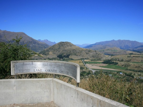
A very popular pull out for many tourists who climb up the Crown Range Road between Arrowtown and Wanaka. On most days it is worth stopping here to appreciate the view.

Describe - Highway or Road number: Crown Range Road

Closest town or city: Arrowtown

Number of parking spots available: 12

Name if a website describes this location.: [Web Link]

Winter View: yes

Summer View: yes

Year around access ?: yes

Comfort station on site: no

Is a photo of an "Information Sign"included?: Yes

Search for...
Geocaching.com Google Map
Google Maps
MapQuest
Bing Maps
Nearest Waymarks
Nearest Scenic Roadside Look-Outs
Nearest Geocaches
Create a scavenger hunt using this waymark as the center point
Recent Visits/Logs:
Date Logged Log User Rating  
Whitepaws9 visited Lakes County Overlook ~ South Island, NZ. 09/10/2016 Whitepaws9 visited it
BruceS visited Lakes County Overlook ~ South Island, NZ. 10/22/2012 BruceS visited it
travelling visited Lakes County Overlook ~ South Island, NZ. 11/13/2010 travelling visited it
3l diesel visited Lakes County Overlook ~ South Island, NZ. 08/08/2010 3l diesel visited it

View all visits/logs