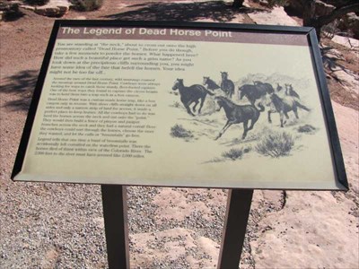
The Legend of Dead Horse Point - Moab, Utah
Posted by:  linkys
N 38° 28.475 W 109° 44.453
12S E 609833 N 4259223
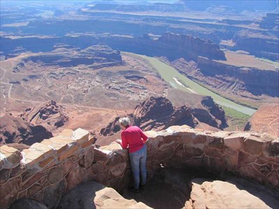
Legend has it some horses were corralled on this point of land, dying of thirst when water was right in front of them, only it was 2,000 feet down below them in the Colorado River.
Waymark Code: WM7PHJ
Location: Utah, United States
Date Posted: 11/18/2009
Views: 26
From the Dead Horse State website:
<center<The Legend of Dead Horse Point
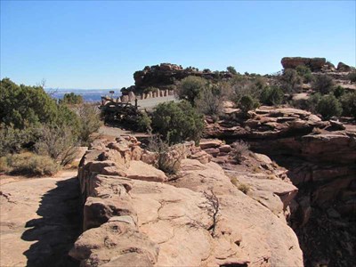
Dead Horse Point is a peninsula of rock atop sheer sandstone cliffs. The peninsula is connected to the mesa by a narrow strip of land called the neck. There are many stories about how this high promontory of land received its name.
According to one legend, around the turn of the century the point was used as a corral for wild mustangs roaming the mesa top. Cowboys rounded up these horses, herded them across the narrow neck of land and onto the point. The neck, which is only 30-yards-wide, was then fenced off with branches and brush. This created a natural corral surrounded by precipitous cliffs straight down on all sides, affording no escape. Cowboys then chose the horses they wanted and let the culls or broomtails go free. One time, for some unknown reason, horses were left corralled on the waterless point where they died of thirst within view of the Colorado River, 2,000 feet below.
Website
From this has sprung the very popular Dead Horse State Park
Where multitudes come to see the narrow neck of land that was supposedly barricaded
And hike or drive out to the end of the point to catch a glimpse of the Colorado River those 2000 feet below.