
4000 year old celestial calendar - America's Stonehenge
Posted by:  Telomere
N 42° 50.528 W 071° 12.589
19T E 319417 N 4745652
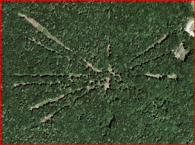
The ancient site known as "America's Stonehenge" shows up as a series of radial lines that correspond to solar and lunar events.
Waymark Code: WM727Y
Location: New Hampshire, United States
Date Posted: 08/22/2009
Views: 42
"America's Stonehenge" was constructed in 2 phases, by an unknown ancient civilization.
The central phase was a 20-acre common habitat with stone chambers, passageways, wells and drains. The 100-acre second phase is a concentric ring of stones aligned to pinpoint the sunrises/sunsets of solstices and equinoxes, as well as specific calendar dates, probably for ceremony.
As the modern site is in a typical New England forest, the sight lines from the central viewing location out to the pointer stones have been kept clear by cutting the trees in between. These sight lines are clearly visible in the satellite view of the area, as radiating "spokes".
More photos in other categories - see "nearest waymarks".