
Gemeindealpe, Austria
Posted by:  Tafari
N 47° 48.783 E 015° 14.980
33T E 518691 N 5295552
The "Gemeindealpe" is a little Skiing and hiking area in Lower Austria next to the styrian border.
Waymark Code: WM582
Location: Niederösterreich, Austria
Date Posted: 12/25/2005
Views: 68
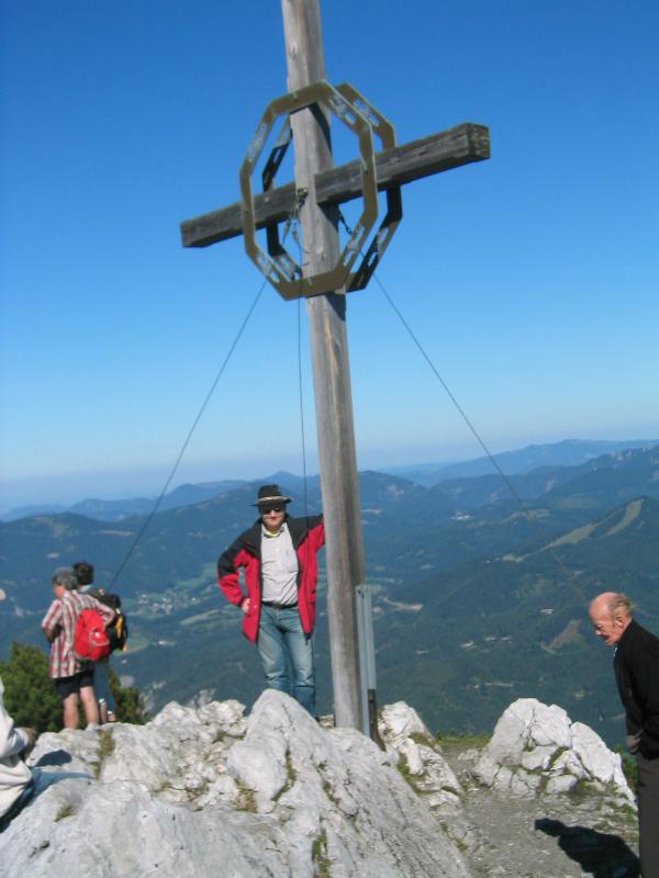
The height is 1.626m or 5.335 ft. It is possible
to go uphill by feet from Mitterbach am Erlaufsee (NÖ). For those who are not
able to go uphill, there is a possibility to go until to the alpine hut
"Terzerhaus" by a chair-lift (recommended also for people who want to ski there).
More Information including the other hiking
routes and point of interests in that area you can find
here,
here or
here. Close to this area you
can also visit Mariazell.
A Foto of you with the summitcross as a proof
of your visit is required for your log!!
Happy waymarking
Ras Tafari
Altitude in Feet: 5335

|
Visit Instructions:
To post a visit log for waymarks in this category, you must have personally visited the waymark location. When logging your visit, please provide a note describing your visit experience, along with any additional information about the waymark or the surrounding area that you think others may find interesting.
We especially encourage you to include any pictures that you took during your visit to the waymark.