
Glenwood Ranger Station - Gila National Forest
Posted by:  linkys
N 33° 18.554 W 108° 53.250
12S E 696667 N 3687560
US Forest Service Ranger District in southwestern New Mexico that includes the Catwalk National Recreation Area.
Waymark Code: WM3FBQ
Location: New Mexico, United States
Date Posted: 03/28/2008
Views: 71
From the forest service website is the following description of this Ranger District: The Glenwood Ranger District is managed for many multi-use purposes; hunting, fishing, hiking, ranching, camping and personal firewood cutting are among the activities. The District manages more than 523,000 acres of the Gila National Forest, including the western portion of the Gila Wilderness and the Blue Range Wilderness. The District has more than 322 miles of trail, offering diverse terrain and dramatic landscapes for the skilled hiker.
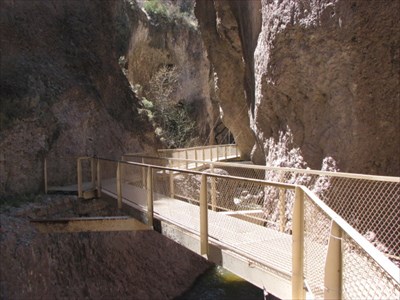
In reality that does not begin to do justice to this part of Gila National Forest. One of the two must see things in this District is the Catwalk National Recreation area.
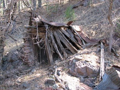
The other is the mining ghost town of Mogollon. Both are off the beaten path, but then isn't that where the best places to visit often ware.
This facility is located just south of the town of Glenwood, and is a full service office.