
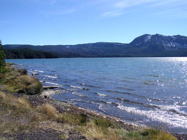
Paulina Lake/Paulina Peak, Oregon
Posted by:  Volcanoguy
N 43° 43.905 W 121° 15.076
10T E 640834 N 4843565
View across Paulina Lake to Paulina Peak in 1903 and 2005.
Waymark Code: WM298
Location: Oregon, United States
Date Posted: 10/07/2005
Views: 45
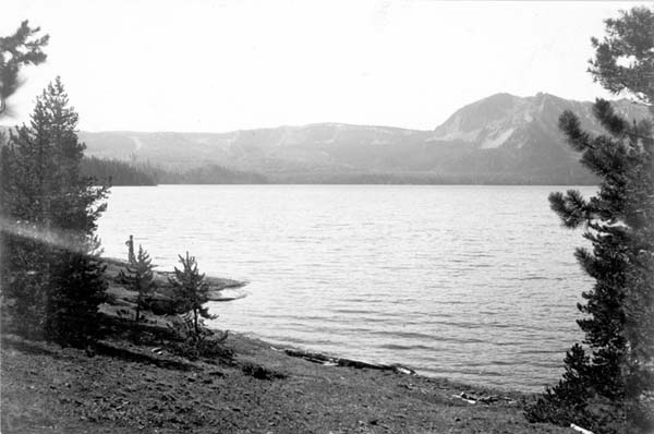
Photo (Digital File:ric00831) comes from USGS Photo Archive (visit
link). The original photo was published in 1905 in USGS Bulletin 252, Preliminary
Report on the Geology and Water Resources of Central Oregon, by Israel C. Russell
with the caption “Amphitheater of Mount Newberry, from west shore of Pauline
Lake, cliffs on southeast side. Crook County, Oregon. 1903.”
Caption says west shore of Paulina Lake but actual location is from northeast
corner of lake. No significant changes in view, other than shoreline vegetation.