
Perspective of Glacial Ice filling Lake Pend Oreille, Idaho
Posted by:  Rose Red
N 48° 15.425 W 116° 19.504
11U E 550096 N 5345094
Glacial Ice filled this basin as far as you can see. Only the mountains above 4,500 feet in elevation would have been visible from the top of the glacier.
Waymark Code: WM250T
Location: Idaho, United States
Date Posted: 09/05/2007
Published By: S10
S10
Views: 18
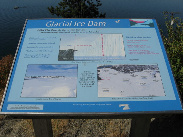
About 15,000 to 12,000 years ago the Continental Ice Sheet moved down from Canada spreading across the lake and rivers. Glacial Ice filled this basin as far as you can see, blocking the Clark Fork River. Only the mountains above 4,500 feet in elevation would have been visible from the top of the glacier.Instructions for logging waymark: A photograph is required of you (or your GPS receiver, if you are waymarking solo) and the signboard.