
Point Pinos Lighthouse: Then and Now
Posted by:  Touchstone
N 36° 38.047 W 121° 56.064
10S E 595266 N 4054813
The two photos below are of the historic Point Pinos Lighthouse in Pacific Grove, California. To access this location (the WM coordinates), you will encounter a certain amount of danger: the waymark coordinates are out on Pacific Grove Golf Course
Waymark Code: WM1WK
Location: California, United States
Date Posted: 09/24/2005
Views: 46
The Point Pinos Lighthouse is the oldest continuously operating lighthouse on
the West coast. Since 1855, the lighthouse has been a navigational aid to
ships going to and from Monterey Bay.
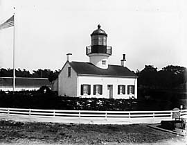
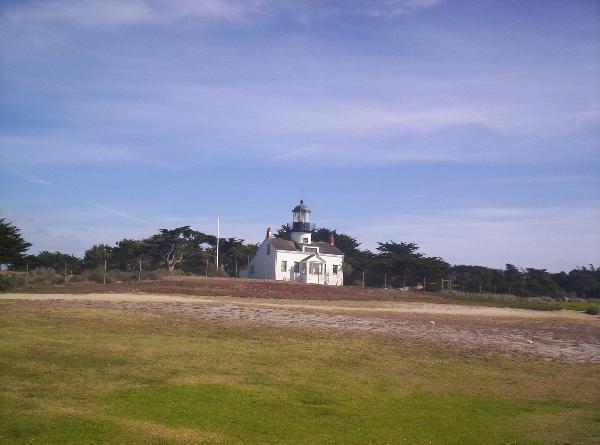
The photo on the left was taken in 1895, and the picture on the right was
taken on September 23, 2005. Doesn't look like much has changed, but there
are a few things of note. In 1895 there was no golf course next to the
lighthouse. A road ran in front of the picket fence, and there was a real
live lightkeeper back then.
Now, the lower floors of the lighthouse are a museum, the light in the tower
is automatic, and the picket fence has been replaced by a higher cyclone
fence. Another important note, the tower had to be rebuilt after the 1906
San Francisco earthquake, but the beautiful Fresnel lens is still intact and
working just as well as it was in 1855.