The Standoff at Gavilan Peak; California 1846
Posted by: Groundspeak Regular Member Bernd das Brot Team
N 36° 45.434 W 121° 30.248
10S E 633522 N 4068985
A battle that made history though (or because) it never happened.
Waymark Code: WM1GVD
Location: California, United States
Date Posted: 05/06/2007
Published By:Groundspeak Charter Member briansnat
Views: 88

This is a battle that didn't happen because of strong wind and a somewhat superstitious commander. Had there only a single shot been fired, California's history might have turned out totally different. This is the story of an American Captain and a Mexican General and the second attempt to raise the Star Spangled Banner on California soil.

In 1846, while California was still a part of Mexico, US Army Captain John C. Fremont of the Topographic Engineers led an expeditionary force of 60 men into the Salinas Valley and to the top of Gavilan Peak. Ostensibly, Fremont and his group were to explore and survey the area. Ostensibly, Fremont and his group were there to explore and survey the area. However, the group's makeup was clearly and armed force. The peak was a strategic location - from his encampment, Fremont could see anyone approaching for miles. Long suspicious of Fremont's motives, Mexican Commandante General Jose Castro ordered him to leave California immediately. In defiance, Fremont quickly built a log stockade at the peak and raised a U.S. military flag.

For three days Fremont looked down on San Juan Bautista and Castro's growing force. For that same length of time the Mexican leaders looked up at an American flag that Fremont's men had raised atop Gavilan Peak. On the evening of March 9 the flag pole fell down. Fremont decided to treat this as an omen and that night left the mountain top and eventually worked his way slowly north through the Sacramento Valley to Oregon. Castro declared to the Mexican Minister of War that he had won the day, but made no effort to follow the Americans.

This text was taken partially from the Park Brochure of Fremont Peak State Park and partially from Inn-California's article The Gavilan Peak Incident.

The coordinates refer to the location of the flagpole on top of Gavilan Peak, which is now called Fremont Peak.


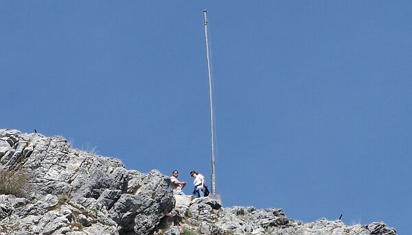
The historic flagpole at Fremont Peak

Name of Battle:
Gavilan Peak Incident


Name of War: Mexican-American War

Entrance Fee: 5.00 (listed in local currency)

Parking: N 36° 45.536 W 121° 30.206

Date(s) of Battle (Beginning): Not listed

Date of Battle (End): Not listed

Visit Instructions:
Post a photo of you in front of a sign or marker posted at the site of the battle (or some other way to indicate you have personally visited the site.

In addition it is encouraged to take a few photos of the surrounding area and interesting features at the site.
Search for...
Geocaching.com Google Map
Google Maps
MapQuest
Bing Maps
Nearest Waymarks
Nearest Battlefields
Nearest Geocaches
Create a scavenger hunt using this waymark as the center point
Recent Visits/Logs:
Date Logged Log User Rating  
WalruZ visited The Standoff at Gavilan Peak; California 1846 05/25/2007 WalruZ visited it

View all visits/logs