First Dutch Earth Cache - Wheel of Bassa EarthCache
First Dutch Earth Cache - Wheel of Bassa
-
Difficulty:
-

-
Terrain:
-
Size:  (not chosen)
Please note Use of geocaching.com services is subject to the terms and conditions
in our disclaimer.
 The Wheel of Bassa was created in 1571, by a mass of water breaking through the Diefdijk, near a small village called Schoonrewoerd. This area is kept original and is of high nature historical value. The Wheel of Bassa is the most beautiful and the biggest wheel in the Netherlands.
The Wheel of Bassa.
One of the most beautiful wheels is the one at Schoonrewoerd near the Diefdijk. The wheel is situated in an area called Vijfheerenlanden, still in the province of Zuid-Holland, about halfway between Zijderveld and Leerdam. The Diefdijk once served to protect the land in Zuid-Holland, between the rivers, when the Betuwe got flooded. In 1571, it failed to give enough protection and thus, the dikes broke, and this is how the Schoonrewoerd wheel originated. The wheel, which is also called the ‘Wheel of Bassa’ is discussed in glorifying terms as being the most beautiful and the biggest wheel in the Netherlands.
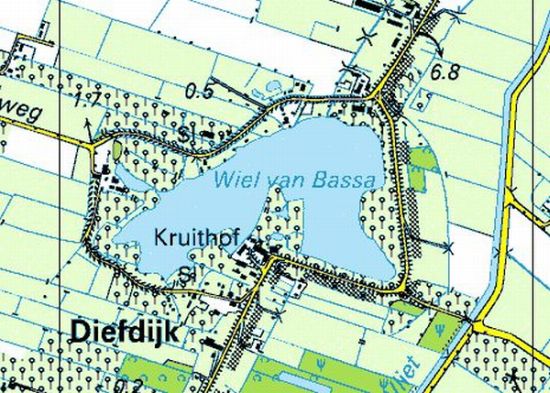
(Topographic overview at the Wheel of Bassa)
A Wheel.
What exactly is a wheel? A wheel is a water that originates after the breaking of dikes. Mostly, they have a limited surface, but they can be about 25 metres deep. Along the big rivers, we can see many wheels, all of them being ‘witnesses’ of the breaking of dikes. In the Betuwe we solely see many wheels: the Galgenwheel near Asperen, the wheel (which is called a ‘waai’ here) near Zijderveld, and the wheels near Elden, Ochten and Ingen. In general, these wheels aren’t just meaningful because of their characteristics in nature, but from nature’s point of view they are valuable as well. The most beautiful one is the Schoonrewoerd wheel indeed. It seems as if time didn’t leave a trace here. Nowadays, the Schoonrewoerd wheel is a nature reserve. The area, which is about 13 acres, is owned by the Zuid-Hollands Landschap. And thus it isn’t accessible, apart from the hiking routes.
A tremendous landscape.
The way to the wheel is worth the trip. Take the access road from the north, thus from the direction of the highway A2. Drive along the Diefdijk. Taking this road gives you a tremendously beautiful view of the surroundings. When you have approached the wheel, walk or go by bike around the wheel clockwise. We took the road to the right where the Diefdijk turns right. The first house is the Bassa family’s farm. They used to live there.
For now, the wheel can’t be seen because of the enormous houses and the lots that belong to it. Only now and then we get a glimpse of the wheel. There’s a path leading to the wheel along a farm on the west side, where the road bends in the direction of the village Schoonrewoerd. If you have come by car, you can park your car here on a small parking place at N 51.55.046 E 005.07.614. After a while you can see an orchard on the left side. It is accessible. Now you cross the wheel and you can get a nice view of the farm where you started your walk.
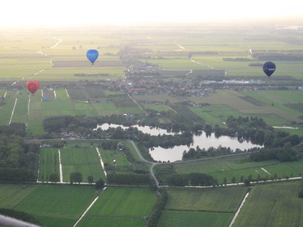
(Air view of the Wheel of Bassa
The most beautiful part.
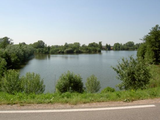
The most beautiful part is the last part, where you can go up the Diefdijk. Now you’re on the east side of the wheel. Once again you will get a nice view of the landscape from the Diefdijk. Here you can admire the wheels beauty at its fullest. You now can imagine that this is the most beautiful wheel in the Netherlands. The original recordings from this point of view is now on private property, namely the farm where the Bassa family once lived and from whom the name of the wheel was derived.
Logging this Earth Cache.
Logging this cache is very easy. Park your car at the coordinate on top of the page. Here you can start the hike around the complete wheel of about 2 kilometers. During the hike you have to answer three questions and take one picture. From the parking place you turn right on the road and follow the cyclepath at your left hand.
WPT1) On N 51.54.960 E 005.07.597 you will find an information plaque on which is stated how deep the hole in the dike was. Mail us the correct answer.
WPT2) Go to N 51.54.867 E 005.08.159. At this point you will find another plaque with the dates the dike was broken at this point. Mail us both years.
(The plague is missing at the moment: the answer here is 1571 and 1573.)
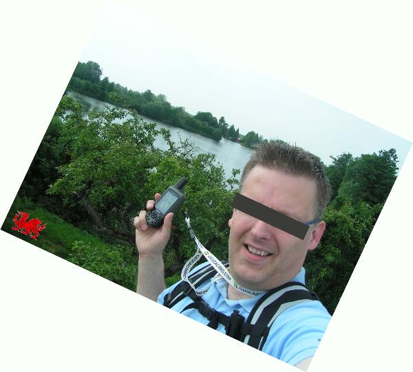
At this point is also the photo task. Take a picture of yourself or one of the teammembers showing the GPS, with on the background the Wheel of Bassa. It must be clearly vissible who visited the place, so only face pictures are allowed!
WPT3) Next point will be at N 51.55.080 E 005.08.101. On your left hand you can see the farmhouse where the Bassa family used to live in early days. Mail us the number of the house.
What next? Mail your answers to wheelofbassa@gmail.com (so not via geocaching.com!) and you will receive a reply whether your solutions are correct or not. When they are correct you're permitted to log the cache as found. Add the picture in your log.
All logs after November 17th 2006 must meet these requirements. They are in agreement with the guidelines of the GSA (Geological Society of America) for placing and visiting an Earth Cache. We have to delete logs which do not meet these requirements!!
 Loggen van deze Earth Cache.
Het loggen van deze cache is redelijk eenvoudig. De auto kan geparkeerd worden op het coordinaat bovenaan de pagina. Hier start de wandeling van ongeveer 2 kilometer rondom het gehele wiel, waarbij antwoord gegeven moet worden op een drietal vragen en tevens een foto gemaakt moet worden. Ga vanaf de parkeerplaats rechtsaf de weg op en neem vervolgens linksaf het fietspad.
WPT1) Op N 51.54.960 E 005.07.597 kom je een informatiebord tegen. Hierop is te lezen hoe diep het gat was dat in de dijk geslagen was. Mail ons het juiste antwoord.
WPT2) Ga naar N 51.54.867 E 005.08.159. Op dit punt staat een informatie paneel, met daarop de jaartallen waarin de Diefdijk op dit punt is doorgebroken. Mail ons beide jaartallen.
(Het informatie paneel ontbreekt momenteel: het antwoord hier is 1571 en 1573.)
Op dit punt is tevens de foto opdracht. Maak hier een foto van jezelf of één van de teamleden met GPS in de hand, met op de achtergrond het Wiel van Bassa. Het moet duidelijk zichtbaar zijn wie hier geweest is, dus uitsluitend gezichtsfoto's!
(Plaats voor de foto opdracht: waypoint 2)
WPT3) Ga vervolgens naar het laatste punt op N 51.55.080 E 005.08.101. Hier staat aan de linkerkant de boerderij waar vroeger de familie Bassa heeft gewoond. Mail ons het huisnummer.
Hoe nu verder? Mail je antwoorden naar wheelofbassa@gmail.com (dus niet via geocaching.com!) en je ontvangt een mailtje terug of de oplossingen al dan niet juist zijn. Daarna kan deze cache pas als gevonden gelogd worden. Voeg aan je log de gemaakte foto toe.
Alle logs na 17 november 2006 moeten aan deze vereisten voldoen. Deze zijn in overeenstemming met de regels van de GSA (Geological Society of America) voor het plaatsen en bezoeken van Earth Caches. Logs die hier niet aan voldoen, moeten we helaas verwijderen!!
Additional Hints
(No hints available.)