 counter since oct. 07 2007
(English Version below)
Diese Cache-Tour führt durch den Aachener Wald im südlichen
Grenzgebiet zu Belgien. Der Aachener Wald ist mit zahlreichen Wegen
durchzogen, die gerne von Spaziergängern und Joggern benutzt
werden. Ausläufer der Eifel sind hier mit Erhebungen bis zu knapp
360m ü. N. N. zu finden. Auf dem tatsächlich höchsten Punkt des
Aachener Waldes auf 359m Höhe stand bis 1944 der Pelzerturm, ein
zur damaliger Zeit sehr beliebter Ausflugspunkt mit Restaurant. Bei
Ende des Krieges wurde er von den Amerikaners gesprengt und aus
Waldschutzgründen nicht mehr neu aufgebaut. Auf diesem Höhenzug,
dem „Klausberg“, sind auch Zeugnisse der frühen Besiedlung dieser
Gegend zu finden: Hügelgräber. Die aus der frühen bis mittleren
Bronzezeit (ca. 1000 bis 100 v. Chr.) stammenden Hügelgräber sind
größtenteils nur mit einem geübten Blick als solche zu erkennen.
Sie bestehen aus lose aufgeschichteten, unbehauenen Steinen, die
einen darunter liegenden Sarkophag bedecken. Oft bilden diese
Steinhaufen geometrische Figuren. Diese Figuren sind allerdings nur
durch Freilegen des darüber geschichteten Erdhügels zu sehen. Der
Aachener Professor Liese des Karlsgymnasiums hat 1924 eines dieser
Hügelgräber freigelegt und untersucht. Dort werdet Ihr ein Rätsel
lösen müssen.
Für
die ca. 7km lange Cache-Tour ist eine topograhische Karte recht
hilfreich, aber nicht unbedingt notwendig. Auf ihr sind abkürzende
Pfade zu sehen, die auf den vielen öffentlichen Infotafeln an den
Waldwegen nicht eingetragen sind. Ohne diese Abkürzungen, die im
folgenden Text aber auch beschrieben werden, kann die Tour auch
länger als 7km werden. Festes Schuhwerk
empfohlen.
Start- und Endpunkt der Runde ist der Parkplatz des
Waldrestaurants „Gut Entenpfuhl“ bei N50° 44.147 E6° 03.553. Die
ausgeschilderte Zufahrt dorthin beginnt an der Lütticher-Str. bei
N50° 44.535 E6° 03.623. Falls Ihr Kinder mit habt, könnte es sein,
dass diese lieber auf dem Spielplatz, oder am kleinen See mit den
Enten, oder auf dem Minigolfplatz bleiben möchten. Also besser die
Kinder mit verbundenen Augen bis in den Wald führen
;-).
In
der Beschreibung gilt: Jeder gesuchte Buchstabe steht für eine
einzelne Ziffer, Rechenoperationen sind mit + und - angegeben. Für
Buchstaben aus gesuchten Wörtern wird deren Position im Alphabet
verwendet.
WPT1: N50° 44.154 E6° 03.577: Wieviele Schwanzfedern
hat der schwarze Vogel auf der Infotafel? A=
__.
WPT2: N50° 44.143 E6° 03.490: Welche Vögel lest Ihr
auf der Hauswand des Restaurants. Erster Buchstabe. B=
__.
Weiter geht’s zu N50° 44.151 E6° 03.365 und dort nach links in
den Waldweg.
WPT3: N50° 43.962 E6° 03.169: Ja, auch bei diesem
Cache gibt es eine Bank zum Zählen. Bildet die Differenz der
sichtbaren Rundkopfschrauben minus der Sechskantschrauben.
C=__.
WPT4: N50° 43.729 E6° 03.049: Welches ist die größte
zweistellige Zahl auf dem Stein? Davon die Quersumme.
D=__.
Hier die erste Abkürzung: Am Stein den Pfad bergauf bis N50°
43.695 E6° 03.146. Dort auf der gegenüberliegenden Seite den
schmalen Pfad hoch bis zum Dreiländerblick bei N50° 43.590 E6°
03.185. Auf der Höhe hier von 348m würde man den besagten Blick
genießen können, wenn hier nicht so viele Bäume
stünden.
Bei
N50° 43.699 E6° 03.429 liegt rechts das erste Hügelgrab. Deutlich
ist der Hügel und der umlaufende Wall zu erkennen. Von den drei
Hügelgräbern dieser Tour ist es eigentlich das am besten
erkennbare.
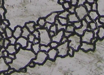
WPT5: N50° 43.765 E6° 03.584: Hier ist das 1924
freigelegte Hügelgrab mit einer Informationstafel. Die
unterirdischen Steinwälle haben die Form eines ungleichmäßigen
Speichenrades. Zählt beginnend mit 1 beim grossen Ostsegment bis
zum Segment zu dem das Stück im Foto gehört (kürzester
Zählabstand)? E= __.
Bei
N50° 43.820 E6° 03.659 liegt im Wald das dritte Hügelgrab. Es ist
nicht mehr so gut erhalten, dafür aber etwas weniger mit Erde
bedeckt und die Steine sind teilweise sichtbar.
Ab
N50° 43.829 E6° 03.693 gibt es wieder eine Abkürzung über einen
fast nicht mehr erkennbaren Pfad in Richtung 120° bis zum Weg bei
N50° 43.781 E6° 03.820
WPT6: N50° 43.609 E6° 03.634: Hier habt Ihr die
Möglichkeit Euch etwas auszuruhen. Welche besondere
Schutzausstattung hat diese Hütte (kleines Schild)? Erster
Buchstabe der Ausstattung. F= __.
Folgt von hier dem „günstigsten“ Weg bis zur dritten Abkürzung
bei N50° 43.574 E6° 04.065. Dort beginnt ein Pfad in Richtung
Osten, der Euch zum Cache führt.
Die Cache-Koordinaten sind:
N50°43.(C-E+D+F)(B-A)F E6°04.(D+A-B)(C+A)(B+F)
Eure Lösungszahlen:
|
WPT1 |
WPT2 |
WPT3 |
WPT4 |
WPT5 |
WPT6 |
|
A |
B |
C |
D |
E |
F |
|
|
|
|
|
|
|
Probe: (A+B+C+D+E+F) = XY, X+Y=9
Die Cache-Position:
|
N50°43. |
C-E+D+F |
B-A |
F |
E6°04. |
D+A-B |
C+A |
B+F |
|
N50°43. |
__ - __ + __ + __ |
__ - __ |
__ |
E6°04. |
__ + __ - __ |
__ + __ |
__ + __ |
|
N50°43. |
|
|
|
E6°04. |
|
|
|
Rückweg: Vom Cache aus dem Weg folgend über N50° 44.002 E6° 04.846
bis N50° 44.136 E6° 04.168. Unterwegs kommt Ihr nahe dem ehemaligen
Standort des Pelzerturmes bei N50° 44.004 E6° 04.354 vorbei.
Allerdings sind davon nur noch einige Steine zu sehen. Weiter
zurück geht es ab der Wegekreuzung bei N50° 44.136 E6° 04.168
in den kleinen Pfad in Richtung 220°, der bald nach 260°
schwenkt und zum Ausgangspunkt führt.
Viel Spaß!
English version:
This cache tour leads you through the
„Aachener Wald“, the Aachen forest in the south of Aachen close to
the Belgian border. Many promenades here are used for strolling and
jogging. You will find branches of the Eifel with heights up to
approx. 360m above sea-level. At the actually highest point of the
Aachener Wald at 359m stood the former “Pelzerturm” until 1944.
That was a popular place for excursions and provided also a
restaurant. At the end of the war the tower was blown up by the
Americans and was not rebuilt to protect the nature. The mountain
range here is the „Klausberg“ where you also can find references to
the early civilization in this area: Cairns. These cairns are dated
back to the early and middle bronze age (about 1000 to 100 years
before Christ) and only visible for a knowing eye. They are
composed of a bulk of stones arranged in some figures and covering
a sarcophagus below. These figures can only be seen after removing
the covering soil. A former professor from
Aachen named Prof. Liese discovered one of these
cairns in 1924. On this tour you will reach this
cairn and solve a puzzle.
A topographic chart may be very useful for
this tour of approx. 7km, but not absolutely essential. With that
you could identify some small shortcuts which are not indicated on
the official information boards along the way. Following only the
„broadways“ without using these shortcuts the tour may be easily
extend 7km. The shortcuts are also described in the following text.
Sturdy shoes recommended.
Starting point is a parking lot of the
restaurant „Gut Entenpfuhl“ at N50° 44.147 E6° 03.553. A small road
that leads to it is signed and starts from Lütticher-Str. at N50°
44.535 E6° 03.623. If you got your children with you, keep an eye
on them. Maybe they prefer playing on the playground here, or
watching the ducks on the little pond or playing miniature golf
rather than searching for a tupperware box. Best way is to keep
your children’s eyes covered until you are in the woods
;-).
Some regulations: Each letter to find
represents a one digit number, calculations are marked by + and -.
Letters from words to find should be substituted by their position
in the alphabet.
WPT1: N50° 44.154 E6° 03.577: How
many feathers does the tail of the black bird have that you see on
the information board? A= __.
WPT2: N50° 44.143 E6° 03.490: What
kind of birds do you read on the wall of the restaurant (sorry, you
need a German word). First letter. B=
__.
Now follow to N50° 44.151 E6° 03.365 and
turn left into the forest.
WPT3: N50° 43.962 E6° 03.169: Yes,
again an cache with a bench to count something. Substract the
number of hexagonal-headed screws from the round-headed ones that
you can find here. C=__.
WPT4: N50° 43.729 E6° 03.049: Find
the largest two digit number on the stone and calculate the sum of
digits. D=__.
And now the first shortcut: Leaving the
stone take the small path uphill to N50° 43.695 E6° 03.146. From
there follow the path on the opposite site up to the point
„Dreiländerblick“ at N50° 43.590 E6° 03.185. At this point at the
height of 348m you could enjoy a big view to three countries if
there weren't all these trees.
At N50° 43.699 E6° 03.429 you find the first
cairn on the right side. You can identify the bump and the
surrounding trench. I think this is the nicest one of the three
cairns that you will find on this
tour.
WPT5: N50° 43.765 E6° 03.584: This is
the cairn that was discovered by Prof. Liese in 1924. View the
information board. The stonelines are shaped like a spoke wheel.
Start counting at the big east segment ("Ost") with number 1 to the
segment to which the detail in the picture below matches. (shortest
distance to count)? E= __.
At N50° 43.820 E6° 03.659 you find the third
cairn on the right side in the woods. It is in a not so condition
but not too much covered with soil and some stones are
visible.
Again a shortcut at N50° 43.829 E6° 03.693
on a mostly covered and partly not visible path in direction 120°
to a way at N50° 43.781 E6° 03.820.
WPT6: N50° 43.609 E6° 03.634: You may
rest here for a moment. What is the special protection feature that
this hut provides (a small sign tells it in German)? First letter
of the feature. F= __.
Now take the appropriate way to the third
shortcut at N50° 43.574 E6° 04.065. From here a path to the east
leads to the cache.
The cache coordinates are
N50°43.(C-E+D+F)(B-A)F E6°04.(D+A-B)(C+A)(B+F)
Your numbers:
|
WPT1 |
WPT2 |
WPT3 |
WPT4 |
WPT5 |
WPT6 |
|
A |
B |
C |
D |
E |
F |
|
|
|
|
|
|
|
To verify: (A+B+C+D+E+F) = XY,
X+Y=9
Cache-position:
|
N50°43. |
C-E+D+F |
B-A |
F |
E6°04. |
D+A-B |
C+A |
B+F |
|
N50°43. |
__ - __ + __ + __ |
__ - __ |
__ |
E6°04. |
__ + __ - __ |
__ + __ |
__ + __ |
|
N50°43. |
|
|
|
E6°04. |
|
|
|
Way
back: Follow the way to N50° 44.002 E6°
04.846 and N50° 44.136 E6° 04.168. On the way you pass the
area where the “Pelzertower” stood at N50° 44.004 E6° 04.354, but you will
only find some remaining stones of it. From the
crossing at N50° 44.136 E6° 04.168 take the
small path that leads downhill to direction 220°, turning to
260° and leading to the starting
point.
Happy geocaching!