
The village is a documented settlement in the Domesday Book of 1086 and was mainly an agricultural community until the late 19th century. Horse racing also took place on the heathland areas, which are now part of the RAF station. At various times other activities including malting, brick-making and stone-quarrying have taken place in the village.
Around 1830, George Boole, the mathematician, taught at Waddington Academy Boarding School in the village, run by Robert Hall. From 1838 to 1840, Boole lived in the village and became headmaster of the academy.
Enemy action during 1941 severely damaged 71 houses in the village, as well as the Horse & Jockey pub and the NAAFI building on the RAF station. The damage was mainly caused by two aerial mines; large bombs dropped by parachute and fused to explode before hitting the ground. Eleven people were killed, among them the NAAFI manager, Mrs Constance Raven, after whom the All-Ranks Club on the RAF station is still named.
The village 12th-century St Michael and All Angels church was rebuilt in 1721 and destroyed in a Second World War air raid on the night of 8 May 1941. It was replaced by the present-day Anglican parish church of St Michael on High Street, a modern stone building consecrated in 1954. The original Great War memorial was also destroyed and replaced by the current memorial.
High Dyke, the road that runs between the main RAF station and the service married quarters, lies on the line of the Roman road Ermine Street. There is only minor evidence that High Dyke is Ermine Street, but the alignment is so exact that it is unlikely to be a coincidence. Ermine Street, as it passes Byards Leap 20 miles (32 km) to the south, is also called High Dyke. The traceable line of Ermine Street peters-out in the adjacent village of Harmston and does not reappear until the other side of Lincoln.
Waddington is known as a Lincolnshire Cliff Village, as it is situated on a ridge of Jurassic limestone called the Lincoln Edge or Lincoln Cliff. Waddington lies 2.7 miles (4 km) south of Lincoln and 13 miles (21 km) north-northwest of Sleaford.
During the Ice Age, most of the region surrounding Waddington was covered by ice sheets and this has influenced the topography and nature of the soils. Waddington's cliff-top position means it is 226 ft (69 m) above sea level, giving it commanding views over the River Witham valley.
The Viking Way enters the village from the north on Far Lane and passes south along High Street then briefly along Millers Road.
RAF Waddington is a British airfield east of the village's centre. It is one of the oldest airfields in the UK, founded in November 1916 for the Royal Flying Corps. RAF Waddington is the RAF's main ISTAR airfield, operating amongst others the E-3D Sentry (a.k.a. AWACS) reconnaissance aircraft. Previous to this, the station had been home to part of the Avro Vulcan nuclear bomber force.
RAF Waddington is now home to 13 Sqn who operate the MQ-9 Reaper Remotely Piloted Air Vehicles (RPAS), although the aircraft are not physically based there.
Two Commonwealth air force personnel of the First World War and 33 of the Second World War buried from this airfield have war graves in a plot St Michael's Churchyard.
----------------------------------------------------------
THE CACHE
Find the concrete marker on the verge that begins AV.
To find the bearing you need to walk on add 116 to the second two digit number.
To find the distance (in metres) you need to walk, add 507 to the three digit number.
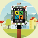
About Village Sign Caches
This cache belongs to the Village Sign Series, a series of caches based on ornate signs that depict the heritage, history and culture of the villages that put them up (generally on the village green!).
The signs can be made of different materials from fibreglass to wood, from forged steel to stone. They can depict anything from local industry to historical events. The tradition probably started in Norfolk or Suffolk and has now spread across most of the country so we thought we would base a series on them!
More information and statistics can be found at the Village Signs Website

About Village Sign Caches
|
 ⠀ ⠀ |
This cache belongs to the Village Sign Series, a series of caches based on ornate signs that depict the heritage, history and culture of the villages that put them up (generally on the village green!).
The signs can be made of different materials from fibreglass to wood, from forged steel to stone. They can depict anything from local industry to historical events. The tradition probably started in Norfolk or Suffolk and has now spread across most of the country so we thought we would base a series on them!
|
More information, bookmarks and statistics can be found at the Village Signs Website
If anybody would like to expand the Village Sign Series, please do.
I would ask that you request a number for your cache first at www.villagesignseries.co.uk
so we can keep track of the Village Sign numbers and names to avoid duplication.