[Ita]
AMItrail laghi
Un sentiero che si snoda tra i colli di Ivrea per l'esplorazione dei 5 laghi.
Ho deciso di scrivere brevi note in ogni cache dedicate a un elemento del mondo naturale presente nelle vicinanze di GZ, raccontando solo una curiosità o un riferimento culturale che lo riguarda. Gli amis dl mystery mi hanno aiutato a scrivere i listing e la cosa è stata molto divertente. E' ovviamente citato l'autore del listing.
Il gioco che propongo a voi e di aggiungere un pensiero, un ricordo, un'altra curiosità o notizia in generale, legata all'elemento citato. Mi piacerebbe che i log avessero un senso e non solo la ripetizione di un messaggio standard, ma so che chiedo molto!
Pubblicherò piccoli pezzi di percorso fino a concludere l'intero anello e in quel momento il percorso completo, senza contare le piccole deviazioni, sarà lungo circa 15 km. Parte da un'altezza di 240 metri e raggiunge i 540 mt di altitudine nel suo punto più elevato. E' adatta a tutti e alcuni dei suoi pezzi sono transitabili solo a piedi.
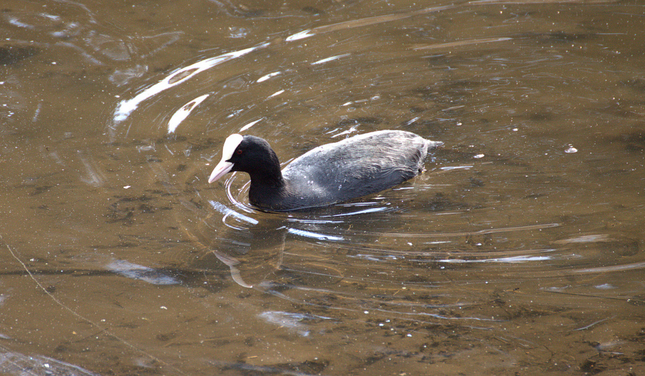
Folaga
La folaga è un uccello prevalentemente acquatico presente in quasi tutti gli specchi d'acqua della zona. D'inverno è gregario e d'estate diventa fortemente territoriale. Spesso è monogama e costruisce un nido molto voluminoso sulla riva dei laghi. Le sue zampe molto grandi le permettono di passeggiare sulle foglie delle piante acquatiche dove in primavera è possibile vederla accompagnata dai suoi piccoli
[eng]
AMItrail lakes
A path through the hills of Ivrea for the exploration of the 5 lakes.
I decided to write short notes in each cache dedicated to an element of the natural world present near GZ, telling only a curiosity or a cultural reference that concerns it. The amis dl mystery helped me write the listings and it was a lot of fun. The author of the listing is obviously mentioned.
The game that I propose to you and to add a thought, a memory, another curiosity or news in general, linked to the mentioned element. I wish the logs made sense and not just a repetition of a standard message, but I know I ask a lot!
I will publish small pieces of the route until the entire loop is completed and at that moment the complete route, not counting the small detours, will be about 15 km long. It starts from a height of 240 meters and reaches 540 meters of altitude at its highest point. It is suitable for everyone and some of its pieces are only passable on foot.
At this listing the complete map of the route in gpx format, with the reporting of all the waypoints in the caches.
most caches do not contain a pen.