Satellite images are similar to images from your digital camera or cell phone camera. But satellite images are more than just pretty pictures. Satellite sensors can see what cameras and people cannot. Scientists use images from Landsat and other Earth-observing satellites to study our planet.
Sensors measure and record the amount of light, or energy, from the sun that reflects off the Earth’s surface to the satellite. They sense these wavelengths of energy in different regions within the electromagnetic spectrum, called spectral bands. Landsat 9’s Operational Lands Imager (OLI-2) measures the amount of reflected light at multiple wavelengths from visible to infrared. The TIRS-2 instrument measures thermal infrared energy, which is emitted from Earth. The measurement of energy is now in the form of numbers, or data, which can be transmitted to Earth and processed into images.
How are these images processed? This is the part that is similar to your digital camera. When you take a picture, you are actually getting three grayscale images.
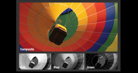
The camera’s detector measures the amount of red, green, and blue light separately using a pattern of filters. Viewing the measurements of any one of these colors would appear as a grayscale image - lighter values in the image would mean more of that wavelength of light in your picture. To view in color, the three images are mapped to the red, green, and blue channels of your monitor or display.
CAPTION: A natural-color Landsat 8 image of the Santa Barbara coast.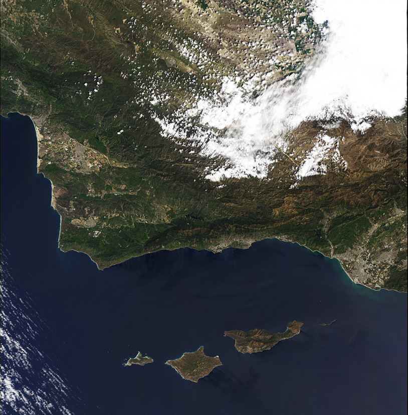
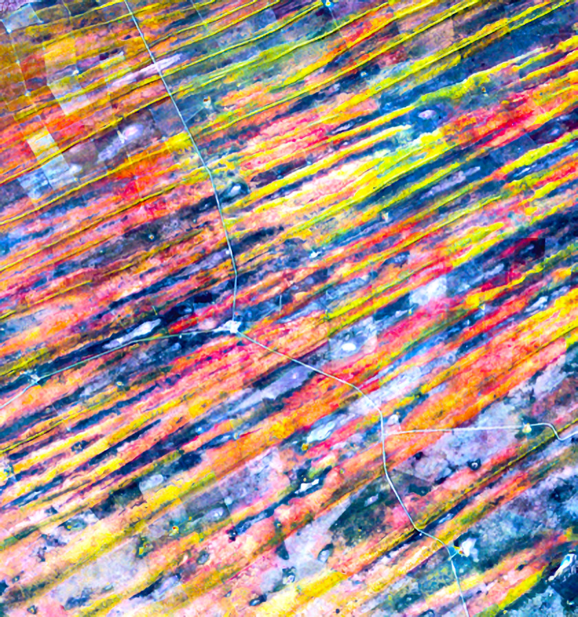
This is the same way satellite images are viewed. Any three bands of data are composited into red, green, or blue channels. Images created from the visible light bands create a ‘natural’ or ‘true’ color image—similar to what your eye can see. Images containing data from bands beyond the visible spectrum are referred to as "false-color images."
CAPTION: False-color images can be very colorful and even resemble works of art like this image of the edge of the Kalahari Desert in Namibia.
CAPTION: False-color images help scientists answer questions about our changing planet. This image combines green, shortwave infrared, and near-infrared to visualize a burn scar after the 2017 Whittier Fire that burned 18,416 acres south of Cachuma Lake in Santa Barbara county. 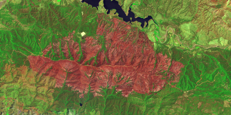
Why measure this energy?
Every pixel of a Landsat image contains a measurement from each of these visible and infrared bands. Each band can tell us different things about the planet. One band can provide information to help scientists to study water quality, another can help assess the health of crops, and another can help determine soil moisture.