Bella Beljica Traditional Geocache
-
Difficulty:
-

-
Terrain:
-

Size:  (small)
Please note Use of geocaching.com services is subject to the terms and conditions
in our disclaimer.
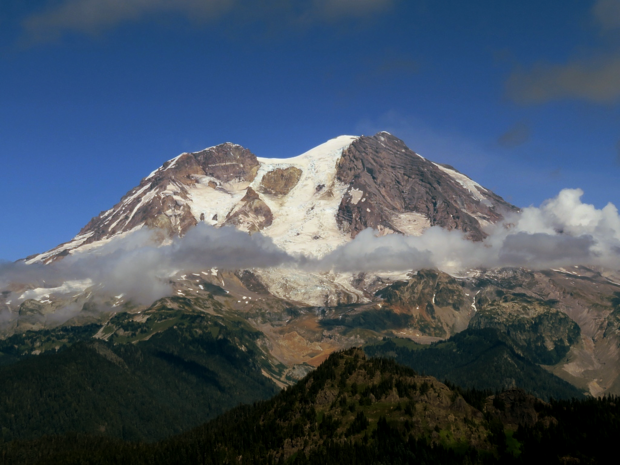
Mount Rainier from the summit.

|
Mount Beljica Distance: 4 miles RT, elevation Gain: 1,100 feet Summit Elevation: 5,475 feet Road Access: Gravel, usually graded
At the edge of Mount Rainier National Park is Mount Beljica, a summit with a trail that if in the park, would have the daily crowds visiting. Beljica is a former lookout site so it offers incredible views of Mount Rainier, the Goat Rocks, Mt. Adams, St. Helens and the many peaks west of the park. The Beljica name is attributed to two families who climbed to the summit in 1897. The families pulled the first initial of each of their combined children and created the name: Burgon, Elizabeth, Lucy, Jessie, Isabel, Clara, and Alex.
Access:
From Tacoma, take State Route 7 to Elbe, then left onto SR 706 to Ashford. Continue 3.8 miles east of Ashford and turn left onto Forest Road 59 (Copper Creek Road). Continue about 5 miles up this road to a junction. Turn right onto FR 5920 and go 2.4 miles on this road to the end at Lake Christine trailhead. The road can be rough at times. Consulting a website like the Washington Trails Association for recent trip reports can be very helpful before going.
Lookout History:
In 1922 a cabin was built near Lake Christina, a half mile below the summit, for living quarters for the lookoutman. The summit did not accommodate any structures. Approximately 100 feet below the top of the mountain was a tool shed and a telephone fixed to a tree. The site was staffed after lightning storms and exceptionally hazardous conditions. Old mountaineers journals called it Beljica Lookout in 1955. The camp was said to be officially abandoned in 1958. If you find the summit benchmark that is 5 feet south of the highest point of the mountain, the telephone booth was 150 feet south of it.
Additional Hints
(Decrypt)
Sbyybj gur fbpvny genvy qbja gb gur qbhoyr gehax gerr. 5 srrg rnfg bs gur gerr haqre qrnq jbbq. Frr fcbvyre cvpf.