
NEDERLANDSE TEKST
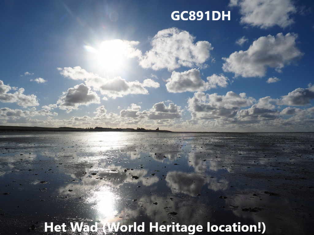
Het Waddengebied
Een stukje werelderfgoed dat we moeten koesteren. Waarvan we kunnen genieten en dat we kunnen beleven!
Informatie over het waddengebied
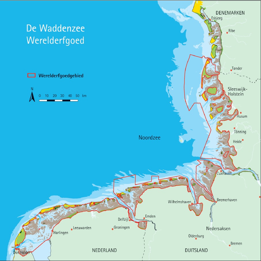
De Waddenzee is één van de grootste getijdengebieden ter wereld. De Waddenzee is bijzonder en uniek. Door eb en vloed staat het gebied 2 keer per dag ‘droog’ en loopt het 2x per dag vol met water. Een waddengebied kan alleen ontstaan als de kust ondiep is en geleidelijk oploopt. (ca 1 meter per km). Hierdoor kunnen de zand- en kleideeltjes (die met het water meekomen) neerslaan. Door de eb- en vloedstromen ontstaan geulen en prielen.
Het waddengebied is een hele belangrijke foerageerplek voor vogels die trekken van het (hoge) noorden naar de warme streken in het zuiden. Gedurende het hele jaar verblijven of passeren er zo’n 10-12 miljoen vogels vooral in het voorjaar en najaar.
Door het bijzondere ecosysteem zijn er ook meer dan 250 plantensoorten.
Het kan er tijdens stormen enorm spoken. Niet voor niets zijn er hoge dijken aangelegd en vechten de kustbewoners en bewoners van de eilanden continue tegen de elementen van de zee. De zee geeft EN neemt! Kijk maar eens naar het monument bij Moddergat en lees het verhaal over de scheepsramp in 1883 (o.a op www.klaaswiersma.nl/artikelen/moddergat.html). Maar ook in de laatste jaren gaat het nog af en toe mis. Alertheid blijft dus essentieel.
Op naar de cachelocatie en genieten van de natuur in en om het waddengebied!
Opdracht voor de log om de geocache te kunnen omzetten in een found:
1. Loop naar GZ en neem een foto. Plaats deze foto van de kust waarop de molen EN de kerk van Paesens te zien zijn bij de log.
2. Een log moet bevatten het gevoel dat deze omgeving bij u oproept(liefst een gedicht).
3. Geef aan CO door hoe hoog bij een storm het water moet komen t.o.v. NAP om de dijk waarop u staat onder water te laten komen. (informatie is te vinden op de heenweg of de terugweg op locatie N 53 24.176 E 006 05.157)
Geocachers met een lichamelijke beperking en/of met een kinderwagen.
U kunt de geocachelokatie bereiken via N53 24.101 E006 05.437
Heeft u een lichamelijke beperking of heeft u een kinderwagen waardoor u het veerooster niet kunt passeren om naar de cache te gaan, dan is hier de vervangende opdracht:
Ga naar locatie N 53 24.176 E 006 05.157.
1. Maak een foto met het meetinstrument duidelijk zichtbaar op de achtergrond.
2. Een log moet bevatten het gevoel dat deze omgeving bij u oproept.(liefst een gedicht)
3. Geef aan CO door hoe hoog bij een storm het water moet komen t.o.v. NAP om de dijk waarop u staat onder water te laten komen.
Dank aan geocaching.com dat ik 1 van de uitverkoren ben om een virtuele geocache te mogen plaatsen
ENGLISH TEXT
The Wadden area
A piece of world heritage that we must cherish. Which we can enjoy and that we can experience!
Information about the Waddenregion
The Wadden Sea is one of the largest tidal areas in the world. The Wadden Sea is special and unique. Due to ebb and flow, the area is 'dry' twice a day and is filled with water twice a day. A wadden region can only arise if the coast is shallow and gradually increases. (approx. 1 meter per km). This allows the sand and clay particles (that come with the water) to precipitate. Trenches and arbors are created by the ebb and flow flows.
The wadden region is a very important foraging area for birds that migrate from the (high) north to the warm regions in the south. Around 10-12 million birds stay or pass through the year, especially in spring and autumn.
Also there are due to the special ecosystem more than 250 plant species.
It can go wild during storms. It is not for nothing that high dikes have been built and coastal residents and residents of the islands are constantly fighting against the elements of the sea. The sea gives AND takes! Just look at the monument at Moddergat and read the story about the ship disaster in 1883 (e.g. at www.klaaswiersma.nl/artikelen/moddergat.html). But even in recent years sometimes things go wrong. Therefore alertness remains essential.
Enough reasons to visit the geocache and enjoy the nature in the Waddenarea!
Command for the log to be able to convert the geocache into a found:
1. Walk to GZ and take a photo. Place that photo of the coast showing the mill AND the church of Paesens in the log.
2. A log must contain the feeling that this environment evokes in you (preferably a poem).
3. Indicate to CO how high in a storm the water must be relative to NAP in order to have the dike on which you stand submerged. (information can be found on the way there or the way back at location N 53 24.176 E 006 05.157)
Geocachers with a physical disability and / or with a pram.
You can reach the geocache location via N53 24.101 E006 05.437
Do you have a physical disability or do you have a pram that prevents you from passing the spring lattice to go to the cache, then here is the replacement assignment:
Go to location N 53 24.176 E 006 05.157.
1. Take a photo with the measuring instrument clearly visible in the background.
2. A log must contain the feeling that this environment evokes in you (preferably a poem.
3. Indicate to CO how high in a storm the water must be relative to NAP in order to have the dike on which you stand submerged.
Thanks to geocaching.com that I am one of the chosen ones to place a virtual geocache
TEXTE EN FRANCAIS
La région des Wadden
Un morceau du patrimoine mondial que nous devons nourrir. Ce que nous pouvons apprécier et que nous pouvons expérimenter!
Informations sur la région des Wadden
La mer des Wadden est l’une des plus grandes marées du monde. La mer des Wadden est spéciale et unique. Une région de Wadden ne peut apparaître que si la côte est peu profonde et s’élève progressivement. (environ 1 mètre par km). Cela permet aux particules de sable et d'argile (fournies avec l'eau) de précipiter. Les tranchées sont créés par les flux de raz de marée et reflux.
La région des Wadden est une zone d'alimentation très importante pour les oiseaux qui migrent du nord (haut) vers les régions chaudes du sud. Environ 10 à 12 millions d'oiseaux restent ou passent dans l'année, surtout au printemps et en automne.
En raison de l'écosystème spécial, il existe également plus de 250 espèces de plantes.
Il peut devenir fou pendant les tempêtes. Ce n’est pas pour rien que de hautes digues ont été construites et que les résidents côtiers et les habitants des îles se battent constamment contre les éléments de la mer. La mer donne ET prend!Il suffit de regarder le monument de Moddergat et de lire l’histoire de la catastrophe navale de 1883 (par exemple sur www.klaaswiersma.nl/artikelen/moddergat.html). Mais même ces dernières années, les choses vont parfois mal. La vigilance reste donc essentielle.
Assez de raisons pour de visiter la cache et la région des Wadden!
Cession pour que le journal puisse convertir la géocache en un objet trouvé:
1. Marche a GZ et prendre une Photo. placez cette photo avec de la côte montrant le moulin ET l’église de Paesens entre le journal.
2. Un journal doit contenir le sentiment que cet environnement évoque en vous (de préférence un poème).
3. Indiquez au CO à quelle hauteur dans une tempête l’eau doit être par rapport à NAP pour que la digue sur laquelle vous vous trouvez soit submergée. (les informations se trouvent sur le trajet ou sur le chemin du retour au point N 53 24.176 E 006 05.157)
Des géocacheurs avec un handicap physique ou avec un landau.
Vous pouvez atteindre le lieu de géocache via N53 24.101 E006 05.437
Avez-vous un handicap physique ou avez-vous un landau qui vous empêche de passer l'horaire du printemps pour aller à la cache, alors voici la mission de remplacement:
Aller à l'emplacement N 53 24.176 E 006 05.157.
1. Prenez une photo avec l'instrument de mesure clairement visible à l'arrière-plan.
2. Un journal doit contenir le sentiment que cet environnement évoque en vous (de préférence un poème).
3. Indiquez au CO à quelle hauteur dans une tempête l’eau doit être par rapport à NAP pour que la digue sur laquelle vous vous trouvez soit submergée.
Grâce à geocaching.com, je suis l’un des élus pour placer une géocache virtuelle
Virtual Rewards 2.0 - 2019/2020
This Virtual Cache is part of a limited release of Virtuals created between June 4, 2019 and June 4, 2020. Only 4,000 cache owners were given the opportunity to hide a Virtual Cache. Learn more about Virtual Rewards 2.0 on the Geocaching Blog.
Banner
NL
Als u de cache hebt gevonden, dan is deze banner uw welverdiende beloning.
EN
If you have found the cache, then this banner is your well-deserved reward.
FR
Si vous avez trouvé la cache, cette bannière est alors votre récompense bien méritée.
code banner: <a href="http://coord.info/GC891DH"><img src="https://img.geocaching.com/cache/c0e249f1-a34a-432a-b6a4-cea78c87f882.png" width="330" height="225" /></a>