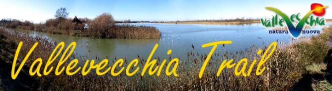


L'OASI
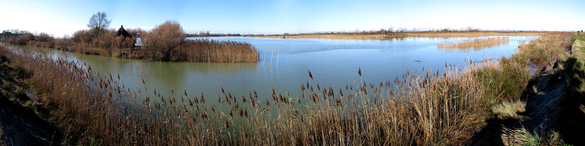
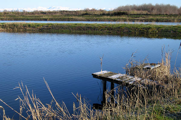
Oasi lagunare tra Caorle e Bibione, Concordia Sagittaria, Portogruaro (Venezia) allo sbocco della valle Zignago, tra i fiumi Tagliamento, Lemene e Livenza, di circa 150 ettari ricavati da bonifiche avvenute negli anni '60,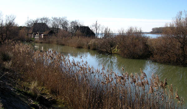 Vallevecchia è caratterizzata da oltre 4 km di litorale sabbioso lasciato allo stato naturale e da un entroterra agrario ottenuto mediante la bonifica delle preesistenti superfici lagunari salmastre.
I suoli sono di tipo sabbioso e argilloso e presentano frequenti infiltrazioni di acqua salmastra.
Sono rappresentate numerose situazioni d'ambiente, tra cui figurano biotopi di duna sabbiosa, di palude dolce e di pineta inseriti dentro un contesto di superfici coltivate.
Il complesso mosaico ambientale determina una particolare ricchezza naturalistica.
CENTRO DI EDUCAZIONE NATURALISTICA E MUSEO
Presso gli edifici dell'azienda agricola pilota e dimostrativa di Veneto Agricoltura è presente una sala didattica/museale con pannelli didattici e diorama che illustrano l'ambiente di Valle Vecchia e la storia che ha portato a trasformare il luogo in oasi naturalistica.
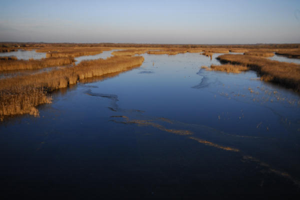
La palude dolce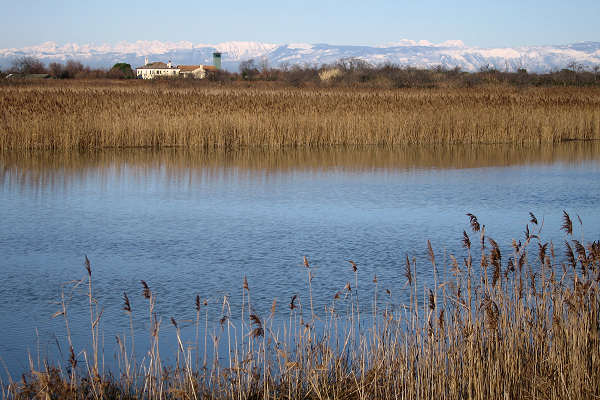
Presso le bocche di porto di Falconera a ridosso del canale Canadare, specchi d'acqua dolce profonda, pozze d'acqua bassa, isolotti e canneti consentono di scoprire l'ambiente paludoso di acqua dolce. Il giro escursionistico si sviluppa per due chilometri, senza difficoltà.
Valle Vecchia di Caorle - Dalla battigia al bosco igrofilo.
Osservazione dei biotopi di dune e depressioni interdunali e, gradatamente, ai boschi igrofili e pinete miste alle spalle della linea costiera e fino alla campagna aperta ai margini delle depressioni delle sacche lagunari.
IL TRAIL
- Lunghezza: 16 km
- Durata: 4 ore (soste e tempo di ricerca escluso)
- Mezzo: piedi (anche Nordic Walking, il terreno è completamente pianeggiante a parte le salite sull'argine), MTB (evitando il lungomare e la deviazione per i casoni Baseleghe), cavallo
Descrizione del percorso
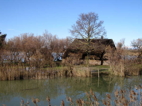
Si parte dal parcheggio indicato nel waypoint, appena superato il ponte d'accesso all'isola. Da li si prende il percorso che supera il primo argine per immergersi nell'ambiente lagunare. Proseguiamo poi lungo l'argine del canale Canadere fino a ricongiungersi alla strada sterrata, nei pressi di una torretta d'osservazione. Verso destra in breve si perviene ad un parcheggio, si supera un ponticello e delle strutture d'osservazione degli uccelli e si costeggia l'argine, oltre il quale in una isoletta si trovano dei casoni.
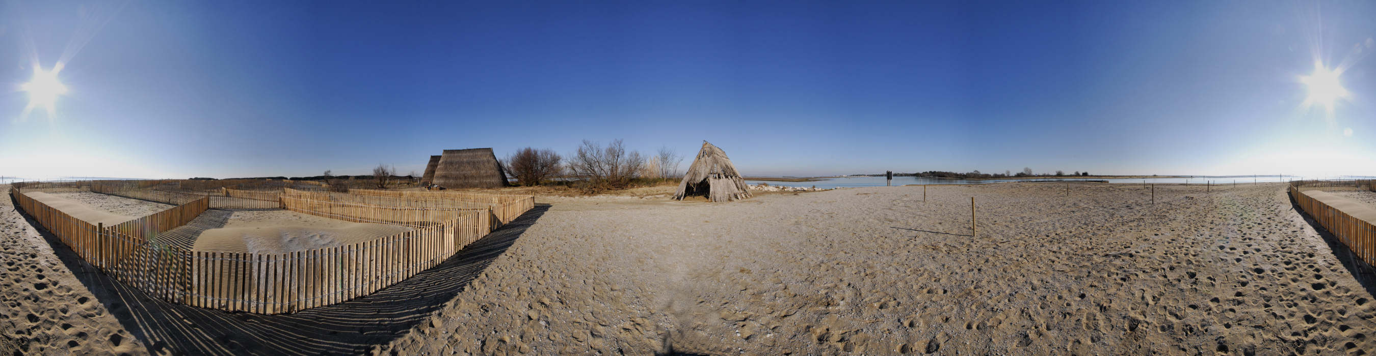
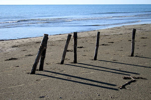 Raggiunto il versante nord della pineta costiera si prosegue per la strada sterrata fino a trovare un varco, verso destra nella pineta, che permette di raggiungere la spiaggia ed il mare.
Il mare è sempre generoso di suggestioni, verso destra s'intravede il nucleo abitato di Caorle con l'inconfondibile sagoma del campanile.
Si può percorrere tutta la lunghissima spiaggia in direzione est, verso Lignano, fino a raggiungere la punta sabbiosa affacciata sull'abitato di Lignano Pineta, dove si trovano alcuni casoni di valle (casoni Baseleghe).
Tornati indietro fino all'accesso principale della spiaggia si riguadagna la strada principale, sterrata, che volendo riporta con un rettilineo di oltre un chilometro al parcheggio.
Da qui invece si prosegue sulla destra seguendo la parte meno frequentata dell'Oasi costeggiando la laguna Baseleghe e il canal dei Lovi fino a trovare un isoletta con un casone, da qui scendere dall'argine e seguire la sterrata principale, tenendo la destra al primo bivio, fino a giungere ad un ponticello. Qui seguire il canale (sconsigliato in MTB visto che il percorso è su erba, si può proseguire dritti fino ad intersecare la strada principale che arriva dalla spiaggia) per vedere l'azienda Agricola Vallevecchia e quindi tornare al parcheggio.
Oltre a visitare il Museo e la sede di VenetoAgricoltura, si possono fare altre varianti al percorso.
Trail in carrozzina o con passeggino
Quasi tutta la camminata lungo l'argine è costeggiata da una comoda strada sterrata agibile anche per chi è in carrozzina (o con passeggino), evitando come per le MTB le deviazioni lungo mare fino ai casoni Baseleghe. L'accesso al mare è pavimentato fino a pochi metri dalla battigia, all'altezza della earthcache, ma ovviamente è sconsigliato il tratto di circa 3km lungo sabbia, preferendo lo sterrato più interno attraverso la pineta. Purtroppo le varie cache risulteranno gran parte irraggiungibili (sono indicate nei listing quali sono accessibili), ma non di meno potrete godere di quasi tutto il trail lungo l'oasi.
Il percorso sterrato non presenta difficoltà, a parte qualche avallamento formato dalla pioggia e qualche buca, però meglio essere accompagnati da un amico.
Consigli
I migliori mesi per andare sono maggio giugno e settembre.
Essendo terreno lagunare le insidie sono date dalle numerose zanzare presenti nei mesi estivi, perciò in questo caso vi consigliamo di portarvi un repellente contro le zanzare, e di evitare di fare il trail nel tardo pomeriggio dopo una giornata di sole (è il periodo del giorno in cui questi insetti sono più famelici e la combinazione di sale e sudore vi rende più appetitosi). Nei mesi estivi inoltre evitate le ore più calde in quanto gran parte del percorso è priva di ombra, perciò consigliamo di aggiungere nello zaino un cappellino e una crema solare. Per il resto buon divertimento!
FINAL
Una volta completato il trail avrete ottenuto i quattro valori A,B,C,D (nelle cache 3, 8 e 11) e la cache finale si trova a:
N 45° 38.(A * D) E 012° 57.(B * C)
La cache è di dimensioni regular, contiene il logbook, una penna e qualche oggetto da scambiare. Buona caccia!

THE OASIS
The Vallevecchia Nature Oasis is located in Caorle, locality "La Brussa", and, as the crow flies, it is only 150 metres far from the town. However, we are separated by the source of the Caorle Lagoon called the Canalon; this is where the rivers Lemene, Reghena, Nicesolo and a branch of the river Livenza merge, meaning you must travel 43 Km in order to reach this oasis by land! But, trust us, it's worth it. Do you know why?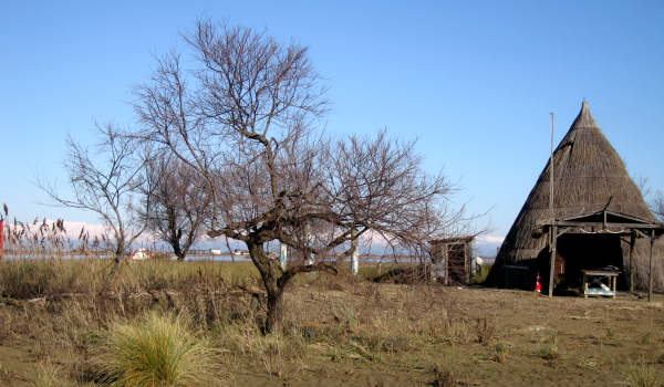
Vallevecchia is an island which covers about 900 hectares of land; it is surrounded by the waters of the sea, the lagoon and the rivers, which contribute to creating an extremely complex but highly interesting ecosystem: it is the perfect getaway for people who love nature, peace and quiet and it features a beautiful, natural, sandy, rugged beach!
Once upon a time, this area was all lagoon; it was only after it was drained and the swamp area reclaimed in the 60s that an island was formed. It is the one remaining stretch of the high-Adriatic coastline to not be inhabited and it is separated from the urbanised world by a unique dune system: help preserve it, the way we Caorle locals do! Explore it on foot or by bicycle, crossing the fields, the dunes and the pine-wood; you'll find bird-watching spots to catch a glimpse of the many non-migratory and migratory bird species, including the red heron, the mallard, but also a chance to spot the vast animal community including the fox, the hare and the roe deer. The salty waters are inhabited by a species of eel which is masterfully prepared on the spit by local fishermen: the Italian name of the dish is “bisato al speo”. Observe this rich animal and plant habitat in silence, taste the salty air of the sea, enjoy the perfectly-cultivated agricultural landscape and respect the code of conduct!
THE TRAIL
- Length: 16 km
- Duration: 4 hours (stops and research time excluded)
- Way of transport: trekki
ng (also Nordic Walking, the terrain is completely flat apart from the embankment ascents), MTB (avoiding the promenade and the detour for the Baseleghe lodges), horse
Route description
It starts from the parking lot indicated in the waypoint, just past the access bridge to the island. From there take the path that goes over the first bank to plunge into the lagoon environment. We then continue along the bank of the Canadere canal until we rejoin the dirt road, near an observation tower. To the right you will soon come to a parking lot, pass a small bridge and the observation structures of the birds and walk along the embankment, beyond which on a small island there are huts.
 Reached the north side of the coastal pine forest, continue along the dirt road until you find a gap, to the right in the pine forest, which allows you to reach the beach and the sea.
The sea is always generous with suggestions, to the right we can see the inhabited center of Caorle with the unmistakable shape of the bell tower.
You can walk the whole long beach towards east, towards Lignano, until you reach the sandy point overlooking the town of Lignano Pineta, where there are some valley huts (casoni Baseleghe).
Returning back to the main access to the beach, it returns to the main dirt road, which, if you wish, returns with a straight over one kilometer to the parking lot.
From here instead continue on the right following the less frequented part of the Oasis skirting the Baseleghe lagoon and the canal of the Lovi up to find a small island with a big house, from here go down from the embankment and follow the main dirt road, keeping the right at the first fork, until reaching a bridge. Here follow the canal (not recommended for MTB as the path is on grass, you can go straight on until it intersects the main road coming from the beach) to see the Vallevecchia Agricultural Company and then return to the parking lot.
In addition to visiting the Museum and the VenetoAgricoltura headquarters, other variations can be made to the route.
Trail in a wheelchair or with a stroller
Almost the entire walk along the embankment is bordered by a comfortable dirt road which is also accessible for those in wheelchairs (or with a stroller), avoiding the diversions along the sea up to the Baseleghe lodges, as for the MTBs. Access to the sea is paved up to a few meters from the shoreline, at the level of the earthcache, but obviously the stretch of about 3km along sand is not recommended, preferring the innermost dirt road through the pine forest. Unfortunately the various caches will be largely unattainable (they are indicated in the listings as they are accessible), but nevertheless you can enjoy almost all the trail along the oasis.
The unpaved path presents no difficulty, apart from a few hollows formed by rain and a few holes, but it is better to be accompanied by a friend.
Tips
The best months to go are May June and September.
Being lagoon ground the pitfalls are given by the numerous mosquitoes present in the summer months, so in this case we advise you to bring mosquito repellent, and to avoid doing the trail late in the afternoon after a sunny day (it is the time of day in which these insects are more hungry and the combination of salt and sweat makes you more appetizing). In the summer months also avoid the hottest hours as most of the route is shadow-free, so we recommend adding a hat and a sunscreen in your backpack. For the rest, have fun!
FINAL
Once the trail is complete you will have the four values A, B, C, D (in the caches 3, 8 and 11) and the final cache is located at:
N 45 ° 38.(A * D) E 012 ° 57.(B * C)
The cache is regular in size, contains the logbook, a pen and some items to exchange. Happy caching!

DIE OASE
Die Naturoase von Vallevecchia gehört zum Ortsgebiet von Caorle und liegt gerade mal 150 Meter von uns entfernt. Allerdings trennt uns von der Oase die Mündung der Lagune von Caorle, auch Canalon genannt, in der die Flüsse Lemene, Reghena, Nicesolo und ein Seitenarm des Livenza zusammenfließen. Wenn Sie also diese veritable Oase der Natur besuchen möchten, dann müssen Sie in Wirklichkeit erst 43 Kilometer zurücklegen. Doch die lohnen sich. Wollen Sie wissen, warum?
 Vallevecchia ist eine 900 Hektar große Insel, die auf allen vier Seiten von Meer-, Lagunen- und Flusswasser umgeben ist, was für die Entstehung von Ökosystemen von bemerkenswerter Komplexität und ökologischem Interesse gesorgt hat. Die Insel ist der perfekte Rückzugsort für Menschen, die Natur, Frieden und Ruhe lieben, und sie besitzt einen herrlichen, wilden Natursandstrand.
Früher einmal war hier alles Lagunengebiet. Erst nach Trockenlegung und Urbarmachung der Sumpfgebiete in den 1960er Jahren wurde Vallevecchia zu einer Insel. Heute ist es der einzige Küstenabschnitt an der Oberen Adria, der nicht urbanisiert ist. Von der Kulturlandschaft trennt ihn sein charakteristisches Dünensystem. Helfen auch Sie mit, Vallevecchia zu bewahren – so wie wir Caorlotten das tun.
Gehen Sie zu Fuß oder fahren Sie mit dem Fahrrad über die Felder, die Dünen und durch den Pinienwald. Von den Beobachtungsplätzen für Birdwatching können Sie zahlreiche sesshafte und Zugvögelarten bewundern, darunter Purpurreiher und Stockente. Aber auch eine Vielzahl Säugetiere aus landwirtschaftlichem Ambiente sind hier zuhause, wie etwa Fuchs, Hase und Reh. Im Brackwasser wiederum leben unsere berühmten Aale, die unsere Fischer mit vorbildlicher Geduld am Spieß grillen – diese Spezialität heißt „Bisato al Speo“.
Beobachten Sie dieses an Tieren und Pflanzen so reiche Habitat in respektvollem Schweigen, atmen Sie tief die salzige Luft ein, die vom Meer heraufweht, genießen Sie das sorgfältig bestellte Bauernland – und beachten Sie die Verhaltensregeln!
DIE SPUR
- Länge: 16 km
- Dauer: 4 Stunden (Stopps und Forschungszeit ausgeschlossen)
- Transportmittel: Trekking (auch Nordic Walking, abgesehen von den Dammaufstiegen ist das Gelände völlig flach), MTB (Vermeidung der Promenade und des Umweges zu den Baseleghe-Hütten), Pferd
Routenbeschreibung
(google translate) Es beginnt am Parkplatz, der im Wegpunkt angegeben ist, direkt hinter der Zugangsbrücke zur Insel. Von dort nehmen Sie den Weg, der über das erste Ufer führt, um in die Lagunenlandschaft einzutauchen. Wir fahren dann entlang des Canadere-Kanals weiter, bis wir uns in der Nähe eines Aussichtsturms wieder auf dem Feldweg befinden. Auf der rechten Seite kommen Sie bald zu einem Parkplatz, passieren eine kleine Brücke und die Beobachtungsstrukturen der Vögel und laufen entlang der Böschung, hinter der sich auf einer kleinen Insel Hütten befinden.
An der Nordseite des Kiefernwäldchens angekommen, folgen Sie der unbefestigten Straße bis Sie eine Lücke finden, rechts im Kiefernwald, der Sie zum Strand und zum Meer bringt.
Das Meer ist mit Vorschlägen immer großzügig, rechts sehen wir das bewohnte Zentrum von Caorle mit der unverwechselbaren Form des Glockenturms.
Sie können den ganzen langen Strand in Richtung Osten, in Richtung Lignano, laufen, bis Sie den Sandpunkt erreichen, der die Stadt Lignano Pineta überblickt, wo sich einige Hütten (Casoni Baseleghe) befinden.
 Zurück zum Hauptzugang zum Strand, kehren Sie zur Hauptstraße zurück, die Sie, wenn Sie möchten, mit einer Gerade über einen Kilometer zum Parkplatz zurückkehren kann.
Fahren Sie von hier aus rechts weiter und folgen Sie dem weniger befahrenen Teil der Oasis entlang der Baseleghe-Lagune und dem Lovi-Kanal, um eine kleine Insel mit einem großen Haus zu finden. Von hier aus gehen Sie vom Damm herunter und folgen der Hauptstraße. Halten Sie sich an der ersten Gabelung rechts, bis Sie eine Brücke erreichen. Hier folgen Sie dem Kanal (nicht für MTB empfohlen, da der Pfad auf Gras liegt, können Sie geradeaus bis zur Kreuzung der vom Strand kommenden Hauptstraße fahren), um die Vallevecchia Agricultural Company zu sehen und anschließend zum Parkplatz zurückzukehren.
Neben dem Besuch des Museums und des Hauptsitzes von VenetoAgricoltura können weitere Änderungen an der Route vorgenommen werden.
Trail im Rollstuhl oder mit einem Kinderwagen
Fast die gesamte Wanderung entlang des Damms wird von einer bequemen Schotterstraße begrenzt, die auch für Rollstuhlfahrer (oder mit einem Kinderwagen) zugänglich ist. So werden die Abzweigungen am Meer bis zu den Baseleghe-Lodges wie auch bei den MTB vermieden. Der Zugang zum Meer ist bis zu einigen Metern vom Ufer entfernt, auf Höhe des Erdhimmels, aber offensichtlich ist die etwa 3 km lange Strecke entlang des Sandes nicht zu empfehlen, da der innerste Feldweg durch den Kiefernwald bevorzugt wird. Leider sind die verschiedenen Caches weitgehend unerreichbar (sie sind in den Einträgen angegeben, da sie zugänglich sind), aber trotzdem können Sie fast alle Wege entlang der Oase genießen.
Der ungepflasterte Weg bietet keine Schwierigkeiten, abgesehen von ein paar Regenfällen und einigen Löchern, aber es ist besser, von einem Freund begleitet zu werden.
Tipps
Die besten Monate sind Mai Juni und September.
Als Lagunenboden werden die Fallgruben durch die zahlreichen Mücken in den Sommermonaten gegeben. In diesem Fall empfehlen wir Ihnen, Mückenschutzmittel mitzubringen und nach einem sonnigen Tag (dies ist die Tageszeit), den Weg am späten Nachmittag zu vermeiden in denen diese Insekten mehr Hunger haben und die Kombination von Salz und Schweiß Sie appetitlicher macht). Vermeiden Sie in den Sommermonaten auch die heißesten Stunden, da der größte Teil der Route schattenfrei ist. Daher empfehlen wir, einen Rucksack und einen Sonnenschutz mitzubringen. Für den Rest viel Spaß!
FINALE
Sobald der Trail abgeschlossen ist, haben Sie die vier Werte A, B, C, D (in den Caches 3, 8 und 11) und der endgültige Cache befindet sich unter:
N 45 ° 38.(A * D) E 012 ° 57.(B * C)
Der Cache hat eine normale Größe und enthält das Logbuch, einen Stift und einige auszutauschende Gegenstände. Viel Spaß beim Cachen!
