FERRARIA SUBMARINA!!!
EARTHCACHE EC73PM
(cache 500 de Palhocosmachado)
PORTUGUÊS

COMPLEXO DA FERRARIA
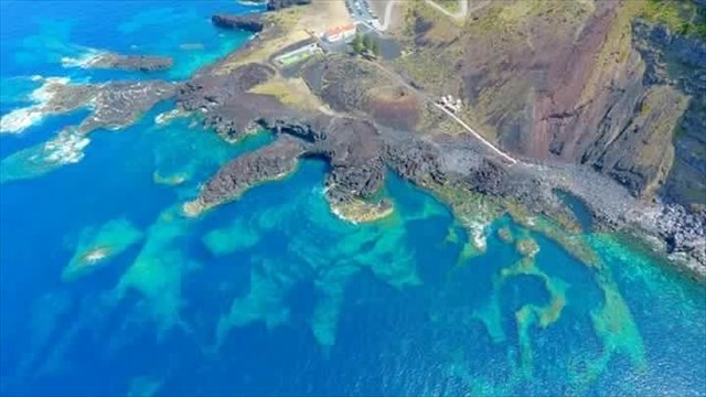
Esta estrutura de grande valor paisagístico e científico é uma formação geológica única no seu género no Mundo, pois trata-se de um promontório com origem em erupções vulcânicas primordiais na formação geológica da ilha, mas também por manifestações recentes do interior da terra.
PICO DAS CAMARINHAS

“O Pico das Camarinhas corresponde a um cone de escórias basálticas, no topo do qual existe uma cratera múltipla, alongada segundo uma orientação geral W-E, direcção esta que define um alinhamento tectónico radial do vulcão poligenético das Sete Cidades.
A escoada lávica emitida deste cone, que fluiu para Oeste, espraiou-se no Oceano Atlântico dando origem ao delta lávico (ou fajã lávica) da Ponta da Ferraria e a uma arriba fóssil. A erupção vulcânica responsável pela formação do Pico das Camarinhas e respectiva escoada lávica e fajã (onde ocorrem inúmeros xenólitos gabróicos e ultramáficos, constituídos por rochas granulares ricas em olivina e piroxena) terá tido lugar por volta do ano 1140 A.D..
As morfologias presentes no local incluem, ainda, um bem preservado cone litoral (forma vulcânica rara no arquipélago) e que corresponde a um pequeno cone piroclástico sem conduta de alimentação profunda, gerado à superfície do delta lávico. A montante do Pico das Camarinhas existe um domo traquítico, instalado na mesma fractura radial do vulcão das Sete Cidades”.
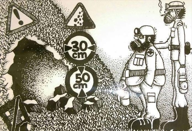
GRUTA
“Caverna, gruta ou furna é toda cavidade natural rochosa com dimensões que permitam acesso a seres humanos. Podem ter desenvolvimento horizontal ou vertical em forma de galerias e salões. Ocorrem com maior frequência em terrenos formados por rochas sedimentares, mas também em rochas ígneas e metamórficas, além de geleiras e recifes de coral”.
ALGAR
“Algar é uma cavidade natural de desenvolvimento predominantemente vertical. Em Portugal é também chamado algarão ou algarocho.
Pode ter várias origens. Pode ser escavado por águas que sobem ou descem - como é no caso nas ilhas dos Açores. Pode também ser produzido por movimentos de lavas bastante fluidas que se movimentam no interior da terra e que, ao recuarem com alguma rapidez, deixam uma caverna aberta no seu lugar. Os algares formam-se, normalmente, em pisos calcários onde devido aos agentes erosivos a rocha vai erodindo formando assim uma cavidade”.
TUBO LÁVICO
“Tubos de lava (ou tubos lávicos) são condutas naturais através dos quais a lava chega à superfície em um fluxo de lava, expelido por um vulcão em erupção. Eles podem estar ativos quando a lava ainda flui em dilecção à superfície, ou extintos, o que significa que o fluxo de lava cessou e a rocha esfriou, deixando um longo canal, semelhante a uma caverna. Uma vez que esses tubos são formados simultaneamente à rocha que os envolve, diz-se que são cavernas primárias”.

ATENÇÃO
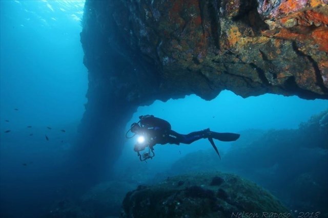
Se desejar visitar esta “estrutura/cavidade” deverá planear com cuidado esta expedição e munir-se do necessário material. Poderá fazê-lo de barco, de caiaque ou mergulhando com escafandro. Não deverá fazê-lo a nado, a partir do exterior da cavidade!
Deverá ter muita atenção ao “estado do mar” e à maré!
Não deverá desenvolver esta actividade sozinho.

Recomendações:
Convém sempre mergulhar acompanhado.
Tenha sempre em atenção, em primeiro lugar, a sua segurança!

PARA REALIZAR E REGISTAR ESTA EARTHCACHE:
PERGUNTAS:

Para “encontrar/registar” esta cache deverá: provar que esteve no local e responder às seguintes questões, enviando um email/mensagem de Geocaching, com as respostas, em português ou em inglês, para o nosso perfil.
Só depois, de enviar as respostas, e conforme as “guidelines” para as Earthcaches, deverá efectuar o seu registo!
Serão removidos todos os registos que não obedeçam a estes requisitos.
Com base nas tuas observações efectuadas na visita a esta “estrutura” e com base nas tuas investigações, procura responder às seguintes questões.:
1) Estamos na presença de um tubo lávico? De uma gruta?
2) Na tua opinião, como se poderá ter-se formado esta “estrutura”, que
se encontra “por baixo” da Ferraria?
3) Classifica a fajã de que faz parte esta estrutura.
4) Estima: a) a sua dimensão maior,
b) a sua altura média?
c) a sua profundidade média, a meia-maré?
5) Quantas entradas tem esta “estrutura”?
6) Identifica o tipo, ou tipos, de rocha que compõem esta estrutura.
7) As rochas visíveis, dentro da estrutura, e fora da água, são de que cor?
8) No fundo desta estrutura (portanto debaixo de água), existem rochas!
Descreve-as e classifica-as.
9) Dentro desta estrutura são visíveis estalactites? E estalagmites?
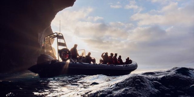
Também é necessário que tire, e partilhe no seu registo, uma foto sua com o GPS na entrada ou dentro da “gruta”.
Também poderá optar por tirar uma foto, neste local, onde apareça, num papel ou placa, o seu nikname e a data da visita.
ATENÇÂO: a partir de de 26 de janeiro, todos os registos, que não tenham a foto comprovativa da visita ao local, serão apagados.


SUBMARINE “FERRARIA”

EARTHCACHE EC73PM
(500 Palhocosmachado cache)
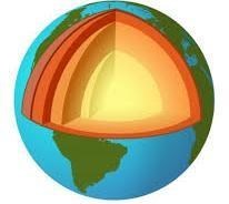
ENGLISH

”COMPLEX OF THE “FERRARIA”
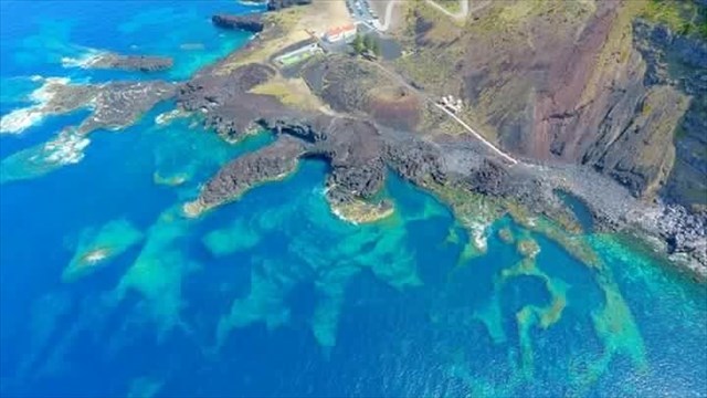
This structure of great scenic and scientific value is a unique geological formation of its kind in the World, because it is a promontory originating in volcanic eruptions primordial in the geological formation of the island, but also by recent manifestations of the interior of the earth.
CAMARINHAS PEAK
"The Peak of the Camarines corresponds to a cone of basaltic slag, in the top of which there is a multiple crater, elongated according to a general orientation W-E, direction that defines a radial tectonic alignment of the polygenetic volcano of the Seven Cities.
The lava flow emitted from this cone, which flowed to the west, spread out in the Atlantic Ocean giving rise to the lava delta (or fajã lávica) of Ponta da Ferraria and to a fossil top. The volcanic eruption responsible for the formation of the Camargo Peak and its lava flow and fajã (where there are numerous gabbroic and ultramafic xenoliths, consisting of granular rocks rich in olivine and pyroxene) will have taken place around AD 1140.

The morphologies present at the site also include a well-preserved coastal cone (a rare volcanic form in the archipelago) and corresponding to a small pyroclastic cone without deep feed conduit generated on the surface of the lava delta. Upstream of the Peak of the Camarines there is a trachytic dome, installed in the same radial fracture of the volcano of the Sete Cidades ".

CAVE
"Cave, grotto or cave is every natural rocky cavity with dimensions that allow access to humans. They can have horizontal or vertical development in the form of galleries and halls. They occur more frequently in lands formed by sedimentary rocks, but also in igneous and metamorphic rocks, in addition to glaciers and coral reefs. "
“ALGAR”
"Algar is a natural cavity of predominantly vertical development. In Portugal it is also called algarão or algarocho.
It can have several origins. It can be excavated by waters that go up or down - as is the case in the islands of the Azores. It can also be produced by movements of very fluid lavas that move inside the earth and that, when retreating with some speed, leave a cave open in its place. The algae usually form on limestone floors where, due to erosive agents, the rock erodes and forms a cavity. "

TUBE LÁVICO
"Lava tubes (or lava tubes) are natural conduits through which lava reaches the surface in a lava flow, expelled by an erupting volcano. They may be active when the lava still flows on the surface, or extinction, which means that the lava flow has ceased and the rock has cooled, leaving a long, cave-like channel. Since these pipes are formed simultaneously to the surrounding rock, they are said to be primary caves. "

ATTENTION
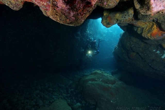
If you wish to visit this "structure / cavity" you should carefully plan this expedition and provide yourself with the necessary material. You can do it by boat, kayak or diving. You should not swim from the outside of the cavity!
You should pay close attention to the "sea state" and the tide!
You should not do this activity alone.

RECOMMENDATIONS:
You should always dive accompanied.
Always keep in mind, first and foremost, your safety!

TO PERFORM AND LOG THIS EarthCache:
QUESTIONS:

To "find / register" this cache should: prove that you were on the spot and respond to the following questions by sending an email / Geocaching message, with the answers, in Portuguese or English, to our profile.
Only then, to send the answers, and according to the guidelines for Earthcaches, you must register!
All records that do not meet these requirements will be removed.
Based on your observations made on the visit to this "cave" and based on your investigations, try to answer the following questions:
1) Are we in the presence of a lava tube? From a cave?
2) In your opinion, how could this "structure" have been formed, which
is "underneath" “Ferraria”?
3) Classify the “fajã” of which this structure is part.
4) It estimates:
a) its greater dimension,
b) its average height?
c) its average depth, the mid-tide?
5) How many entries does this "structure" have?
6) Identifies the type, or types, of rock that make up this structure.
7) The visible rocks, inside the structure, and outside the water, are of what color?
8) At the bottom of this structure (therefore under water), there are rocks!
Describe and classify them.
9) Within this structure are stalactites visible? And stalagmites?

It is also necessary that you take, and share in your registration, a photo of yourself with the GPS at the entrance or inside the "cave".
You can also choose to take a photo, in this place, where your name and the date of the visit appear on a paper or board.
ATTENTION: from January 26, all records, which do not have the photo proving the visit to the site, will be deleted.
